10 fun facts about Benin
1. Benin was formerly known as Dahomey, a powerful West African kingdom that flourished during the 18th and 19th centuries.
2. Benin City and Benin River are not in Benin, but Nigeria!
3. Vodun, often called Voodoo, has deep roots in Benin. The country celebrates National Vodun Day on the second Friday of January.
4. Benin is home to Ouidah’s Temple of Pythons, a sacred shrine where dozens of royal pythons move freely around the grounds.
5. Snakes are widely respected in Benin, where seeing one cross your path is often considered a sign of good fortune.
6. Ganvié is a village built entirely on stilts on Lake Nokoué. It is often nicknamed the “Venice of Africa.”
7. Porto-Novo is Benin’s official capital, but the government is based in Cotonou, the country’s largest city and main economic center.
8. Benin’s median age is 18.2 years in 2026.
9. The official language of Benin is French, though it’s only spoken by around one-third of the population.
10. Benin is home to more than 50 ethnic groups. The largest, the Fon and related groups, make up around 38% of the population.
Read more: Facts about Benin

At a glance
Capital city: Porto-Novo
Population: 14.8 million
Area: 112,622 sq km
Major languages: French, Fon, Bariba, Fulfulde and Aja
Major religions: Christianity, Islam, Vodun
Time zone: UTC+1 (West Africa Time)
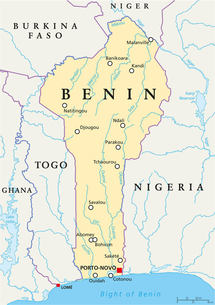
Where is Benin?
Continent: Africa
Region: West Africa
Neighboring countries: Togo, Burkina Faso, Niger and Nigeria
Highest point: Mont Sokbaro (658 m / 2,159 ft)
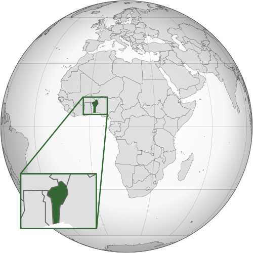
Geography of Benin
Benin is a long, narrow country in West Africa and one of the smaller African countries by area.
It stretches from the Gulf of Guinea in the south to the Niger River in the north.
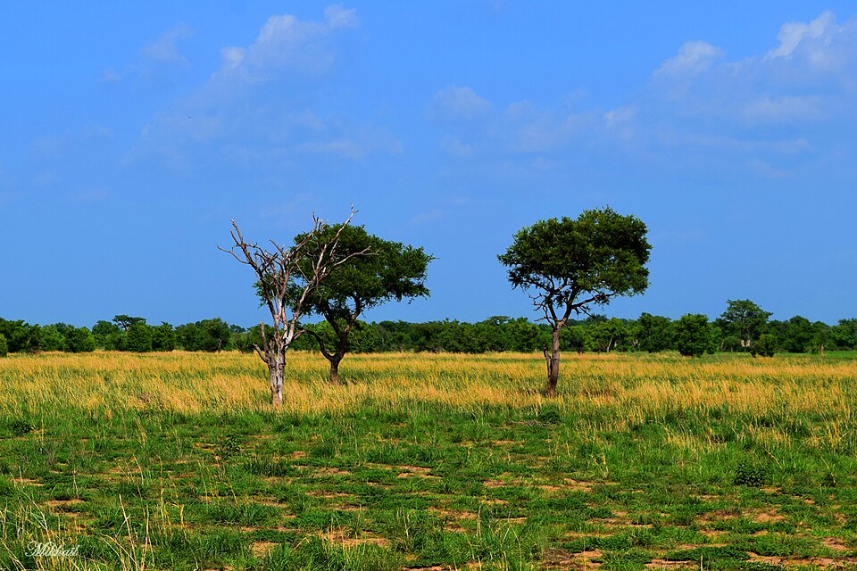
Northern Savanna
Much of northern Benin is covered by wooded savanna and grassland. This region includes the W-Arly-Pendjari Complex, one of West Africa’s most important wildlife areas.
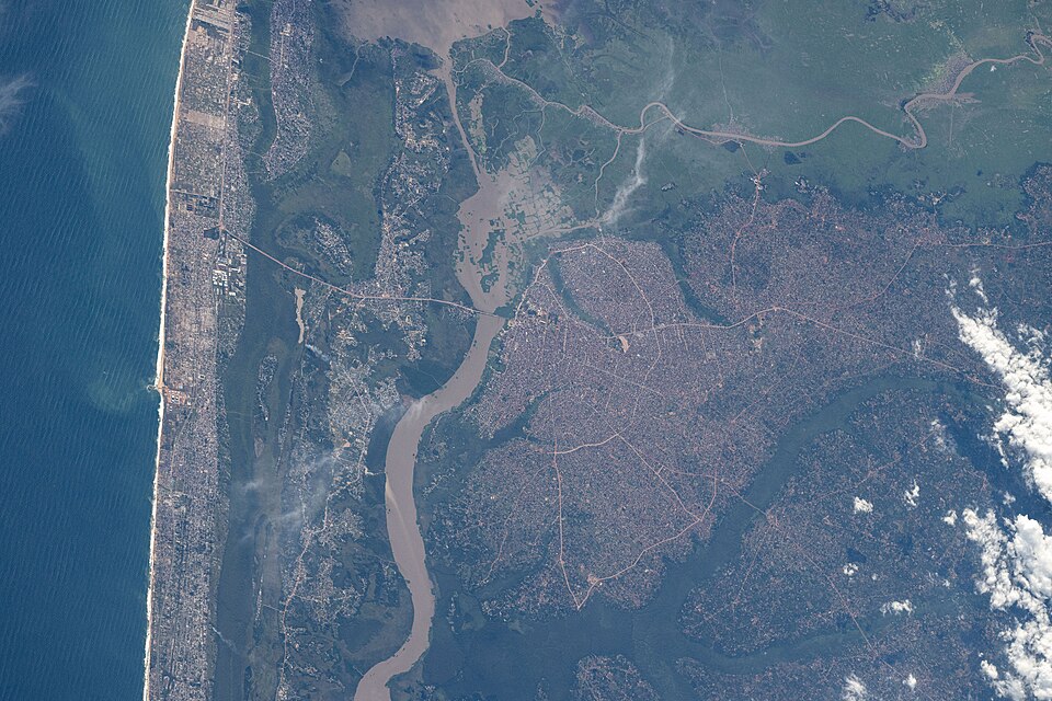
Gulf of Guinea Coast
Benin has a short coastline on the Gulf of Guinea. Its southern coast is low and sandy, with lagoons, wetlands and major cities including Cotonou and Porto-Novo.

Rivers and Lakes
Benin’s main waterways include the Ouémé and Mono rivers, which flow south toward the Gulf of Guinea, and the Niger River along the northeastern border. Lake Nokoué is the country’s largest lake.
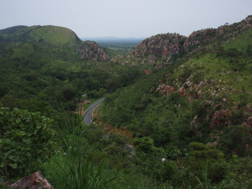
Atakora Mountains
The Atakora Mountains run through northwestern Benin. This range includes Mont Sokbaro, traditionally regarded as the country’s highest point.
See article: Flag of Benin
Benin flag
The flag of Benin dates from the final years of French colonial rule. During the colonial period, Dahomey used the French tricolor, but it adopted its own green, yellow and red flag in 1959, shortly after becoming self-governing within the French Community.
The design remained in use after independence in 1960. It was replaced with a green flag bearing a red star during the Marxist period, then restored on 1 August 1990 after the return to multi-party democracy.
Image credits:
Benin (centered orthographic projection), Flappiefh, via Wikimedia Commons, licensed under CC BY-SA 3.0.
Northern Savannas, Arbres dans la savane: Padonou Dotou, via Wikimedia Commons, licensed under CC BY-SA 4.0. Cropped.
Atakora Mountains, North Benin: Wegmann via Wikimedia Commons, licensed under CC BY-SA 4.0. Cropped.

Caitriona Maria is an education writer and owner of The Facts Institute. With seven years of teaching experience and a background in educational content, she specialises in creating clear reference resources about countries, geography and global topics.