10 fun facts about Equatorial Guinea
1. Equatorial Guinea is the only sovereign African country where Spanish is an official language.
2. Equatorial Guinea is made up of a mainland region, Río Muni, and several islands, including Bioko and Annobón.
3. Ciudad de la Paz officially replaced Malabo as the capital of Equatorial Guinea in 2026.
4. The previous capital city, Malabo, is not on the mainland. It sits on Bioko Island, about 160 km (100 mi) from continental Equatorial Guinea.
5. The tiny village of Ureca on Bioko Island is the wettest place in Africa and one of the wettest in the world, receiving up to 11,400 mm (450 inches) of rain per year.
6. The world’s largest frog, the goliath frog, is found only in Equatorial Guinea and Cameroon. It can grow over 30 cm long and weigh more than 3 kg.
7. There are four countries in the world with “Guinea” in their name: Equatorial Guinea, Guinea, Guinea-Bissau and Papua New Guinea.
8. Equatorial Guinea has no inscribed UNESCO World Heritage Sites, despite being home to rainforests, volcanic islands and rare wildlife.
9. Teodoro Obiang Nguema Mbasogo has been president since 1979. He is currently Africa’s longest-serving head of state and the world’s longest-serving president.
10. Equatorial Guinea has one of the highest adult literacy rates in sub-Saharan Africa, at around 94%
Read more: Facts about Equatorial Guinea
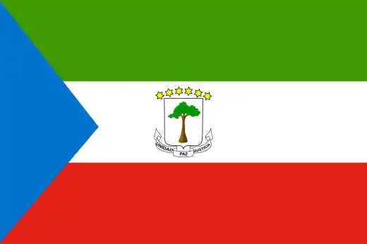
At a glance
Capital city: Ciudad de la Paz
Population: 1.9 million
Area: 28,051 sq km
Major languages: Spanish, Fang, Bubi, Portuguese, French, Creoles
Major religions: Christianity, Islam and traditional Indigenous beliefs
Time zone: UTC+1 (West Africa Time)
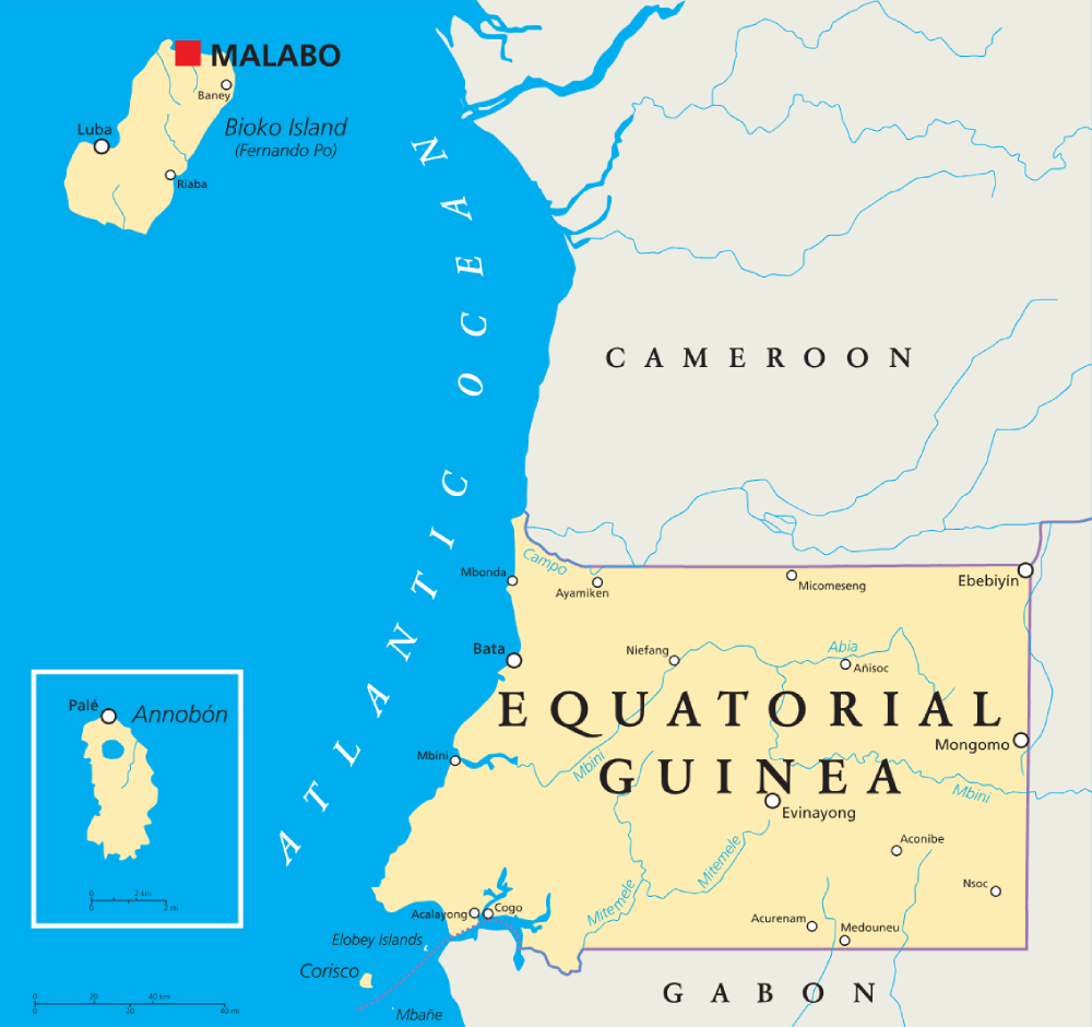
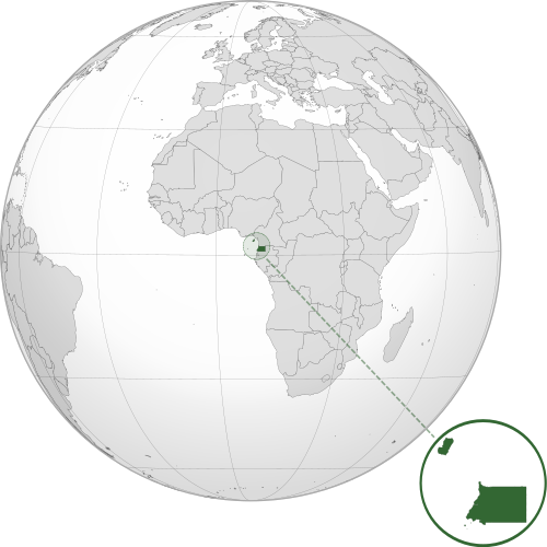
Geography of Equatorial Guinea
Equatorial Guinea is one of the smallest African countries and lies in Central Africa.
The country consists of a mainland region called Río Muni and several islands in the Gulf of Guinea. It’s covered in tropical forests with several volcanoes, both active and extinct.
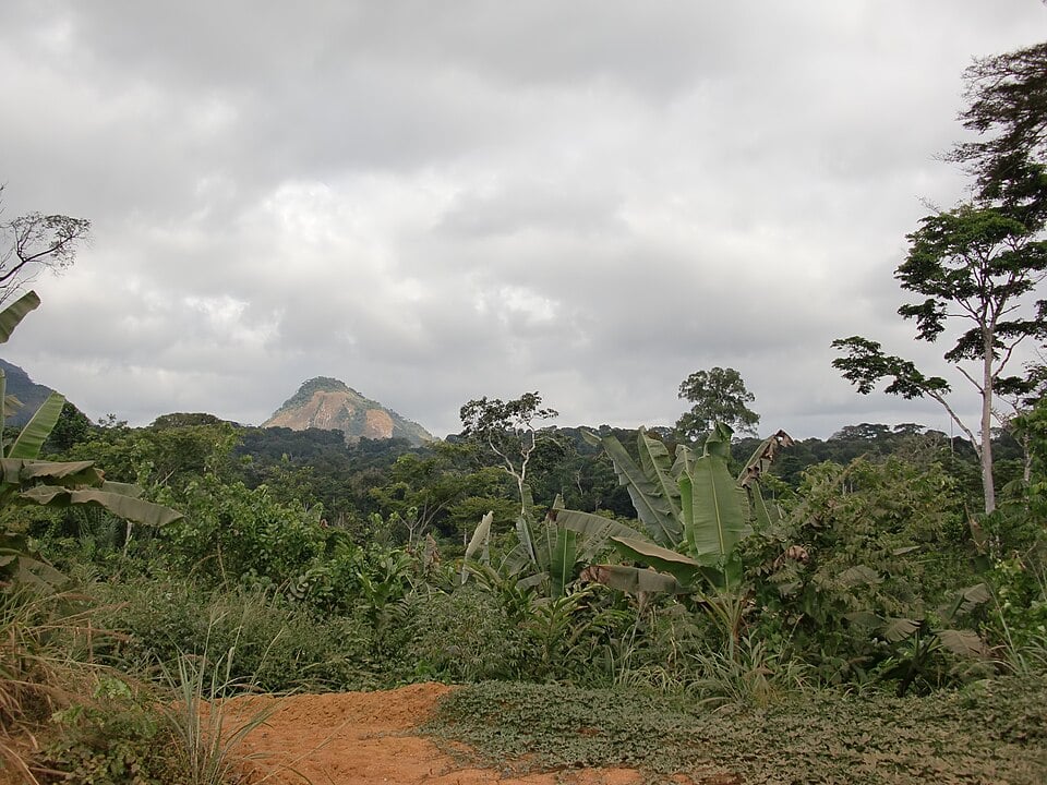
Río Muni Mainland
Río Muni is the mainland part of Equatorial Guinea. It borders Cameroon and Gabon, with coastal plains rising inland to low hills and heavily forested valleys.

Bioko Island
Bioko Island is part of the Cameroon Volcanic Line and is home to Malabo, Equatorial Guinea’s former capital. The island is volcanic, mountainous and much wetter than the mainland in places.
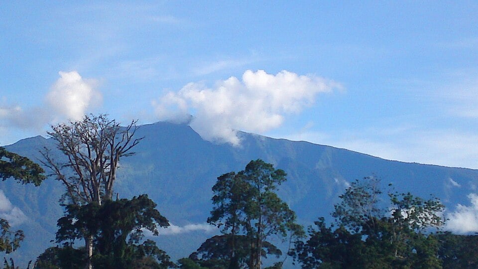
Pico Basilé
Pico Basilé is Equatorial Guinea’s highest point, rising to about 3,011 m on Bioko Island. It is part of the volcanic landscape that shapes the island.
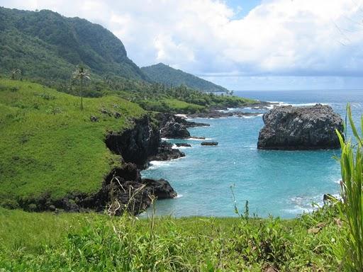
Annobón Island
Annobón is a small volcanic island far southwest of the mainland. It is one of the most remote parts of Equatorial Guinea and is also part of the Cameroon line.
See article: Flag of Equatorial Guinea
Equatorial Guinea flag
The flag of Equatorial Guinea was first adopted when the country gained independence from Spain on 12 October 1968. Its design features green, white and red horizontal stripes, a blue triangle at the hoist and the national coat of arms in the center.
During the rule of Francisco Nguema, the coat of arms on the flag was changed. After Nguema was overthrown in 1979, the original independence-era emblem was restored, and the flag has remained unchanged since then.
Image credits:
Equatorial Guinea (centered orthographic projection): Addicted04, via Wikimedia Commons, licensed under CC BY-SA 3.0.
Río Muni mainland: Mehlauge, via Wikimedia Commons, licensed under CC BY-SA 3.0. Cropped.
Pico Basilé: Serge Moons, via Wikimedia Commons, licensed under CC BY-SA 3.0. Cropped.
Annobón Island: Bioko Islander, via Wikimedia Commons, licensed under CC BY-SA 3.0. Cropped.

Caitriona Maria is an education writer and owner of The Facts Institute. With seven years of teaching experience and a background in educational content, she specialises in creating clear reference resources about countries, geography and global topics.