10 fun facts about Somalia
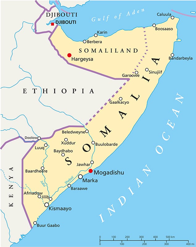
1. Somalia is the easternmost country on mainland Africa and forms much of the region known as the Horn of Africa.
2. Somalia has more than 3,000 km (1,860 miles) of coastline, giving it the longest coastline of any country on mainland Africa.
3. Ancient Somalia may have formed part of the region known as Punt, which traded valuable goods such as incense, frankincense and myrrh with ancient Egypt thousands of years ago.
4. The name Madagascar may have originated from a medieval mix-up. Explorer Marco Polo appears to have confused the island with the Somali city of Mogadishu, which may have given rise to the name Madagascar.
5. Camels play an important role in Somali culture, providing milk, meat, transport, income and traditionally even social status for their owners.
6. In 1991, Somaliland declared unilateral independence from Somalia. In 2025, Israel became the first UN member state to formally recognize it as an independent state, although it remains unrecognized by most of the world.
7. Anjero is a popular Somali flatbread with a soft, spongy texture. It is commonly eaten with meat or vegetable dishes and is closely related to the injera eaten elsewhere in the Horn of Africa.
8. Somalia’s flag features a single white five-pointed star on a light-blue background. The blue was originally inspired by the flag of the United Nations, which played an important role in Somalia’s transition towards independence.
9. The hijacking of the US-flagged cargo ship Maersk Alabama by Somali pirates in 2009 inspired the 2013 film Captain Phillips, starring Tom Hanks.
10. Somalia is the birthplace of several internationally known figures, including British Olympic champion Mo Farah, who was born in what is now Somaliland in 1983.
Read more: Facts about Somalia

At a glance
Capital city: Mogadishu
Population: 19.7 million
Area: 637,657 sq km
Major languages: Somali, Arabic, Italian, English
Major religions: Islam
Time zone: UTC+3 (East Africa Time)
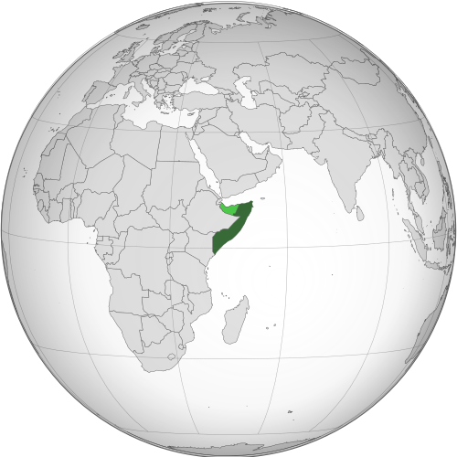
Where is Somalia?
Continent: Africa
Region: Eastern Africa
Neighboring countries: Djibouti, Ethiopia and Kenya
Highest point: Mount Shimbiris (2,460 m / 8,071 ft)
Geography of Somalia
Somalia in Eastern Africa occupies much of the Horn of Africa, with a long coastline along the Gulf of Aden and Indian Ocean.
Much of the country is dry and relatively flat, with broad plateaus and plains, while mountains rise along parts of the northern coast.
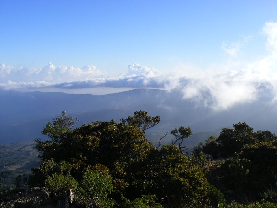
Northern Mountains & Gulf of Aden Coast
Northern Somalia has the country’s most mountainous terrain, where rugged ranges rise close to the Gulf of Aden. The Cal Madow Mountains contain Shimbiris, regarded as Somalia’s highest point.
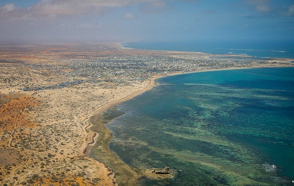
Central Plateaus & Dry Plains
Much of central Somalia consists of broad plateaus and semi-arid plains. Rainfall is generally low and unreliable, and seasonal droughts are a major feature of the landscape.
Jubba & Shabelle River Valleys
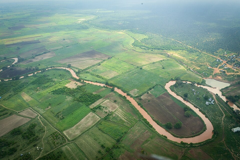
The Jubba and Shabelle are Somalia’s two major permanent rivers, both flowing from the Ethiopian Highlands into southern Somalia. Their valleys contain some of the country’s most fertile land and support farming and settlements in an otherwise largely dry environment.
Indian Ocean Coast & Southern Lowlands
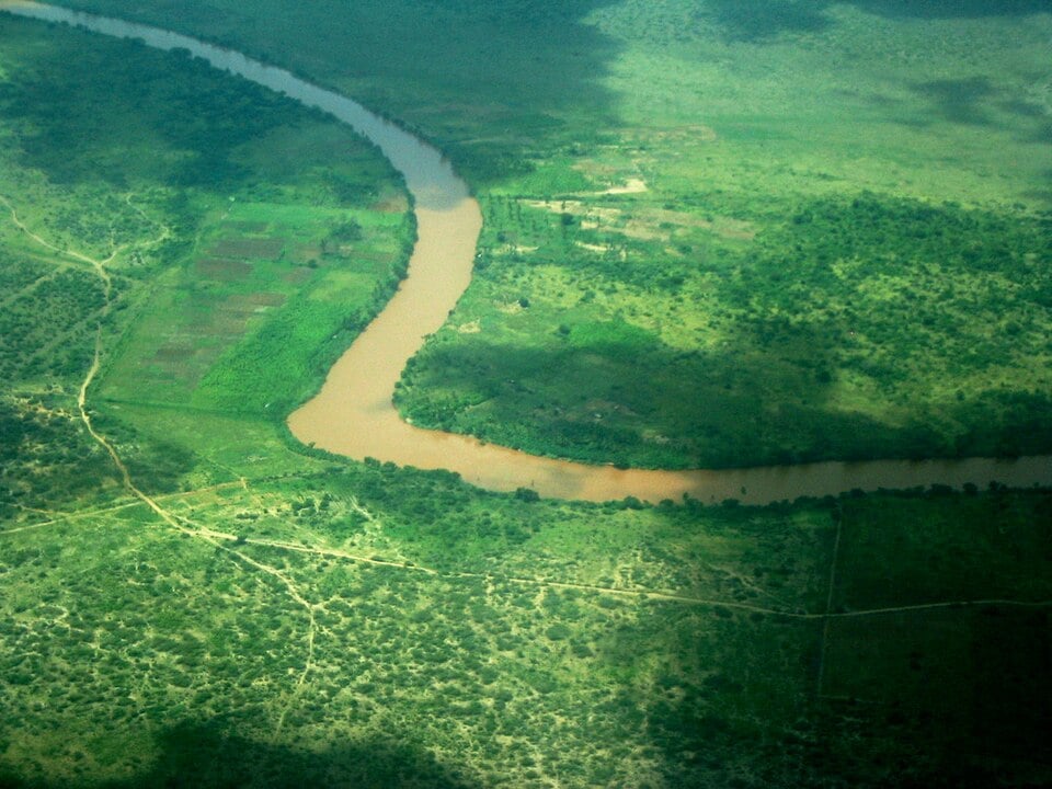
Southern Somalia is generally lower and flatter, with extensive plains stretching towards the Indian Ocean. The far south becomes greener around the Jubba River and areas close to the Kenyan border.
See article: Flag of Somalia
Somalia flag
Somalia’s flag was designed in 1954 while the territory was being prepared for independence.
The flag was used when British Somaliland became independent on 26 June 1960 and was retained when it united with Italian Somaliland on 1 July to form the Somali Republic.
Image credits:
Geography, image four: Jubba River, downstream Jamaame: Sylvie Doutriaux, via Wikimedia Commons, licensed under CC BY-SA 2.0. Cropped.

Caitriona Maria is an education writer and owner of The Facts Institute. With seven years of teaching experience and a background in educational content, she specialises in creating clear reference resources about countries, geography and global topics.