The Dominican Republic is a country in the West Indies, a group of islands often referred to as the Caribbean. It is the largest economy in that region, with a GDP of $113.6 billion in 2022.
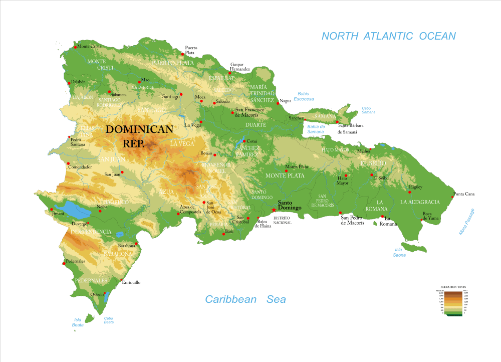
Map of the Dominican Republic
Key geography facts
1. The Dominican Republic occupies approximately two-thirds of Hispaniola island, the second-largest island in the Caribbean after Cuba.
2. The Dominican Republic is home to Pico Duarte, the highest peak in the Caribbean, standing at 10,417 feet (3,175 meters).
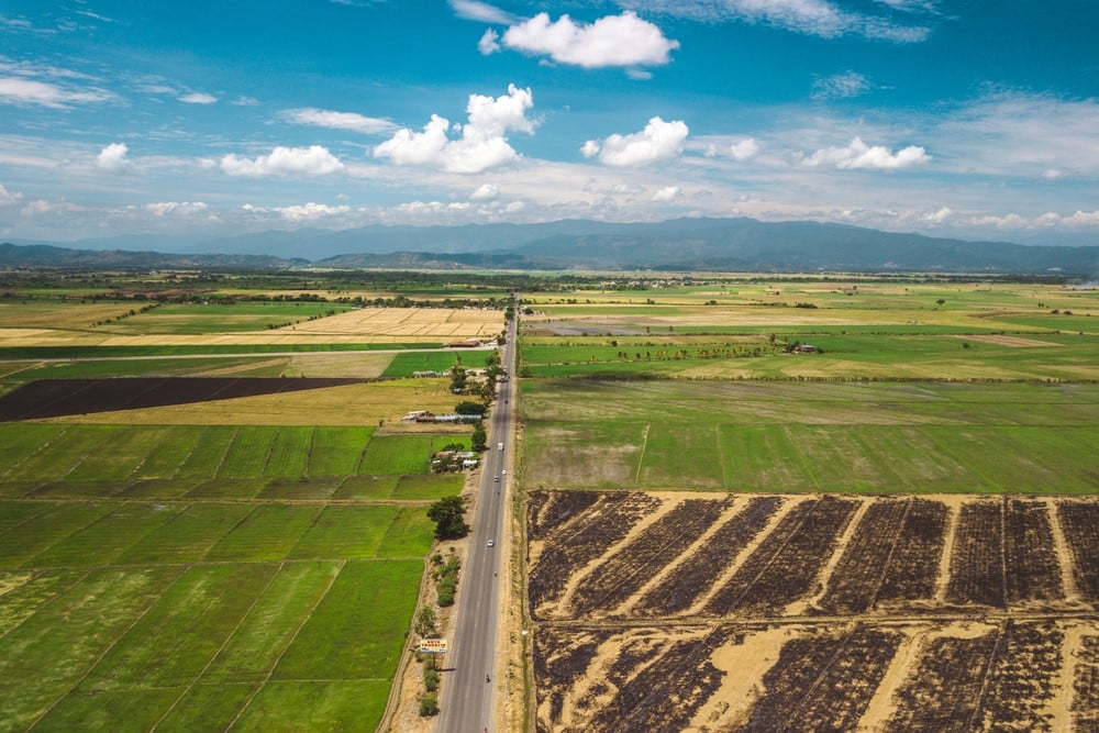
3. The country has a tropical climate, with warm temperatures year-round and a diverse landscape that includes rainforests, deserts, and fertile valleys.
4. Lake Enriquillo in the Dominican Republic is a salt lake located 144 feet (44 meters) below sea level. It is the largest lake in the Caribbean and the only saltwater lake in the world inhabited by crocodiles.
Recommended reading: Fun Facts About The Dominican Republic
The Dominican Republic regions
The Dominican Republic has 32 administrative divisions consisting of 31 provinces and one National District:
- Azua
- Baoruco
- Barahona
- Dajabón
- Duarte
- El Seibo
- Elías Piña
- Espaillat
- Hato Mayor
- Hermanas Mirabal
- Independencia
- La Altagracia
- La Romana
- La Vega
- María Trinidad Sánchez
- Monseñor Nouel
- Monte Cristi
- Monte Plata
- Pedernales
- Peravia
- Puerto Plata
- Samaná
- Sánchez Ramírez
- San Cristóbal
- San José de Ocoa
- San Juan
- San Pedro de Macorís
- Sánchez Ramírez
- Santiago
- Santiago Rodríguez
- Santo Domingo (National District)
- Valverde
Map of the Dominican Republic in the Caribbean
The Caribbean island of Hispaniola is divided into two countries: Haiti (west) and the Dominican Republic (east).
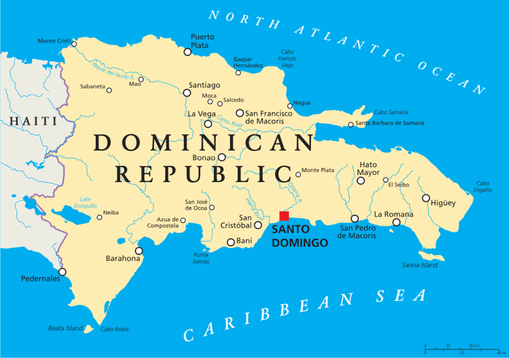
The Dominican Republic major cities and municipalities
Santo Domingo – The capital and largest city, known for its rich history as the oldest continuously inhabited European settlement in the Western Hemisphere, vibrant culture, and economic significance.

Santiago de los Caballeros – The second-largest city, located in the Cibao Valley, known for its cultural heritage, agricultural production, and as a major economic hub in the country.

Concepción de la Vega – Commonly known as La Vega, this is a vibrant city renowned for its rich history as one of the island’s oldest European settlements and its lively annual carnival celebration.
San Pedro de Macorís – A coastal city famous for its sugar industry, rich baseball tradition, and as a port city with historical significance.

La Romana – A city on the southeast coast, known for its tourism industry, beautiful beaches, and as a gateway to nearby resorts and islands like Isla Saona.
Los Alcarrizos – A densely populated city near Santo Domingo, known for its growing residential areas and proximity to the capital.
San Felipe de Puerto Plata – A popular tourist destination on the northern coast, known for its resorts, beaches, and the historic San Felipe Fortress.

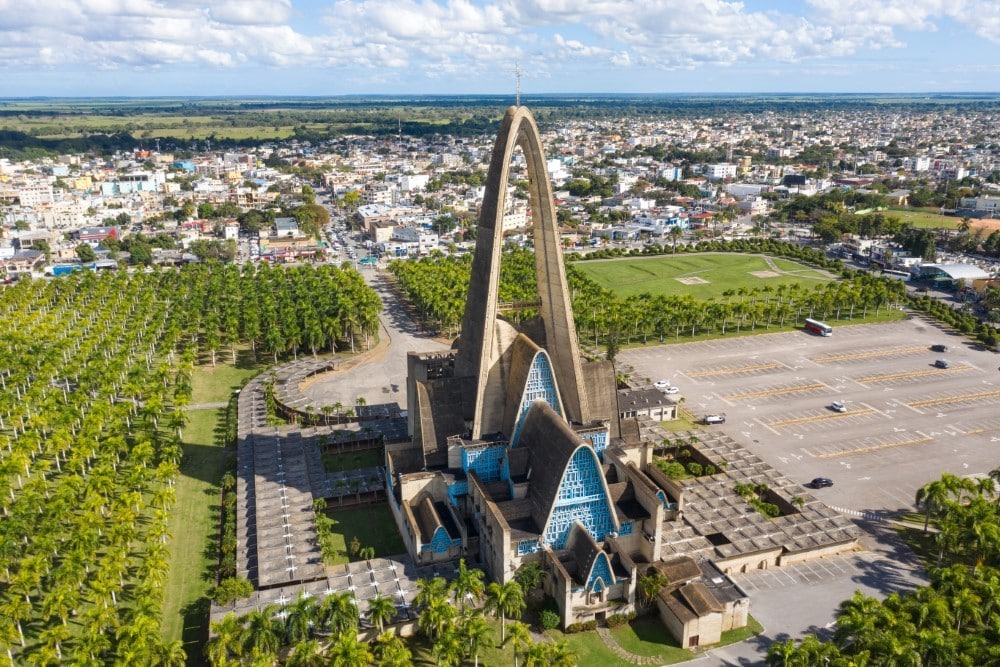
Higüey – Located in the southeastern part of the country, known for the Basílica Catedral Nuestra Señora de la Altagracia, a major pilgrimage site, and as a gateway to the Punta Cana resort area.
San Cristóbal – A city located southwest of Santo Domingo, known for its cultural significance, industrial activities, and agricultural production.

San Francisco de Macorís – A city in the northern region, recognized for its agricultural production, especially cacao, and as a regional economic center.
Caitriona Maria is an education writer and owner of The Facts Institute. With seven years of teaching experience and a background in educational content, she specialises in creating clear reference resources about countries, geography and global topics.