10 fun facts about Chad
1. Chad is Africa’s largest landlocked country. It has no coastline, yet covers more than 1.2 million sq km (about 463,000 sq mi).
2. Chad is named after Lake Chad, a vast lake on the country’s western border.
3. Chad’s flag is almost identical to Romania’s flag. Both use vertical stripes of blue, yellow and red, although Chad’s blue stripe is darker.
4. Chad has been called the “Babel Tower of the World” because it is home to more than 200 ethnic groups and over 100 languages and dialects.
5. The Sahara Desert covers much of northern Chad, making the country home to some of Africa’s most dramatic desert landscapes.
6. The Tibesti Mountains in northern Chad are the largest and highest mountain range in the Central Sahara and include Emi Koussi, the highest point in Chad.
7. The Lakes of Ounianga are a group of 18 lakes in the Sahara Desert that survive despite receiving less than 2 mm of rainfall per year.
8. The sandstone Ennedi Massif is marked by natural arches, desert wildlife and ancient rock art dating back thousands of years.
9. In Chad, scientists discovered Toumaï, a fossil skull thought to be around 6 to 7 million years old and one of the oldest known members of the human family.
10. Chad is home to the Gerewol festival, where Wodaabe men dress up, dance and compete in a traditional male beauty contest judged by women.
Read more: Facts about Chad

At a glance
Capital city: N’Djamena
Population: 21 million
Area: 1.284 million sq km
Major languages: French, Arabic, Sara
Major religions: Islam, Christianity
Time zone: UTC+1 (West Africa Time)
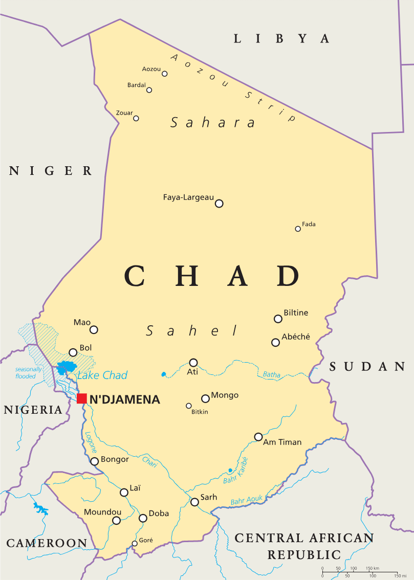
Where is Chad?
Continent: Africa
Region: Central Africa
Neighboring countries: Libya, Sudan, Central African Republic, Cameroon, Nigeria and Niger
Highest point: Emi Koussi (3,415 m / 11,204 ft)
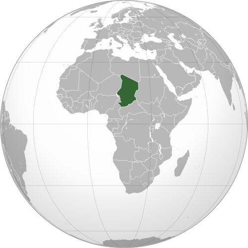
Geography of Chad
Chad is a large, landlocked country in Central Africa and one of the largest African countries by area.
Its landscapes change sharply from the Sahara Desert in the north to the Sahel in the center and wetter savanna regions in the south.
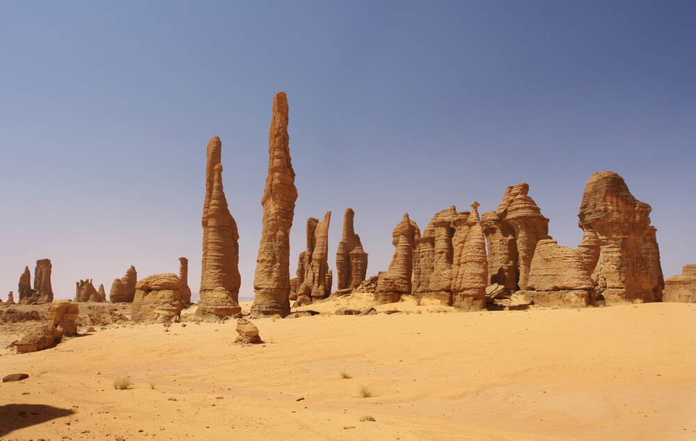
Sahara Desert
Chad extends well into the Sahara Desert. The northern desert region of the country receives very little rainfall.
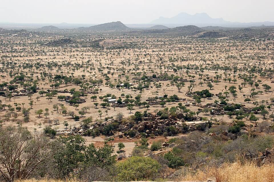
Sahel Belt
Central Chad forms part of the Sahel, the semi-arid zone south of the Sahara. This region has grassland, scrub and seasonal grazing areas that depend heavily on rainfall.
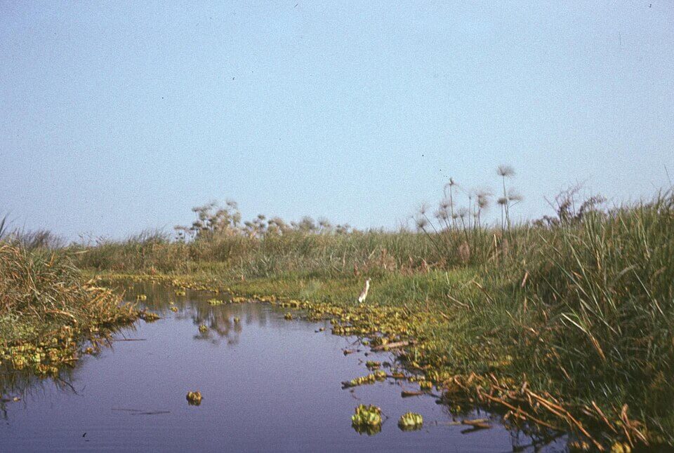
Lake Chad and Rivers
Lake Chad lies along Chad’s western border and is shared with neighboring countries. The Chari and Logone rivers flow north from the wetter south and provide most of the water that reaches the lake.
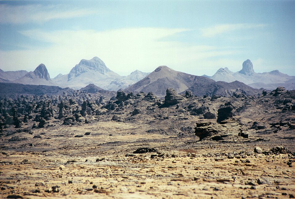
Tibesti Mountains
The Tibesti Mountains rise in northern Chad and include Emi Koussi, the country’s highest point. This volcanic mountain range is rich in tungsten, tin and uranium.
See article: Flag of Chad
Chad flag
The flag of Chad was adopted on 6 November 1959, while Chad was still an autonomous republic within the French Community. An earlier proposal used the pan-African colors of green, yellow and red, but the green stripe was replaced with blue to avoid confusion with other African flags.
The final blue, yellow and red design remained in use after Chad became independent from France in 1960.
Image credits:
Guéra, central Chad (Sahel region): 120, via Wikimedia Commons, licensed under CC BY-SA 4.0. Cropped.
Lake Chad: Institute of Ethnology and Cultural Anthropology, Adam Mickiewicz University, via Wikimedia Commons, licensed under CC BY-SA 3.0 PL. Cropped.

Caitriona Maria is an education writer and owner of The Facts Institute. With seven years of teaching experience and a background in educational content, she specialises in creating clear reference resources about countries, geography and global topics.