10 fun facts about Kenya
1. Kenya has been described as the “birthplace of humankind”. Some of the world’s oldest known stone tools, dating back around 3.3 million years, were discovered in northern Kenya.
2. Kenya takes its name from Mount Kenya, the country’s highest peak and Africa’s second-highest mountain.
3. Nairobi National Park is one of the few national parks in a capital city. It is home to a variety of wildlife such as the black rhino.
4. Umoja, a unique village in Kenya, is inhabited by women and children. Men are not allowed to live there, although they may enter as visitors and must abide by the community’s rules.
5. Lake Turkana in northern Kenya is the world’s largest permanent desert lake and the world’s largest alkaline lake. It is sometimes called the “Jade Sea” because of its greenish-blue color.
6. The Maasai Mara forms part of the route of the Great Migration, during which huge herds of wildebeest, zebras and gazelles move between Kenya and Tanzania.
7. Africa’s largest lake is partly located in Kenya. Lake Victoria is also the world’s second-largest freshwater lake by surface area.
8. Polygamy is legal in Kenya which means men can take more wives without consulting existing spouses.
9. Kenya lies along the East African Rift, where tectonic forces are slowly pulling part of the African continent apart. The rift has created escarpments, volcanoes and chains of lakes.
10. Ugali is a staple food in Kenya. It is a thick, dough-like dish usually made by cooking maize flour in water.
Read more: Facts about Kenya

At a glance
Capital city: Nairobi
Population: 57.5 million
Area: 580,367 sq km
Official languages: Kiswahili (Swahili), English
Major religions: Christianity, Islam
Time zone: UTC+3 (East Africa Time)
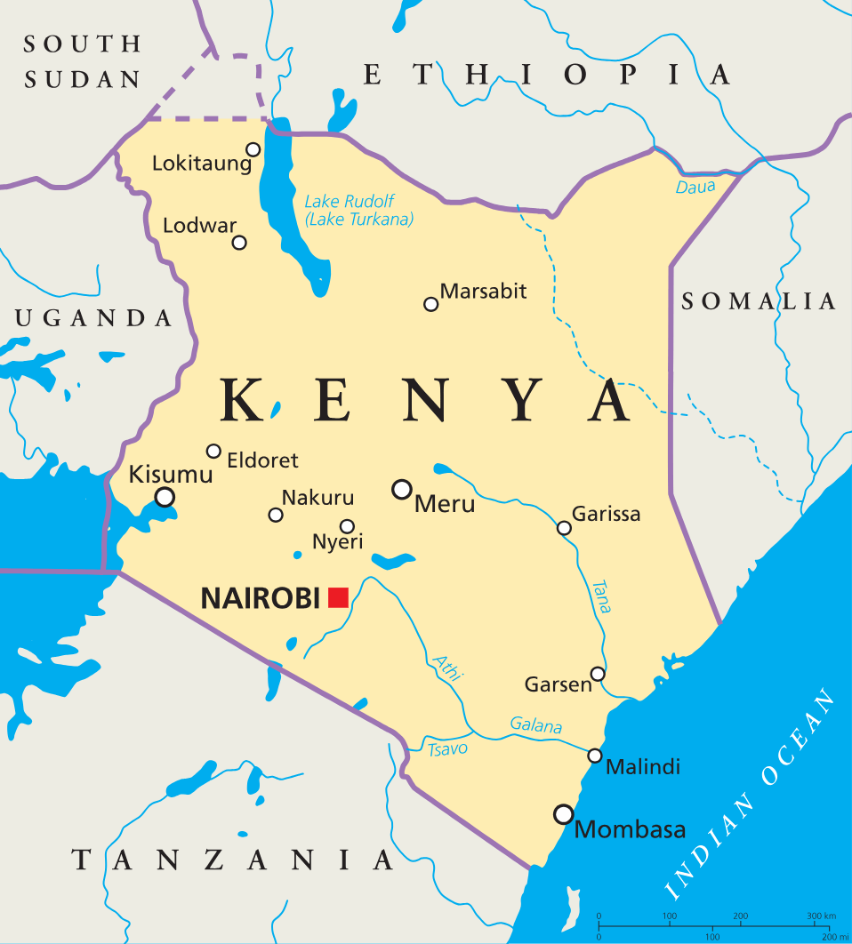
Where is Kenya?
Continent: Africa
Region: East Africa
Neighboring countries: Ethiopia, Somalia, South Sudan, Uganda and Tanzania
Highest point: Batian, Mount Kenya (5,199 m / 17,057 ft)
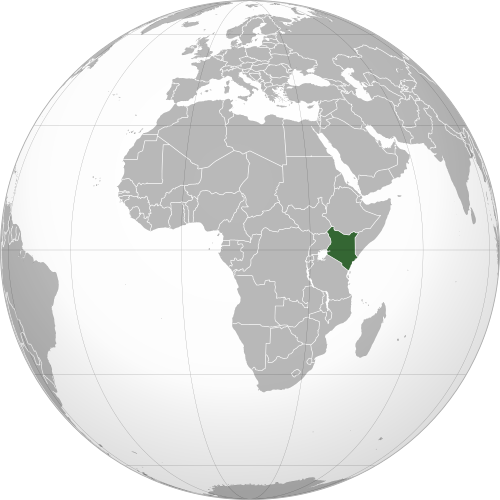
Geography of Kenya
Kenya is one of the most geographically diverse African countries and lies in Eastern Africa.
Its landscapes range from an Indian Ocean coastline and fertile highlands to the Great Rift Valley, open savanna, lakes and dry northern plains.
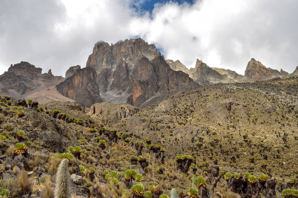
Mount Kenya and the Central Highlands
The central highlands are among the greenest and most fertile parts of Kenya. Mount Kenya rises from this region and, at 5,199 meters, is the country’s highest point and the second-highest mountain in Africa.
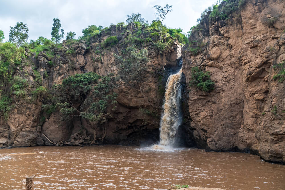
Great Rift Valley
The Great Rift Valley runs from north to south through Kenya. Its dramatic landscape includes steep escarpments, volcanic landforms, hot springs and a chain of lakes, including Lake Nakuru, Lake Bogoria and Lake Elementaita.
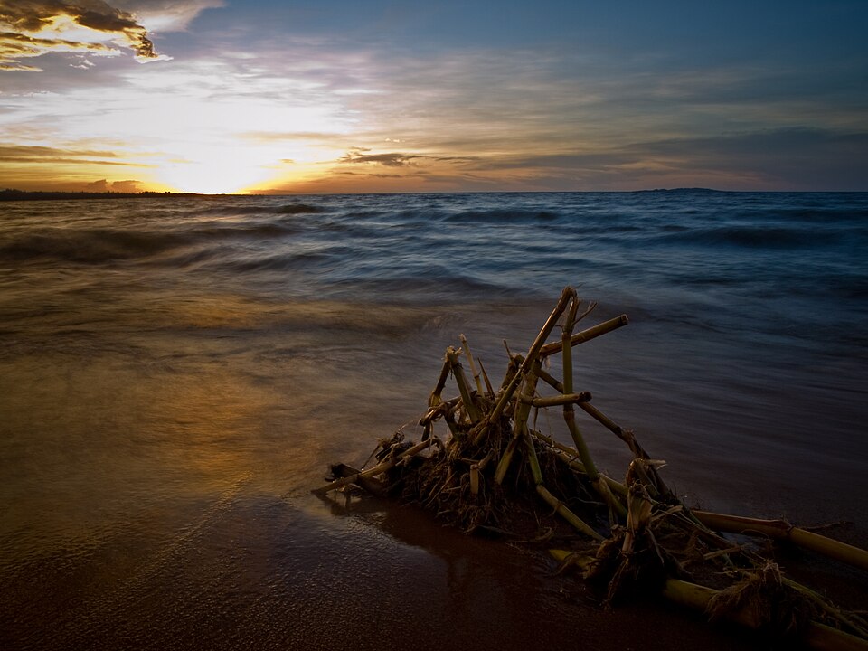
Lake Victoria and Western Kenya
Western Kenya slopes toward Lake Victoria, the largest lake in Africa. The surrounding region includes fertile farmland, wetlands, hills and rivers that flow westward into the lake.
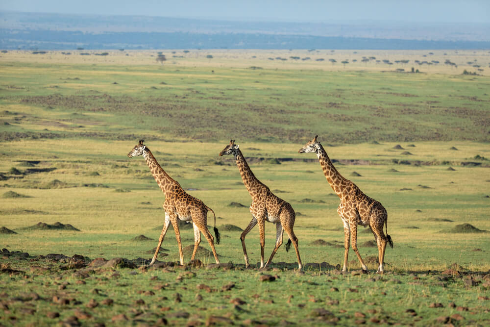
Savanna and Northern Plains
Large areas of southern Kenya are covered by open savanna and grassland, including the famous Maasai Mara. Northern and eastern Kenya are much drier, with semi-arid plains, scrubland and desert landscapes. There are also several isolated mountains that receive more rainfall than the surrounding lowlands.
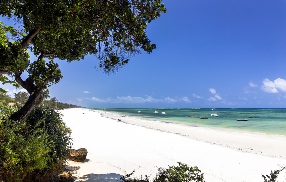
Indian Ocean Coast
Kenya has a low-lying coastline that stretches nearly 300 miles (480 km) along the Indian Ocean. It includes sandy beaches and coastal towns such as Mombasa, Malindi and Lamu.
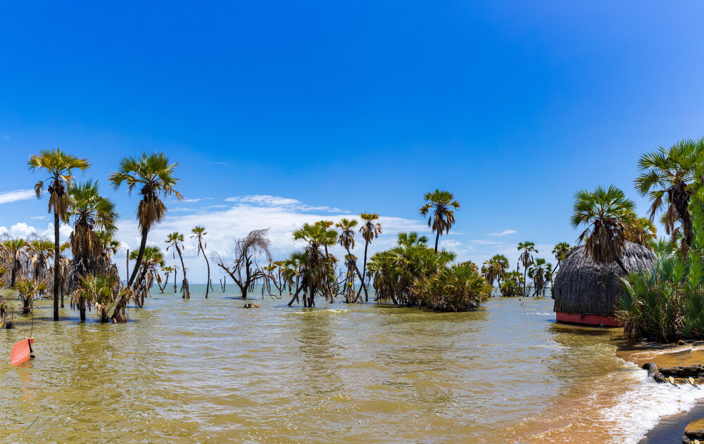
Lake Turkana
Lake Turkana lies in the dry north of Kenya and extends into Ethiopia. Sometimes called the “Jade Sea” because of its greenish color, it is the world’s largest permanent desert lake.
See article: Flag of Kenya
Kenya flag
The flag of Kenya developed from the colors used by the Kenya African Union and later the Kenya African National Union during the independence movement. As independence approached, the design was adapted to represent the whole country rather than a single political party.
White stripes were added between the black, red and green bands, along with a central Maasai shield and crossed spears. The flag was officially adopted on 12 December 1963, the day Kenya gained independence from the United Kingdom.
Image credits:
Kenya (centered orthographic projection): Mandingoesque, via Wikimedia Commons, licensed under CC BY-SA 3.0.
Lake Victoria, Kenya: William Warby, via Wikimedia Commons, licensed under CC BY 2.0. Cropped.

Caitriona Maria is an education writer and owner of The Facts Institute. With seven years of teaching experience and a background in educational content, she specialises in creating clear reference resources about countries, geography and global topics.