Maps of the United States help illustrate the layout of the 50 states and their geographic relationships. They also show how states are grouped into broader regional classifications used for geographic and statistical analysis.
On this page, you can explore several types of US maps, including reference maps, educational maps, and blank maps designed for learning and geography practice.
General reference US map
If you are looking for a map that provides a broad overview of the 50 states, here it is. This is helpful for basic orientation, planning, and understanding the layout of the country.

Educational US maps
Visualize the placement of the states and their capitals with the following educational US maps. These maps focus on different ways of learning US geography, including state names, abbreviations and capitals.
US state abbreviations map
This map shows the standard two-letter abbreviations used for each US state.
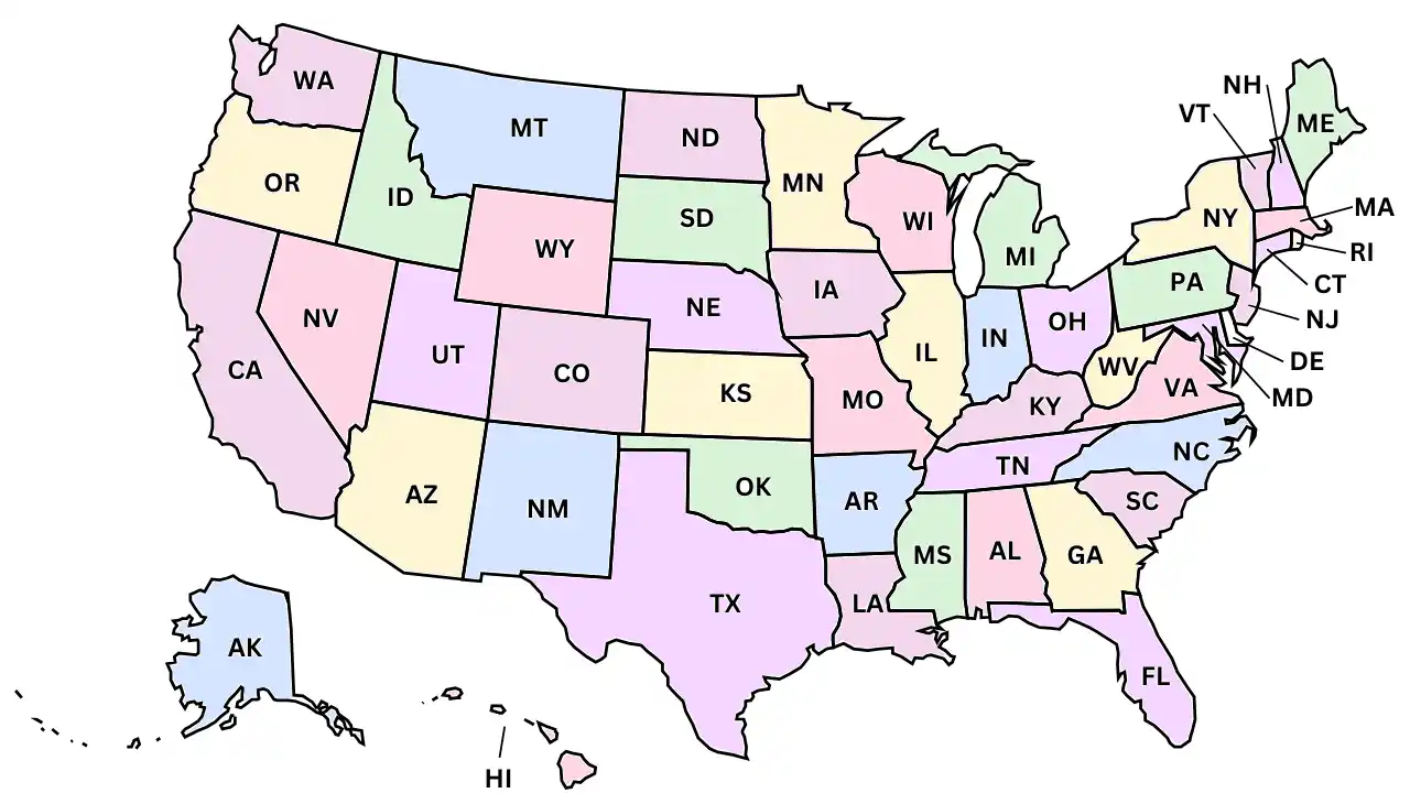
Learn the state names and abbreviations.
US states and capitals map
This map displays the names of all 50 states along with the state capitals.
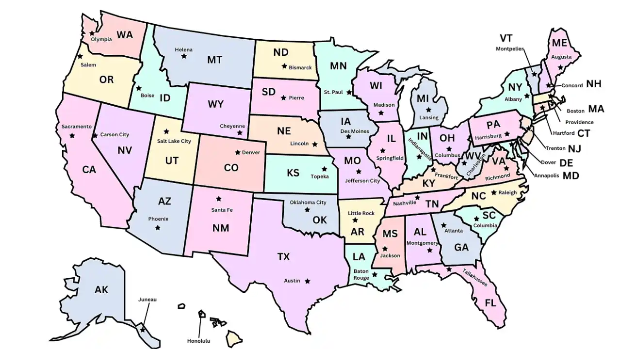
US state capitals map
This map highlights the state capitals of each US state.

Blank map
Prefer to practice offline? You can also download our printable blank US map.
Downloadable maps
If you prefer printable worksheets, you can download our complete US map learning set designed for classroom or home study.

Check out our printable US map worksheets.
For additional government-produced map resources, the National Atlas provides downloadable US maps, including topographic and geographic datasets.
Play our states challenge game
Once you have learned the names and locations of the states, test your knowledge with our 50-state map naming game.
