10 fun facts about Malawi
1. Malawi is a landlocked country, which means it doesn’t have access to the sea. However, Lake Malawi (Lake Nyasa) gives it hundreds of kilometers of shoreline.
2. Malawi is often called the “Warm Heart of Africa” because of the friendliness and hospitality associated with its people.
3. Lake Malawi is sometimes called the “calendar lake” because it is traditionally said to measure about 365 miles long and 52 miles wide.
4. The name Malawi is commonly said to mean “flames”, often linked to the fiery appearance of the sun over Lake Malawi.
5. Agriculture employs around three-quarters of Malawi’s workforce, and most farming depends on rainfall.
6. The Chongoni Rock-Art Area contains 127 recorded sites as old as the late Stone Age.
7. Majete Wildlife Reserve successfully reintroduced animals including lions, rhinos and cheetahs after years of poaching. It later became Malawi’s first reserve where visitors could see the Big Five.
8. Tobacco remains Malawi’s most important export and accounts for roughly half of its merchandise export value. Other important exports include tea, sugar and groundnuts.
9. Lake Malawi contains hundreds of fish species, many of which are found nowhere else on Earth. Its importance to the study of evolution has been compared to that of the Galápagos Islands.
10. In 1991, a hominid jawbone dating back around 2.4 million years was discovered in Malawi. It is one of the earliest fossils attributed to the genus Homo.
Read more: Facts about Malawi

At a glance
Capital city: Lilongwe
Population: 22.2 million
Area: 118,484 sq km
Major languages: English, Chichewa
Major religions: Christianity, Islam
Time zone: UTC+2 (Central Africa Time)
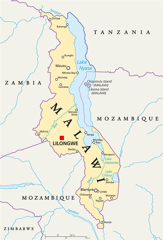
Where is Malawi?
Continent: Africa
Region: Eastern Africa
Neighboring countries: Mozambique, Tanzania and Zambia
Highest point: Sapitwa Peak, Mount Mulanje (3,002 m / 9,849 ft)
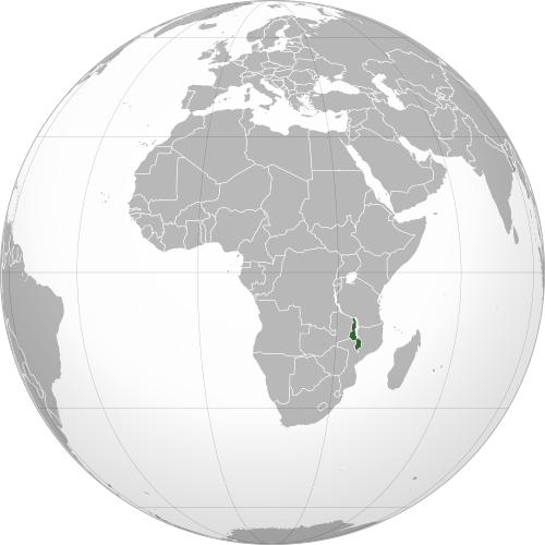
Geography of Malawi
Malawi is one of the landlocked African countries and lies in Eastern Africa.
Its landscape is dominated by Lake Malawi and the Great Rift Valley, with rolling plateaus, highland grasslands, river valleys and isolated mountains.
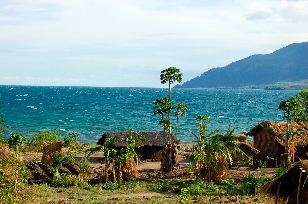
Lake Malawi and the Rift Valley
Lake Malawi stretches along much of the country’s eastern side and lies within the Great Rift Valley. It covers around one-fifth of Malawi’s total area, and its shoreline extends through Malawi, Tanzania and Mozambique.
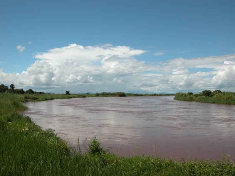
Shire River and Lower Valley
The Shire River flows south from Lake Malawi and is the lake’s only outlet. It passes through Lake Malombe and the broad Lower Shire Valley before continuing into Mozambique, where it joins the Zambezi River.
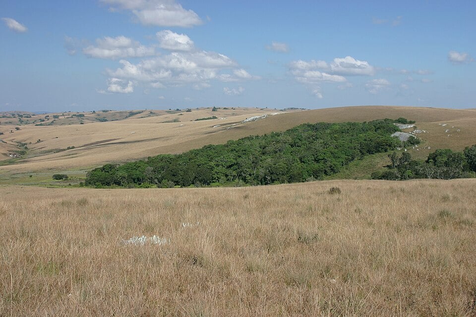
Nyika Plateau and Northern Highlands
The Nyika Plateau rises in northern Malawi and is covered by rolling grassland, streams and pockets of forest. Its highest areas reach around 2,600 meters above sea level, making it one of the country’s most elevated regions.
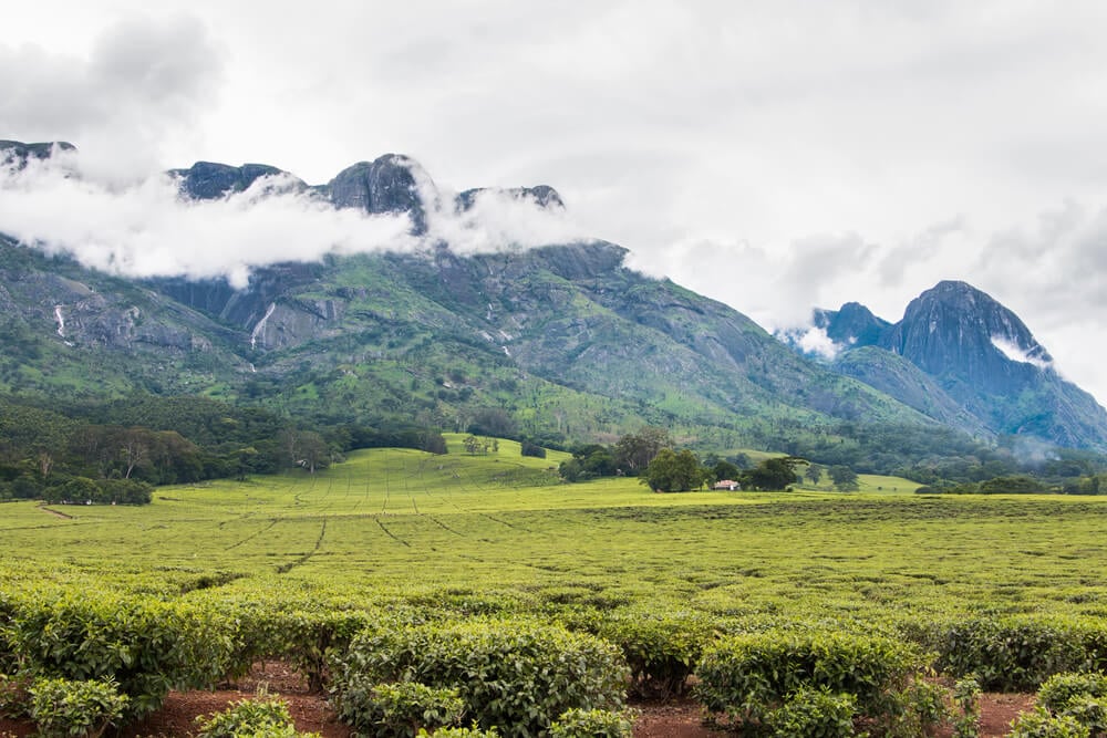
Central Plateau and Southern Highlands
Much of central Malawi consists of a gently rolling plateau with farmland, grass-covered valleys and scattered hills. Southern Malawi includes the Shire Highlands, Zomba Plateau and the dramatic Mount Mulanje massif.
See article: Flag of Malawi
Malawi flag
The flag of Malawi was first adopted in July 1964, when the country gained independence from Britain.
In 2010, Malawi introduced a new flag with a full white sun and a different stripe arrangement, but the change proved unpopular. In 2012, the original independence flag was officially restored and has remained the national flag ever since.
Image credits:
Shire River: Alex Antener, via Wikimedia Commons, licensed under CC BY-SA 3.0. Cropped.
Nyika Plateau: Dr. Thomas Wagner, Environmental and Agricultural Consulting and Research, via Wikimedia Commons, licensed under CC BY-SA 3.0. Cropped.

Caitriona Maria is an education writer and owner of The Facts Institute. With seven years of teaching experience and a background in educational content, she specialises in creating clear reference resources about countries, geography and global topics.