10 fun facts about Mauritania
1. Mauritania is named after the ancient Berber kingdom of Mauretania, even though the kingdom was located much farther north, along Africa’s Mediterranean coast. The name comes from the Mauri people, whose name also gave rise to the word “Moors.”
2. Mauritania is predominantly covered by desert, and only around 0.5% of its land is considered suitable for growing crops.
3. Mauritania is home to the Richat Structure, also called the “Eye of the Sahara.” The enormous circular formation measures around 40 kilometers (25 miles) across and is clearly visible from space.
4. Mauritania has one of the longest trains in the world. Its iron ore train can stretch for around 2 kilometers and contain approximately 200 wagons as it crosses the Sahara between Zouérat and Nouadhibou.
5. Mauritania’s currency, the ouguiya, is divided into five khoums (meaning “one fifth”). It is one of the only modern currencies that are not divided into units based on 10 or 100.
6. The ancient towns of Ouadane, Chinguetti, Tichitt and Oualata were founded during the 11th and 12th centuries to serve the trade routes traversing the Sahara. Together, they form a UNESCO World Heritage Site.
7. Banc d’Arguin National Park provides shelter to more than two million migratory birds arriving from places including northern Europe, Siberia and Greenland.
8. The coast of Mauritania is home to the largest remaining population of Mediterranean monk seals, one of the world’s most endangered marine mammals.
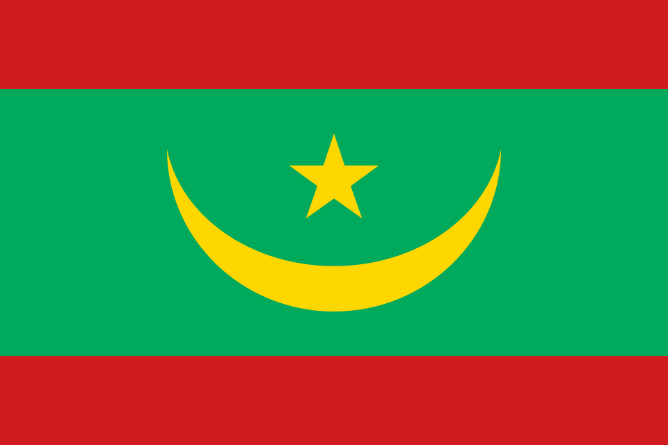
9. Red bands were added to the top and bottom of Mauritania’s flag in 2017. They represent the sacrifices made by Mauritanians who defended the country.
10. Mauritania is one of Africa’s newest oil producers, and is also rich in mineral resources, especially iron ore.
Read more: Facts about Mauritania
At a glance
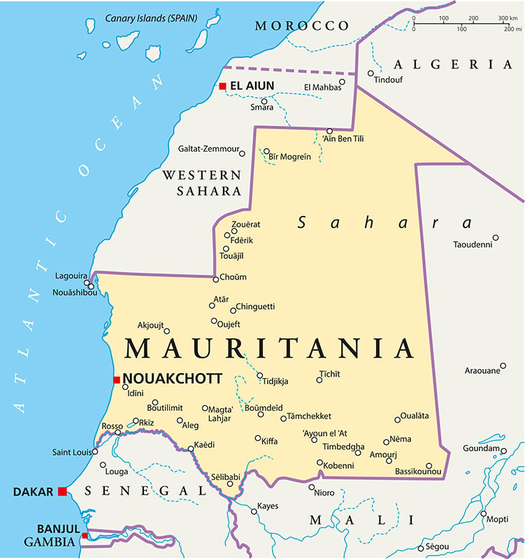
Capital city: Nouakchott
Population: 5.3 million
Area: 1,030,700 sq km
Major languages: Arabic, Pular, Soninke, Wolof, French
Time zone: UTC 0 (Greenwich Mean Time)
Geography of Mauritania
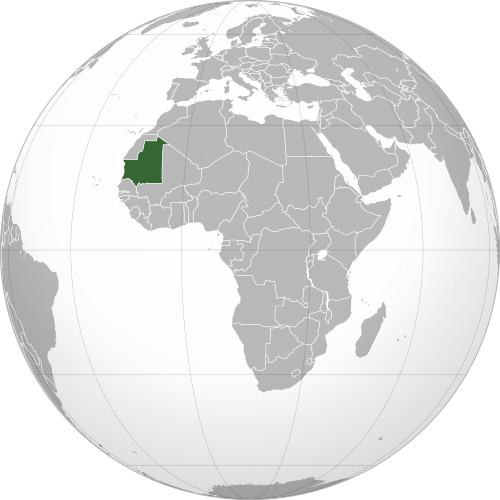
Mauritania is one of the larger African countries and lies in Western Africa, with a long Atlantic coastline.
Most of the country lies within the Sahara Desert, while the far south forms part of the semi-arid Sahel.
Sahara Desert and Interior Plains
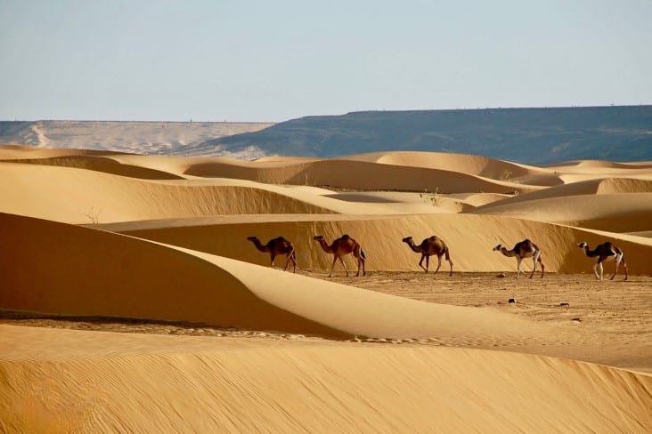
The Sahara covers about 90% of Mauritania. Across this vast desert landscape, shifting sand dunes stretch towards the horizon, broken only by sparse vegetation and isolated desert towns.

Adrar Plateau and Rocky Highlands
Central and northern Mauritania contain a series of plateaus, cliffs and rocky uplands, including the Adrar and Tagant plateaus. The Adrar region is also home to the Richat Structure, an enormous circular geological formation.
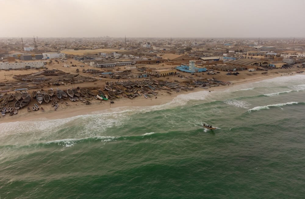
Atlantic Coast and Banc d’Arguin
Mauritania has a long Atlantic coastline of about 754 kilometers (469 miles). Along the northern coast, Banc d’Arguin is an extensive area where the Sahara meets the Atlantic Ocean, with islands, sandbanks and coastal wetlands.
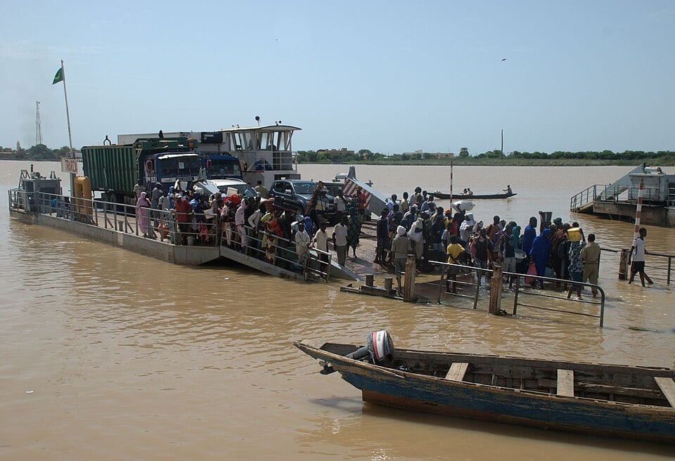
Senegal River Valley and Southern Sahel
Southern Mauritania becomes greener as the Sahara gives way to the Sahel. The Senegal River forms much of the country’s southern border and, along with groundwater, is the country’s main source of drinking water.
See article: Flag of Mauritania
Mauritania flag
Mauritania adopted its first national flag in 1959, shortly before gaining independence from France in 1960. The original design featured a green background with a golden crescent and star.
Following a constitutional referendum in 2017, red stripes were added at the top and bottom of the flag to represent the sacrifices made during the struggle for independence. The current flag was first raised on 28 November 2017.
Image credits:
The Eye of the Sahara seen from space: Axelspace Corporation, via Wikimedia Commons, licensed under CC-BY-SA 4.0. Cropped.
Rosso, Muaritania its on the banks of the Senegal River: Bertramz, via Wikimedia Commons, licensed under CC BY-SA 3.0. Cropped.

Caitriona Maria is an education writer and owner of The Facts Institute. With seven years of teaching experience and a background in educational content, she specialises in creating clear reference resources about countries, geography and global topics.