Africa is the second-largest continent in the world, with 54 internationally recognized countries and a wide variety of landscapes.
Explore the interactive map above to discover Africa’s countries, capital cities, major rivers and mountain peaks. Select a country to view geographical information, or use the map controls to show and hide different features.
Where is Africa on the world map?
Africa lies south of Europe and southwest of Asia. The continent is bordered by the Atlantic Ocean to the west, the Indian Ocean to the east and southeast, and the Mediterranean Sea to the north.
The Equator crosses central Africa, passing through countries including Gabon, the Republic of the Congo, the Democratic Republic of the Congo, Uganda, Kenya and Somalia. Africa extends across all four hemispheres.
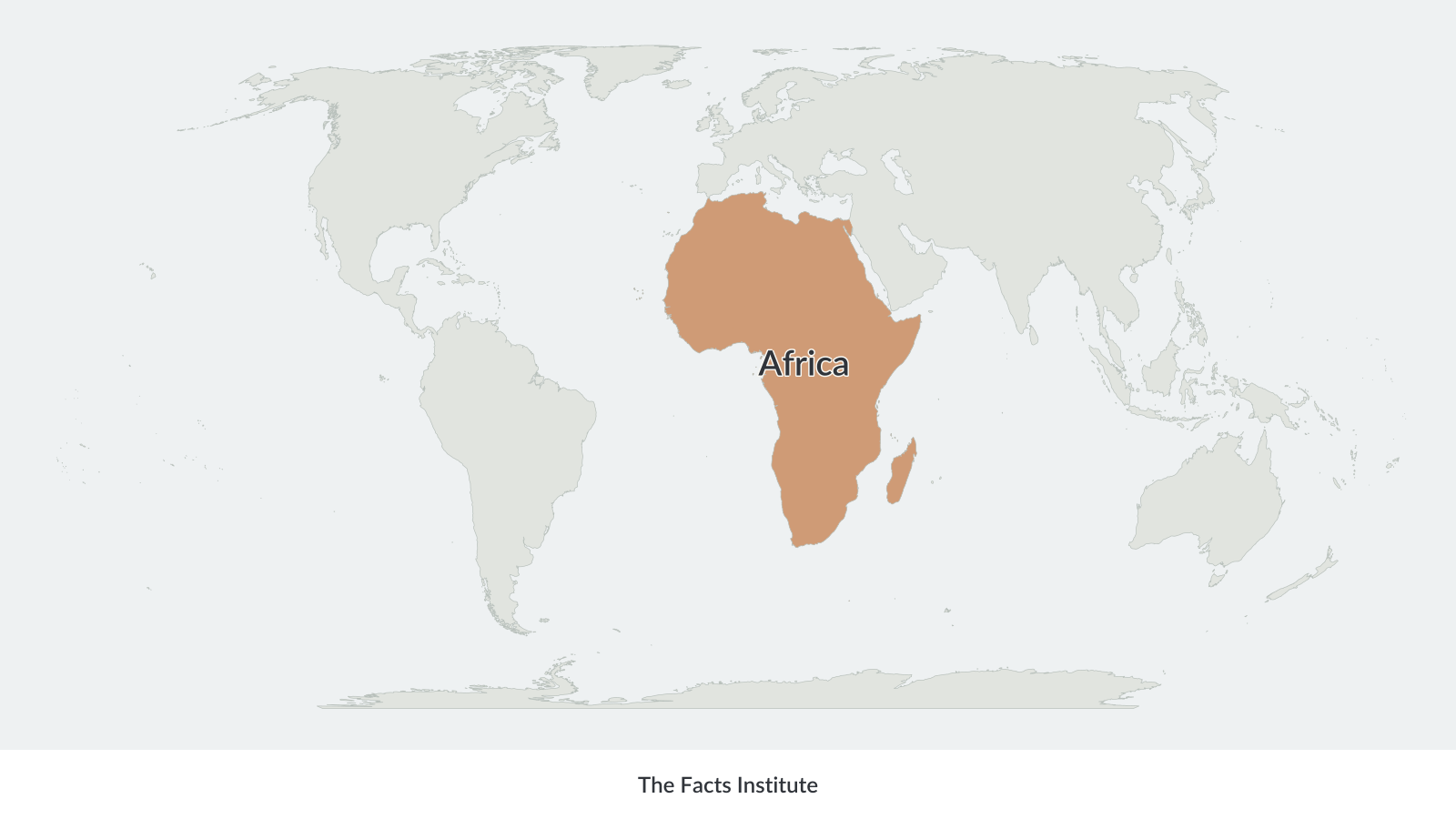
Africa stretches from the Mediterranean coast in the north to Cape Agulhas in South Africa. The Red Sea separates northeastern Africa from the Arabian Peninsula, while the Suez Isthmus connects Africa to Asia.
Madagascar, located off the southeastern coast, is the continent’s largest island.
Africa physical map
A physical map of Africa shows the continent’s natural features, including deserts, mountains, rivers, highlands, valleys and lowland regions.
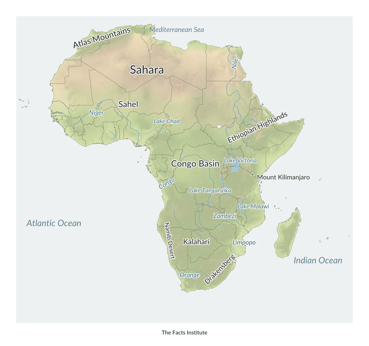
The Sahara Desert stretches across much of North Africa and is the largest hot desert in the world. South of the Sahara lies the Sahel, a transitional region between the desert and the tropical landscapes farther south.
The Congo Basin occupies a large part of Central Africa and contains one of the world’s largest tropical rainforest regions. The Congo River and its tributaries form a major river system, while the Nile flows northward through northeastern Africa toward the Mediterranean Sea.
Other important physical features include the Ethiopian Highlands, the Atlas Mountains in the northwest and the East African Rift system. Mount Kilimanjaro in Tanzania is Africa’s highest mountain, reaching approximately 5,895 meters (19,341 feet).
Major lakes include Lake Victoria, Lake Tanganyika and Lake Malawi.
The physical map uses differences in elevation to distinguish mountainous areas from lower-lying terrain.
Africa political map
A political map of Africa shows its international borders, countries and capital cities.
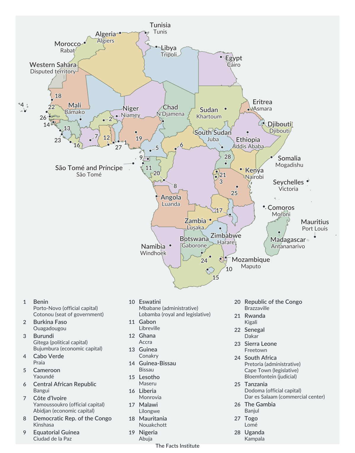
Africa has 54 internationally recognized sovereign countries, extending from Morocco, Algeria and Egypt in the north to South Africa, Lesotho and Eswatini in the south.
The continent is commonly divided into five major geographical regions: Northern Africa, Western Africa, Middle (Central) Africa, Eastern Africa and Southern Africa.
Western Sahara is a disputed territory in northwestern Africa. Its political status remains unresolved, and maps may represent its boundaries differently.
Algeria is the largest African country by area, while Seychelles is the smallest sovereign country. Nigeria has the continent’s largest population.
The political map identifies individual countries and their capitals, making it useful for studying African geography.
More Africa maps and geography resources
Explore more Africa resources, including:
These resources provide additional ways to study the continent, compare its countries and practice identifying geographical features.
Map sources: Terrain elevation data from USGS (SRTM and GMTED2010) and NOAA (ETOPO1), via Mapzen/AWS.

Caitriona Maria is an education writer and owner of The Facts Institute. With seven years of teaching experience and a background in educational content, she specialises in creating clear reference resources about countries, geography and global topics.