South America is the fourth-largest continent in the world, with 12 independent countries and a wide variety of landscapes.
Explore the interactive map above to discover South America’s countries, capital cities, major rivers and mountain peaks. Select a country to view geographical information, or use the map controls to show and hide different features.
Where is South America on the world map?
South America lies south of North America, connected to it through the Isthmus of Panama. The continent is bordered by the Pacific Ocean to the west and the Atlantic Ocean to the east.
Most of South America lies in the Southern Hemisphere, although the Equator crosses its northern region, passing through Ecuador, Colombia and Brazil. The continent is entirely within the Western Hemisphere.
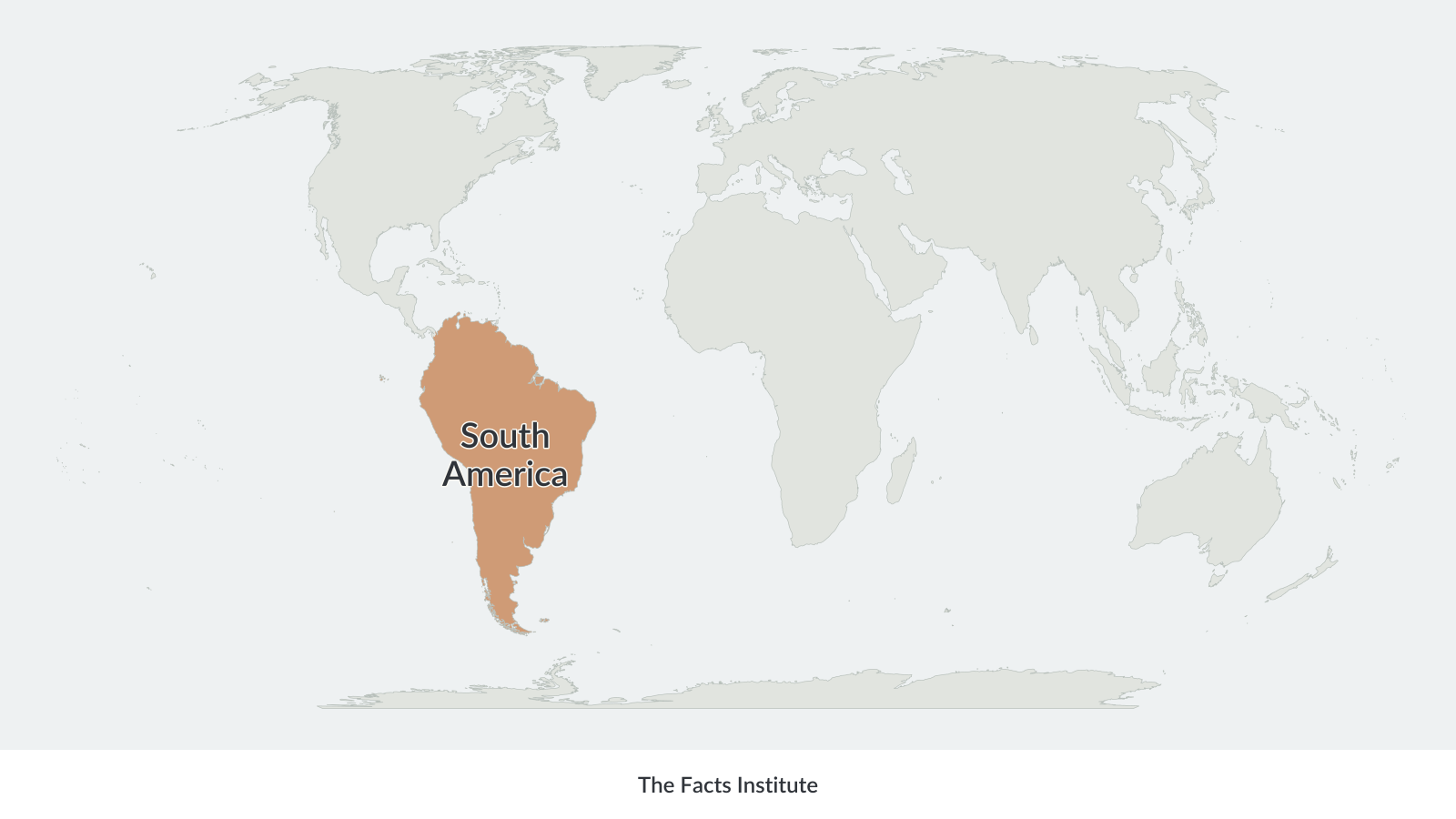
South America stretches from the Caribbean coast in the north to Cape Horn and the Tierra del Fuego archipelago in the far south. Brazil occupies much of the eastern portion of the continent, while Chile extends along its western coast.
South America physical map
A physical map of South America shows the continent’s natural features, including mountains, rivers, highlands, valleys and lowland regions.
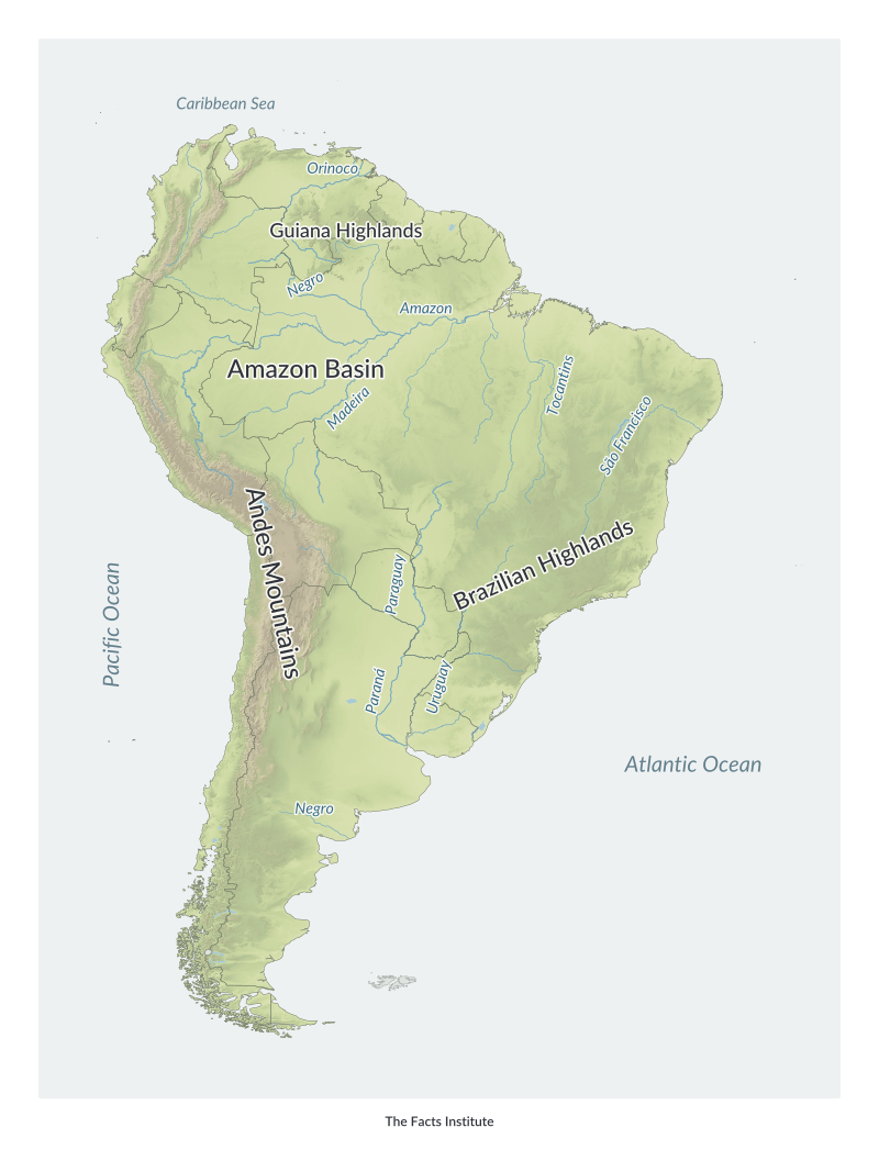
The Andes Mountains extend along the western side of South America, running through several countries, including Colombia, Ecuador, Peru, Bolivia, Chile and Argentina. They form the longest continental mountain range in the world.
East of the Andes lies the vast Amazon Basin, which covers much of northern South America. The Amazon River and its tributaries form one of the world’s largest river systems.
Other important physical features include the Guiana Highlands in the northeast and the Brazilian Highlands in the east. The Paraná, Paraguay and Orinoco are also among the continent’s major rivers.
The physical map uses differences in elevation to distinguish mountainous areas from lower-lying terrain.
South America political map
A political map of South America shows its international borders, countries and capital cities.
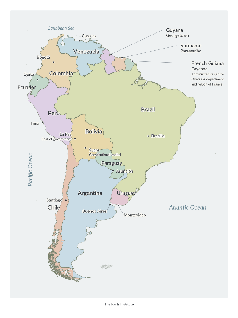
South America has 12 sovereign countries: Argentina, Bolivia, Brazil, Chile, Colombia, Ecuador, Guyana, Paraguay, Peru, Suriname, Uruguay and Venezuela.
French Guiana, located on the northeastern coast, is an overseas department and region of France rather than an independent country.
Brazil is the largest South American country by both land area and population. Suriname is the smallest sovereign country on the continent by area.
The political map identifies individual countries and their capitals, making it useful for studying South American geography.
More South America maps and geography resources
Explore more South America resources including:
These resources provide additional ways to study the continent, compare its countries and practise identifying geographical features.
Map sources: Terrain elevation data from USGS (SRTM and GMTED2010) and NOAA (ETOPO1), via Mapzen/AWS.

Caitriona Maria is an education writer and owner of The Facts Institute. With seven years of teaching experience and a background in educational content, she specialises in creating clear reference resources about countries, geography and global topics.