10 fun facts about Cameroon
1. Cameroon is often nicknamed “Africa in miniature” because it contains many of the continent’s landscapes and cultures within one country.
2. Cameroon is home to more than 200 ethnic groups, making it one of Africa’s great cultural crossroads.
3. Around 275 indigenous languages are spoken in Cameroon, making it one of the most linguistically diverse countries in the world.
4. The name Cameroon comes from the Portuguese phrase Rio dos Camarões, meaning “River of Shrimps,” after the shrimp found in the Wouri River when Portuguese explorers reached the area in 1472.
5. Cameroon’s flag has a yellow central star known as the Star of Unity, representing national unity.
6. Lake Nyos in Cameroon released a deadly cloud of carbon dioxide in 1986, killing around 1,800 people and thousands of animals. The gas had built up in the deep lake water from volcanic sources below.
7. Mount Cameroon is the country’s highest mountain and one of Africa’s largest and most active volcanoes.
8. Cameroon’s national football team has won the Africa Cup of Nations five times. Cameroon legend Samuel Eto’o is also the tournament’s all-time top scorer.
9. Debundscha, near Mount Cameroon, is one of the wettest places on Earth, receiving more than 10,000 mm of rain in some years. That is over 10 metres, or about 33 feet.
10. The world’s largest frog, the goliath frog, lives in Cameroon. It can grow over 30 cm long and weigh more than 3 kg.
Read more: Facts about Cameroon

At a glance
Capital city: Yaoundé
Population: 29.9 million
Area: 475,440 sq km
Major languages: English, French
Major religions: Christianity, Islam
Time zone: UTC+1 (West Africa Time)

Where is Cameroon?
Continent: Africa
Region: Central Africa
Neighboring countries: Nigeria, Chad, Central African Republic, Republic of the Congo, Gabon and Equatorial Guinea
Highest point: Mount Cameroon (4,095 m / 13,435 ft)
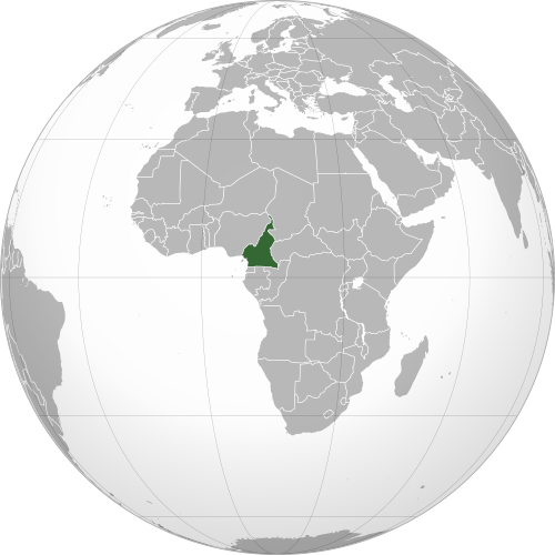
Geography of Cameroon
Cameroon is one of the most geographically diverse African countries and lies in Central Africa, with a coastline on the Gulf of Guinea.
Its landscapes are unusually varied, ranging from tropical rainforest and mountains to volcanic highlands and drier savannas.
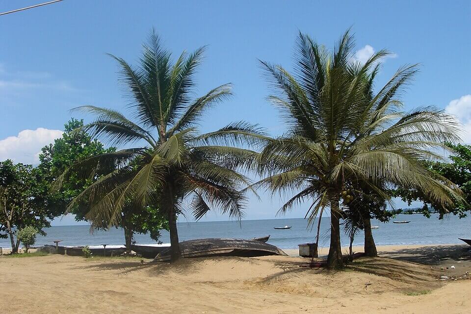
Atlantic Coast
Cameroon has a coastline on the Gulf of Guinea, part of the Atlantic Ocean. The coast includes beaches, mangroves and the port city of Douala.
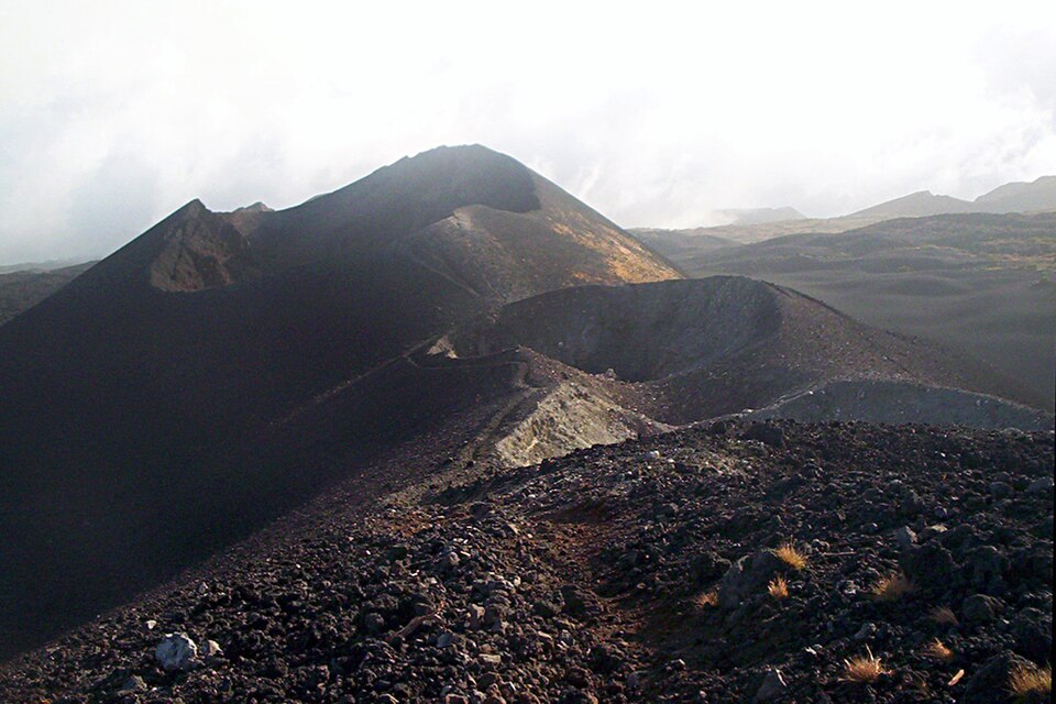
Mount Cameroon
Mount Cameroon is the highest mountain in Cameroon. It rises near the coast in the southwest of the country and is part of the Cameroon Volcanic Line.
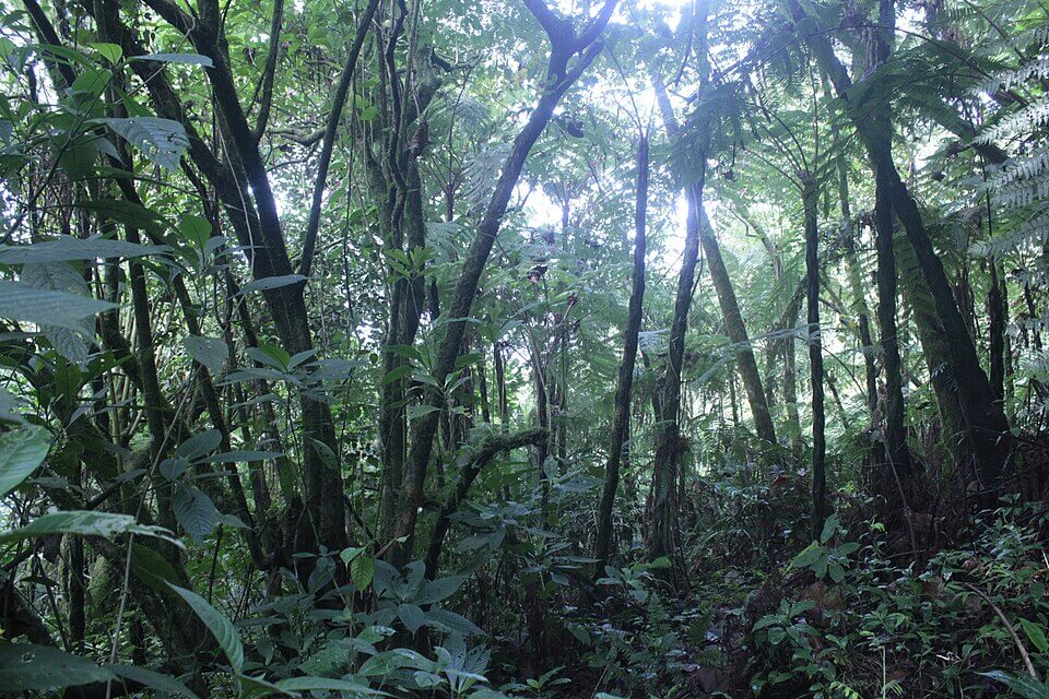
Southern Rainforests
Much of southern Cameroon is covered by dense tropical rainforest. This region forms part of the wider Congo Basin rainforest.
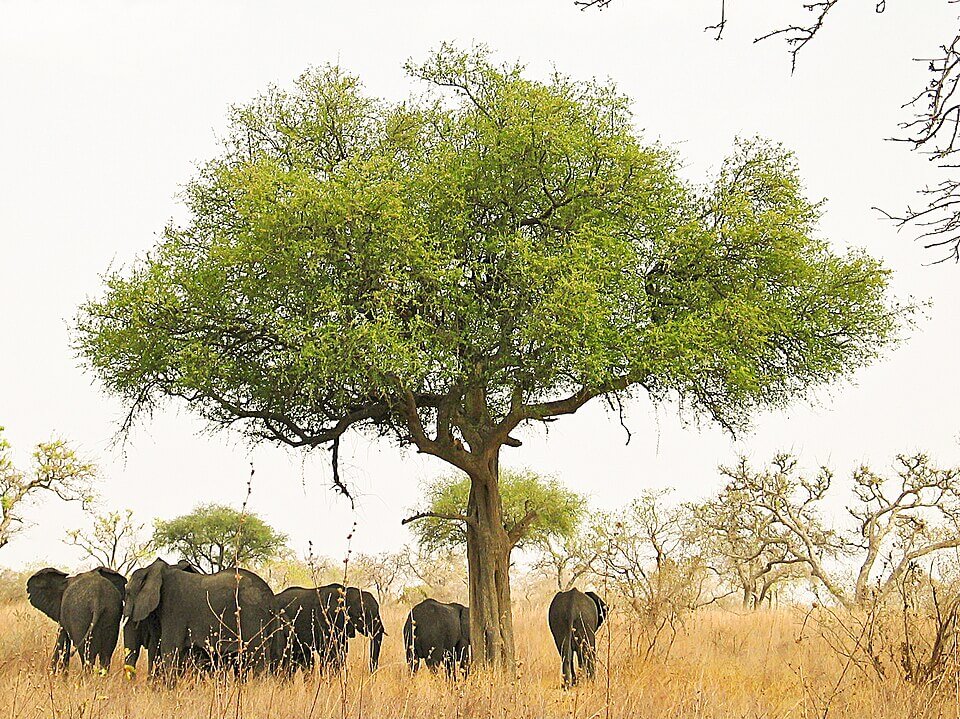
Northern Savanna and Lake Chad
Northern Cameroon is much drier than the south, with savanna, grassland and semi-arid landscapes. The far north reaches Lake Chad, a shallow lake shared with neighboring countries.
Climate of Cameroon
Cameroon has a tropical climate overall, but conditions vary sharply from south to north. The south and southwest are humid and receive heavy rainfall, while northern Cameroon has a much longer dry season and increasingly semi-arid conditions.
The contrast is particularly striking around Mount Cameroon, where some locations receive exceptionally high rainfall. Debundscha, on its southwestern slopes, has historically received more than 10,000 mm (394 in) of rain per year.
See article: Cameroon Climate
See article: Flag of Cameroon
Cameroon flag
The flag of Cameroon has its roots in the country’s move toward independence. Modern Cameroon was first colonized by Germany as Kamerun, before being divided between France and Britain after World War I. French Cameroon introduced a green, red and yellow national flag in 1957, shortly before independence.
When British Southern Cameroons joined the Republic of Cameroon in 1961, two yellow stars were added to represent the two parts of the federation. The current flag was adopted on 20 May 1975, when the two stars were replaced with a single central star symbolizing national unity.
Image credits:
Elephants around a tree at Waza: Amcaja, via Wikimedia Commons, licensed under CC SA 1.0. Cropped.
Mount Cameroon craters: User:Amcaja, via Wikimedia Commons, licensed under CC BY-SA 3.0. Cropped.
Tropical rainforest Mount Cameroon: Atabong Armstrong, via Wikimedia Commons, licensed under CC BY-SA 4.0. Cropped.
Kribi, Cameroon (beach photo): ymea, via Wikimedia Commons, licensed under CC BY-SA 3.0. Cropped.

Caitriona Maria is an education writer and owner of The Facts Institute. With seven years of teaching experience and a background in educational content, she specialises in creating clear reference resources about countries, geography and global topics.