10 fun facts about Eritrea
1. The name Eritrea comes from the ancient Greek term Erythra Thalassa, meaning “Red Sea.”
2. One of the oldest human fossils of its kind was discovered in Eritrea. A one-million-year-old hominid skull was found near Buia, close to the Red Sea coast.
3. Eritrea’s capital, Asmara, is a UNESCO World Heritage Site known as a “Modernist African City.”
4. Asmara is home to the Fiat Tagliero service station, a futuristic 1930s building designed to look like an airplane.
5. The port city of Massawa was once known as the “Pearl of the Red Sea” because of its waterside setting and Ottoman, Egyptian and Italian-era architecture.
6. Eritrea is home to the ancient Aksumite ruins of Qohaito, including temple remains and rock art sites.
7. Tens of thousands of Eritrean women fought during the country’s war for independence. By the end of the conflict, women are believed to have made up over a quarter of the fighting force.
8. Eritrea lies on the East African Rift system, near the Danakil Depression, where three tectonic plates are slowly pulling apart, causing the land to sink over time.
9. Eritrea has a tank graveyard where old military vehicles from the war have been gathered in an open field.
10. Parts of Eritrea are among the hottest places on Earth. In the Danakil Depression, temperatures can reach around 50°C (120°F), and the area receives virtually no rainfall.
Read more: Facts about Eritrea

At a glance
Capital city: Asmara
Population: 3.6 million
Area: 117,600 sq km
Major languages: Tigrinya, Arabic, Tigre, Afar, Beja, Bilen, Kunama, Saho, Nara, English
Major religions: Christianity, Islam
Time zone: UTC+3 (East Africa Time)
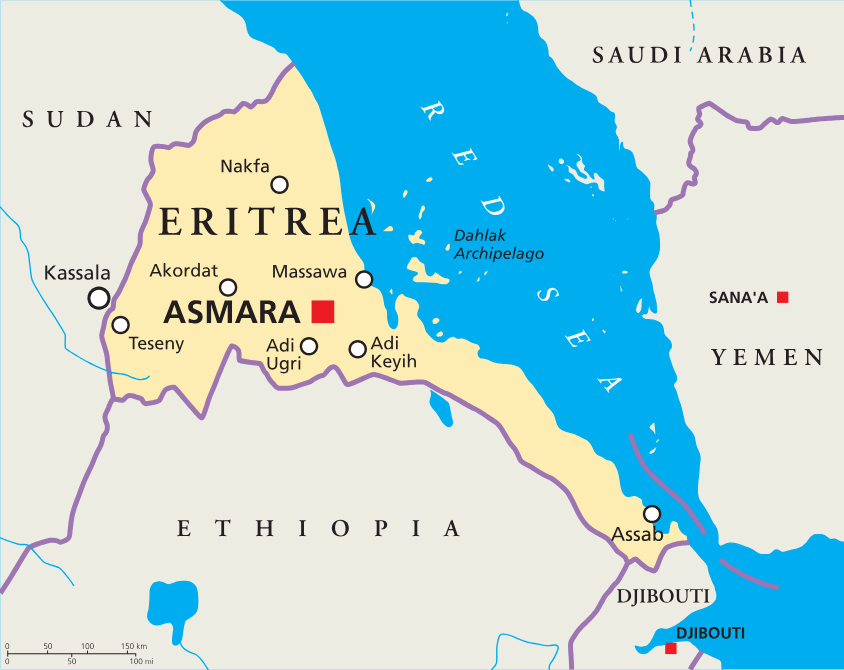
Where is Eritrea?
Continent: Africa
Region: East Africa / Horn of Africa
Neighboring countries: Sudan, Ethiopia and Djibouti
Highest point: Mount Soira / Emba Soira (3,013 m / 9,885 ft)
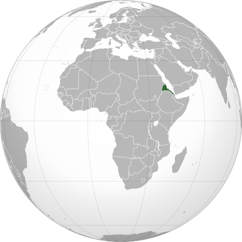
Geography of Eritrea
Eritrea lies in the Horn of Africa and is one of the African countries that make up Eastern Africa, with a long coastline on the Red Sea.
Its landscapes range from dry coastal plains and islands to rugged highlands, desert lowlands and parts of the Danakil Depression.
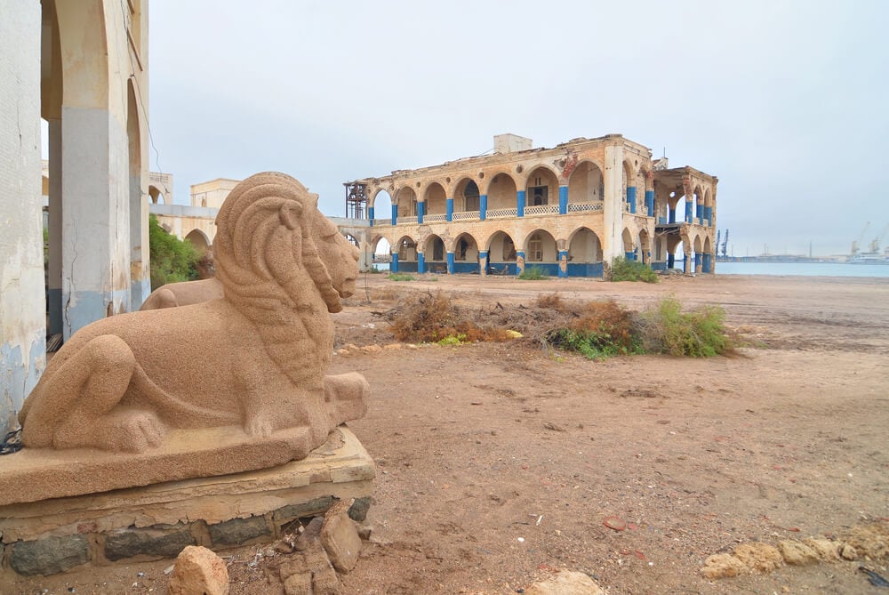
Red Sea Coast
Eritrea has a long coastline on the Red Sea. The coast is mostly hot and dry, with important port cities including Massawa and Assab.
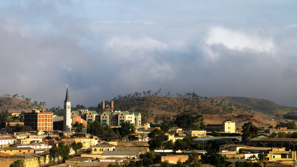
Eritrean Highlands
Much of central Eritrea is dominated by rugged highlands and mountain plateaus. This region includes Asmara, the capital city, and Emba Soira, the country’s highest point.
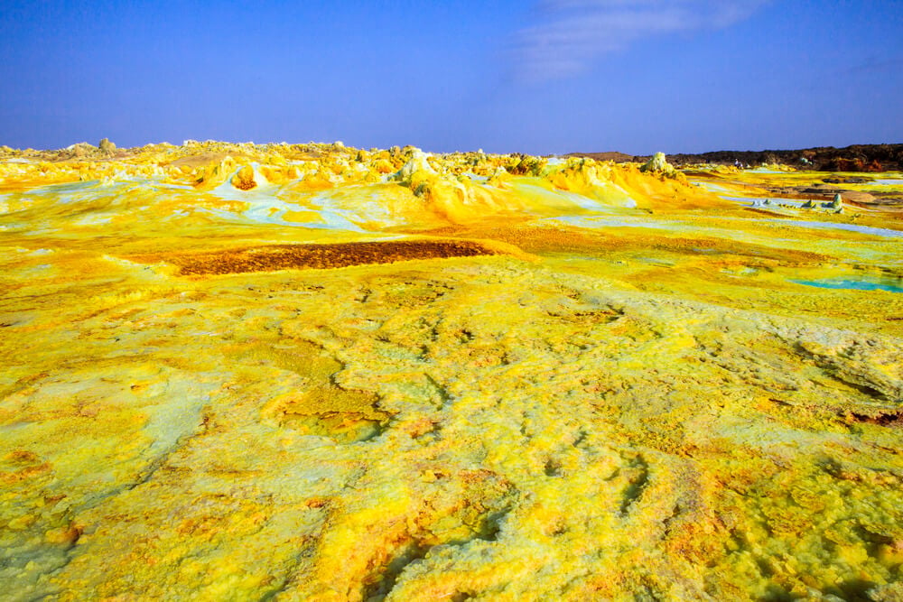
Danakil Depression
Eritrea includes part of the Danakil Depression, one of the hottest and driest regions in Africa. The region sits about 120 meters (394 feet) below sea level.
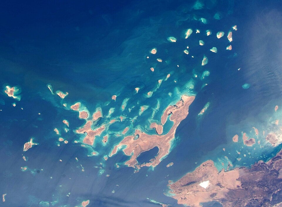
Dahlak Archipelago
The Dahlak Archipelago is a group of islands in the Red Sea, off the coast near Massawa. The islands are known for coral reefs, marine life and dry coastal landscapes.
See article: Flag of Eritrea
Eritrea flag
The flag of Eritrea reflects both the country’s early autonomous period and its long struggle for independence. In 1952, Eritrea adopted a blue flag with olive branches while it was federated with Ethiopia, but the flag was later banned as Ethiopia progressively dismantled Eritrea’s autonomy before formally annexing the territory in 1962.
After independence in 1993, Eritrea adopted a new national flag based partly on the flag of the Eritrean People’s Liberation Front (EPLF). The modern design replaced the EPLF star with an olive wreath, linking it back to Eritrea’s earlier 1950s flag. The design was standardized in 1995.
Image credits:
Eritrea (centered orthographic projection): Martin23230LocationEritrea.svg: User:Rei-arturderivative work: Sémhur, via Wikimedia Commons, licensed under CC BY-SA 3.0.
Massawa, Eritrea (Red Sea coast): RobNaw, via Depositphotos.

Caitriona Maria is an education writer and owner of The Facts Institute. With seven years of teaching experience and a background in educational content, she specialises in creating clear reference resources about countries, geography and global topics.