Croatia is a crescent-shaped country in southeast Europe, featuring a mix of plains, rugged mountains, and more than a thousand islands along its stunning coastline.
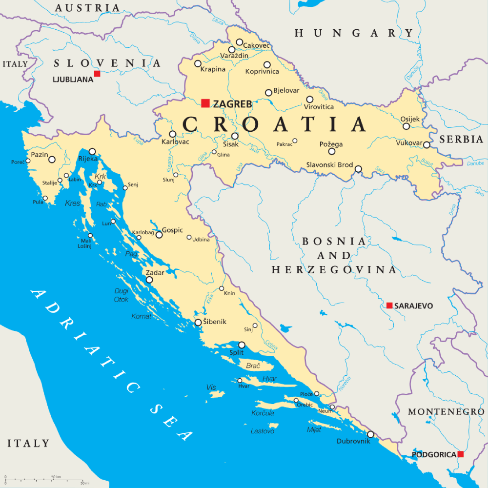
Map of Croatia

Key geography facts
1. Croatia has more than 1,100 islands and islets scattered along the Adriatic coastline, many of which are popular tourist destinations.
2. The country’s landscape includes fertile plains in the north, forested mountains in the center, and rocky coastal regions in the west.
3. Croatia’s highest mountain, Dinara, reaches 1,831 meters (6,007 feet) and is located near the border with Bosnia and Herzegovina.
4. The climate varies widely—continental in the interior with snowy winters and Mediterranean along the coast with warm, dry summers.
5. The Sava and Drava rivers are major waterways in the country, providing vital navigation routes and contributing to its fertile plains.
Recommended reading: Fun Facts About Croatia
Croatia regions
There are five distinct regions in Croatia: Central Croatia, Dalmatia in the south, Istria in the north, the Kvarner Gulf in the northern Adriatic and Slavoni in the northeast.
These regions are further divided into counties for administrative purposes.
Central Croatia
- Bjelovar-Bilogora
- Karlovac
- Koprivnica-Križevci
- Krapina-Zagorje
- Lika-Senj
- Međimurje
- Primorje-Gorski Kotar
- Sisak-Moslavina
- Varaždin
- Zagreb
Dalmatia
- Dubrovnik-Neretva
- Šibenik-Knin
- Split-Dalmatia
- Zadar
Istria
- Istria
Slavoni
- Brod-Posavina
- Osijek-Baranja
- Požega-Slavonia
- Virovitica-Podravina
- Vukovar-Syrmia
Zagreb is often considered separately as the capital city and is its own administrative area. While it is geographically part of Central Croatia, it is usually highlighted on its own due to its political, economic, and cultural significance.
Map of Croatia in Europe
Croatia lies in southeastern Europe, bordering countries like Slovenia, Hungary, Serbia, Montenegro and Bosnia and Herzegovina.
Croatia major cities
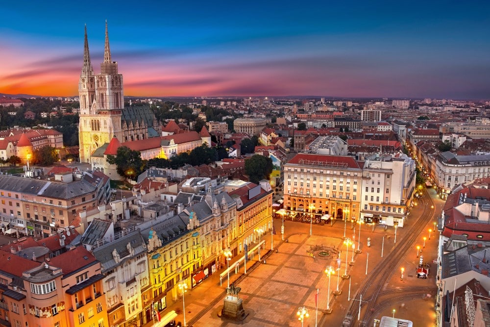
Zagreb – The capital and largest city of Croatia, known for its exquisite architecture, vibrant cultural scene, and as the country’s political and economic center.
Split – A major coastal city known for its ancient Roman architecture, such as Diocletian’s Palace, its historical center and its significant role in tourism and maritime activities.

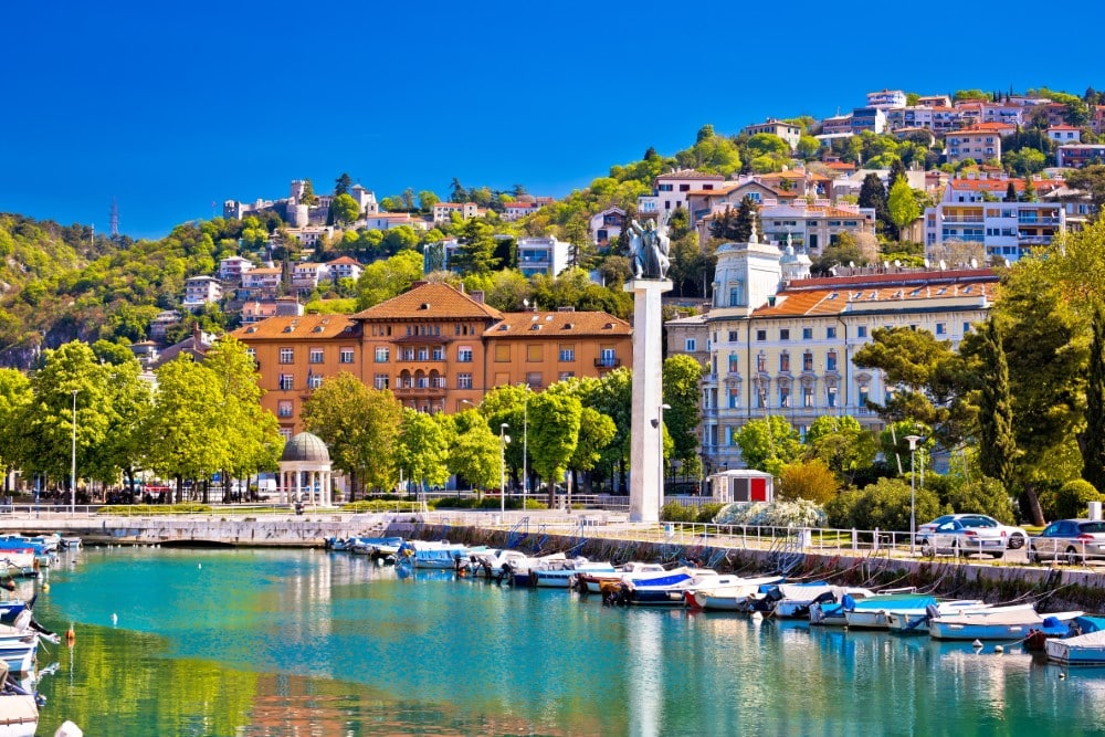
Rijeka – A key port city known for its industrial activities, cultural events such as The International Rijeka Carnival, and strategic location on the Adriatic Sea. Rijeka was also nominated as the 2020 European Capital of Culture.
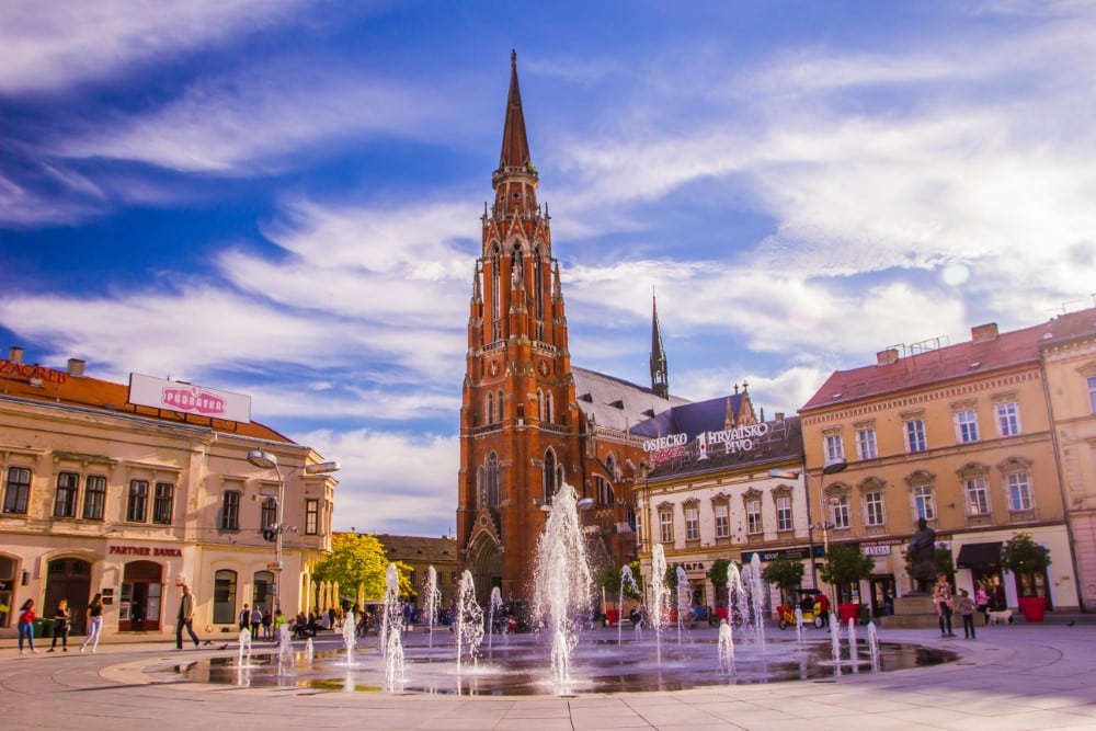
Osijek – the fourth largest city in Croatia and a key economic and transport hub in the east of the country. Strategically located near the confluence of the Drava and Danube rivers, it thrives on trade, manufacturing, and construction.
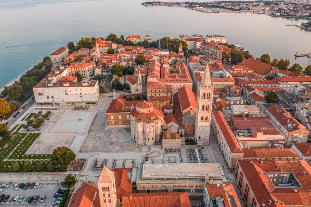
Zadar – A historic coastal city in southwestern Croatia known for its Roman and Venetian ruins, beautiful sunsets, and its role as a prominent tourist destination along the Adriatic Sea.
Caitriona Maria is an education writer and owner of The Facts Institute. With seven years of teaching experience and a background in educational content, she specialises in creating clear reference resources about countries, geography and global topics.