10 fun facts about South Sudan
1. South Sudan became independent from Sudan in 2011, making it the world’s newest internationally recognized country.
2. Cattle traditionally represent wealth and social status and play an important role in marriage arrangements, where cattle may be given as bridewealth.
3. More than 60 different ethnic groups live in South Sudan, contributing to its many indigenous languages, traditions and cultures.
4. The White Nile, one of the main tributaries of the Nile, flows through South Sudan and passes through the capital, Juba, before continuing north into Sudan.
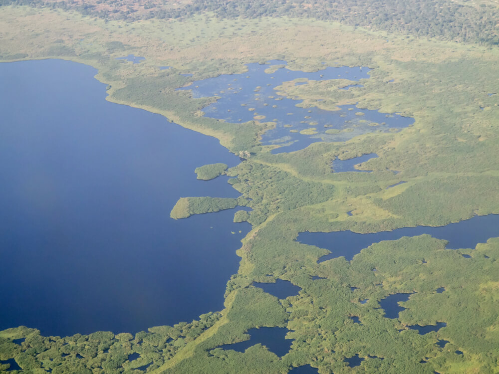
5. South Sudan is home to the Sudd, Africa’s largest wetland and one of the largest tropical wetlands in the world.
6. The Boma–Badingilo Migratory Landscape became South Sudan’s first UNESCO World Heritage Site in 2026.
7. The Boma–Badingilo region hosts the world’s largest land mammal migration, with as many as six million antelopes and other animals moving across its vast savannas and floodplains.
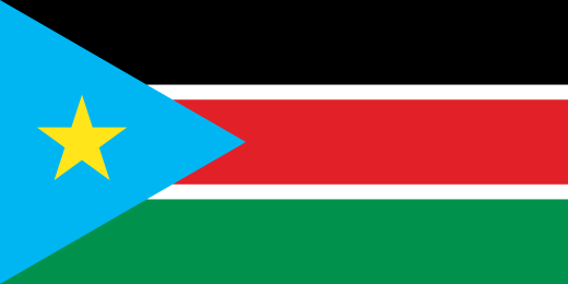
8. South Sudan’s flag was standardised in 2023, when authorities specified that its triangle should be light blue and its yellow star upright. The blue represents the waters of the Nile River.
9. South Sudan is a landlocked country, meaning it is completely surrounded by land and has no coastline or direct access to the open sea.
10. South Sudan was once part of Sudan, which was Africa’s largest country by area before the two countries separated in 2011.
Read more: Facts about South Sudan
At a glance
Capital city: Juba
Population: 12.2 million
Area: 644,329 sq km
Major languages: English, Arabic
Major religions: Christianity and indigenous beliefs
Time zone: UTC+3 (East Africa Time)
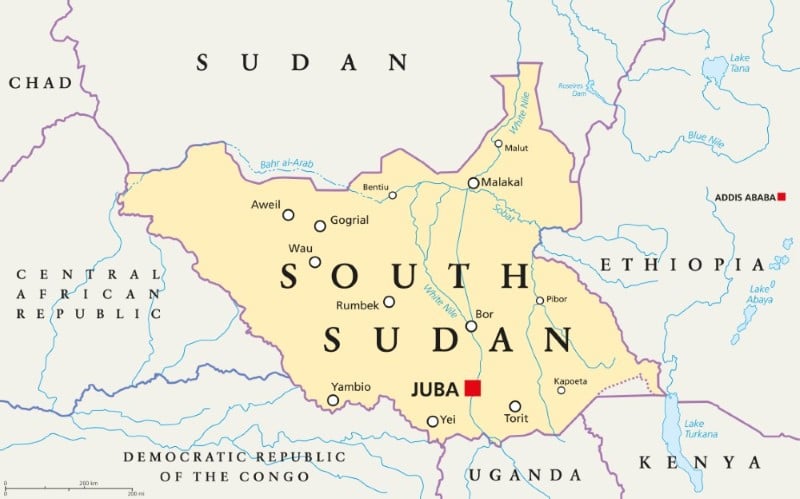
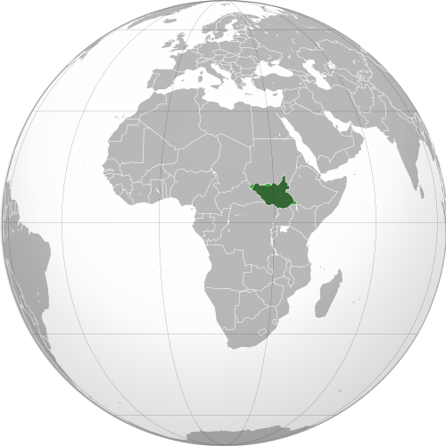
Where is South Sudan?
Continent: Africa
Region: Eastern Africa
Neighboring countries: Sudan, Ethiopia, Kenya, Uganda, the Democratic Republic of the Congo and the Central African Republic
Highest point: Mount Kinyeti (3,187 m / 10,456 ft)
Geography of South Sudan
South Sudan is one of the landlocked African countries and lies in Eastern Africa.
Much of the country consists of broad plains, savanna and wetlands, while higher ground and mountains occur mainly along the southern and eastern borders.
White Nile & the Sudd
The White Nile flows north through the center of South Sudan and is the country’s most important river system. In the central part of the country, the river spreads across the vast Sudd, one of the world’s largest tropical wetlands with an estimated area of approximately 57,000 sq km (22,000 sq mi).
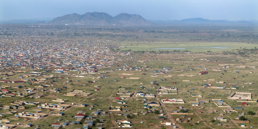
Central Plains & Savanna
Large areas of South Sudan consist of flat or gently rolling plains covered by grassland and savanna. Seasonal rainfall causes many rivers and floodplains to expand during the wet season, while the landscape becomes much drier during the long dry season.
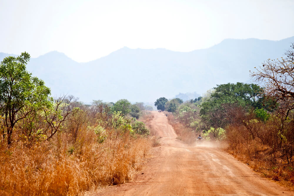
Southern & Eastern Highlands
Higher terrain occurs towards South Sudan’s borders with Uganda, Kenya and Ethiopia. The most mountainous region lies in the far south, where the Imatong Mountains rise close to the Ugandan border. Mount Kinyeti, in the Imatong Mountains, is the highest point in South Sudan.
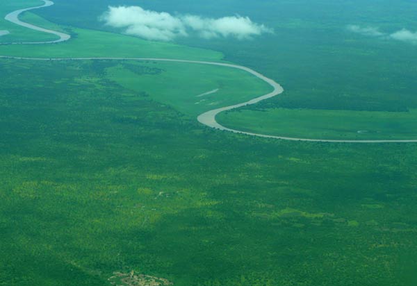
Floodplains & River Basins
Beyond the Sudd, extensive floodplains occur along tributaries of the Nile, including the Bahr el Ghazal and Sobat river systems. These rivers and wetlands support rich grasslands and wildlife and play an important role in farming, fishing and seasonal livestock grazing.
See article: Flag of South Sudan
South Sudan flag
South Sudan’s flag was originally used as the regional flag of autonomous Southern Sudan following the 2005 peace agreement that ended the Second Sudanese Civil War. Its design was closely based on the flag of the Sudan People’s Liberation Movement.
When South Sudan became independent on 9 July 2011, the flag was retained as the national flag. In 2023, official guidance standardized details of the design, including the light sky-blue triangle and the upward-pointing yellow star.
Image credits:
South Sudan (centered orthographic projection): TUBS Africa_(orthographic_projection).svg: Martin23230Sudan_(orthographic_projection)_highlighted.svg: Dinamikderivative work: Spesh531, via Wikimedia Commons, licensed under CC BY-SA 3.0.
Sobat River: Andreas31, via Wikimedia Commons, licensed under CC BY-SA 3.0. Cropped.

Caitriona Maria is an education writer and owner of The Facts Institute. With seven years of teaching experience and a background in educational content, she specialises in creating clear reference resources about countries, geography and global topics.