10 fun facts about the Democratic Republic of the Congo
1. The Democratic Republic of the Congo is the second-largest country in Africa by area, after Algeria.
2. The Congo River is Africa’s second-longest river after the Nile and is also the deepest river in the world.
3. Kinshasa, the capital of DR Congo, sits directly across the Congo River from Brazzaville, the capital of the Republic of the Congo. They are the closest pair of national capitals in the world.
4. Ancient harpoon points discovered near the Semliki River are around 90,000 years old, making them some of the earliest known sophisticated tools made from bone.
5. Much of DR Congo lies within the Congo Basin, home to the world’s second-largest tropical rainforest after the Amazon.
6. DR Congo is one of the world’s megadiverse countries, with an exceptional variety of plants and wildlife found across its rainforests, rivers, mountains and savannas.
7. The okapi is found naturally only in the forests of DR Congo. Despite its zebra-like striped legs, its closest living relative is the giraffe.
8. Virunga National Park, established in 1925, is Africa’s oldest national park and is home to mountain gorillas, hippopotamuses and the two most active volcanoes of Africa.
9. Mount Nyiragongo near the town of Goma is one of the world’s most dangerous volcanoes and the world’s largest lava lake.
10. DR Congo has five UNESCO World Heritage Sites, and all five are natural sites protecting some of the country’s extraordinary landscapes and wildlife.
At a glance
Capital city: Kinshasa
Population: 112.8 million
Area: 2,344,858 sq km
Major languages: French, Lingala, Swahili, Kituba and Tshiluba
Major religion: Christianity
Time zone: UTC+1 (West Africa Time) and UTC+2 (Central Africa Time)
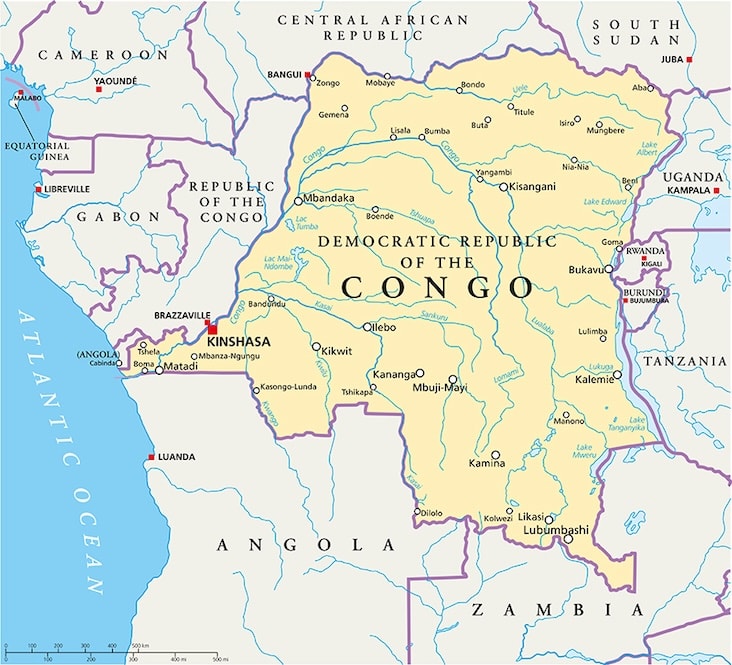
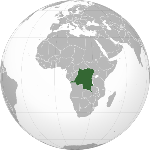
Where is the Democratic Republic of the Congo?
Continent: Africa
Region: Central (Middle) Africa
Neighboring countries: Republic of the Congo, Central African Republic, South Sudan, Uganda, Rwanda, Burundi, Tanzania, Zambia and Angola
Highest point: Margherita Peak, Mount Stanley (5,109 m / 16,762 ft)
Geography of the Democratic Republic of the Congo
The Democratic Republic of the Congo (DRC) is one of the largest African countries and lies in Central Africa, straddling the Equator.
Much of the country lies within the vast Congo Basin, surrounded by plateaus and mountains, with a short coastline on the Atlantic Ocean.
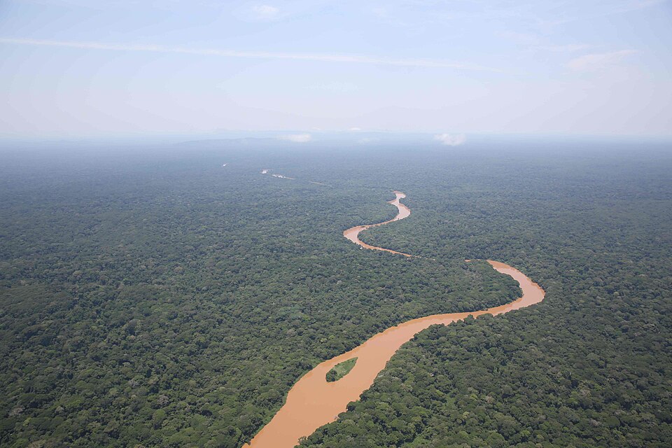
Congo Basin & Rainforest
The Democratic Republic of the Congo lies at the heart of the Congo Basin and contains vast rainforests covering about 1.55 million square kilometers (600,000 square miles). These forests make up roughly half of Africa’s tropical forest area, while around 10% of the DRC’s plant species are found nowhere else in the world.
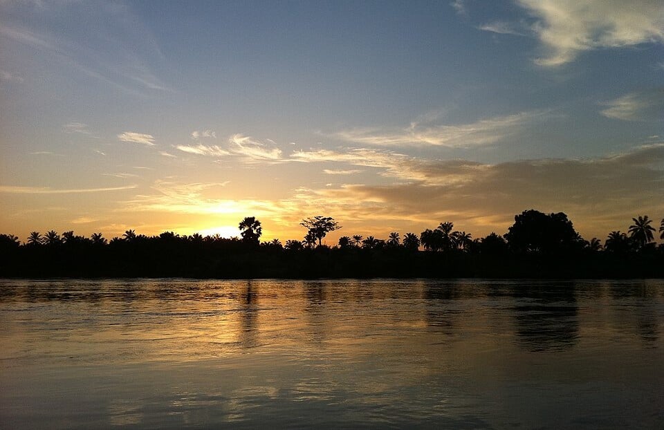
Congo River & Tributaries
The Congo River curves through a large part of the country and is joined by major tributaries including the Kasai and Ubangi rivers. Its upper course, known as the Lualaba River, flows north through southeastern and central DRC. Together, these waterways drain most of the DRC and form one of the largest river systems in the world.
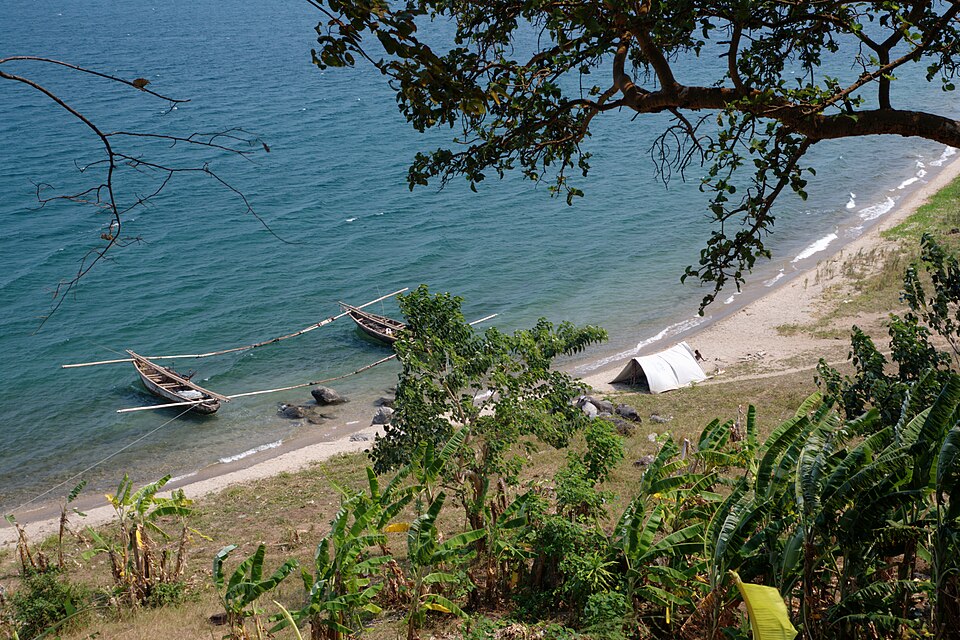
Eastern Mountains & Great Lakes
Along the eastern border, the land rises sharply into mountains and highlands associated with the East African Rift system. Several major lakes lie within this region, including lakes Albert, Edward, Kivu and Tanganyika, many of which form parts of the DRC’s borders with neighbouring countries.
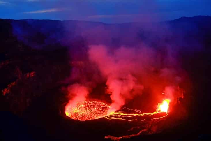
Rwenzori Mountains & Virunga Volcanoes
The far east contains some of the highest and most dramatic terrain in the country. The Rwenzori Mountains rise along the border with Uganda and contain Margherita Peak on Mount Stanley, the DRC’s highest point. Farther south, the Virunga Mountains include several volcanoes near the borders with Rwanda and Uganda.

Atlantic Coast & Lower Congo
Although most of the DRC lies deep within Central Africa, a narrow western corridor gives the country a short coastline on the Atlantic Ocean. The lower Congo River flows through this region before reaching the ocean, connecting the vast interior river system with the Atlantic.
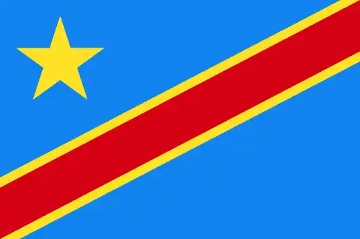
See article: Flag of the Democratic Republic of the Congo
The Democratic Republic of the Congo flag
DR Congo’s flag has changed several times alongside major political changes in the country. After independence from Belgium in 1960, the country adopted a blue flag with a large yellow star and six smaller stars representing its provinces. During Mobutu Sese Seko’s rule, the country was renamed Zaire and used a green flag featuring a torch emblem.
Following Mobutu’s fall in 1997, the Democratic Republic of the Congo name was restored and a new flag introduced. The current sky-blue flag, featuring a yellow star and a red diagonal stripe bordered in yellow, was adopted in 2006 after the introduction of a new constitution.
Image credits:
Okapi Wildlife Reserve: MONUSCO Photos, via Wikimedia Commons, licensed under CC BY-SA 2.0. Cropped.
Kasai River: Sagar Bhatt, via Wikimedia Commons, licensed under CC BY-SA 3.0. Cropped.
Fishing Boats on Lake Tanganyika: Emesik, via Wikimedia Commons, licensed under CC BY-SA 3.0. Cropped.

Caitriona Maria is an education writer and owner of The Facts Institute. With seven years of teaching experience and a background in educational content, she specialises in creating clear reference resources about countries, geography and global topics.