10 fun facts about Rwanda
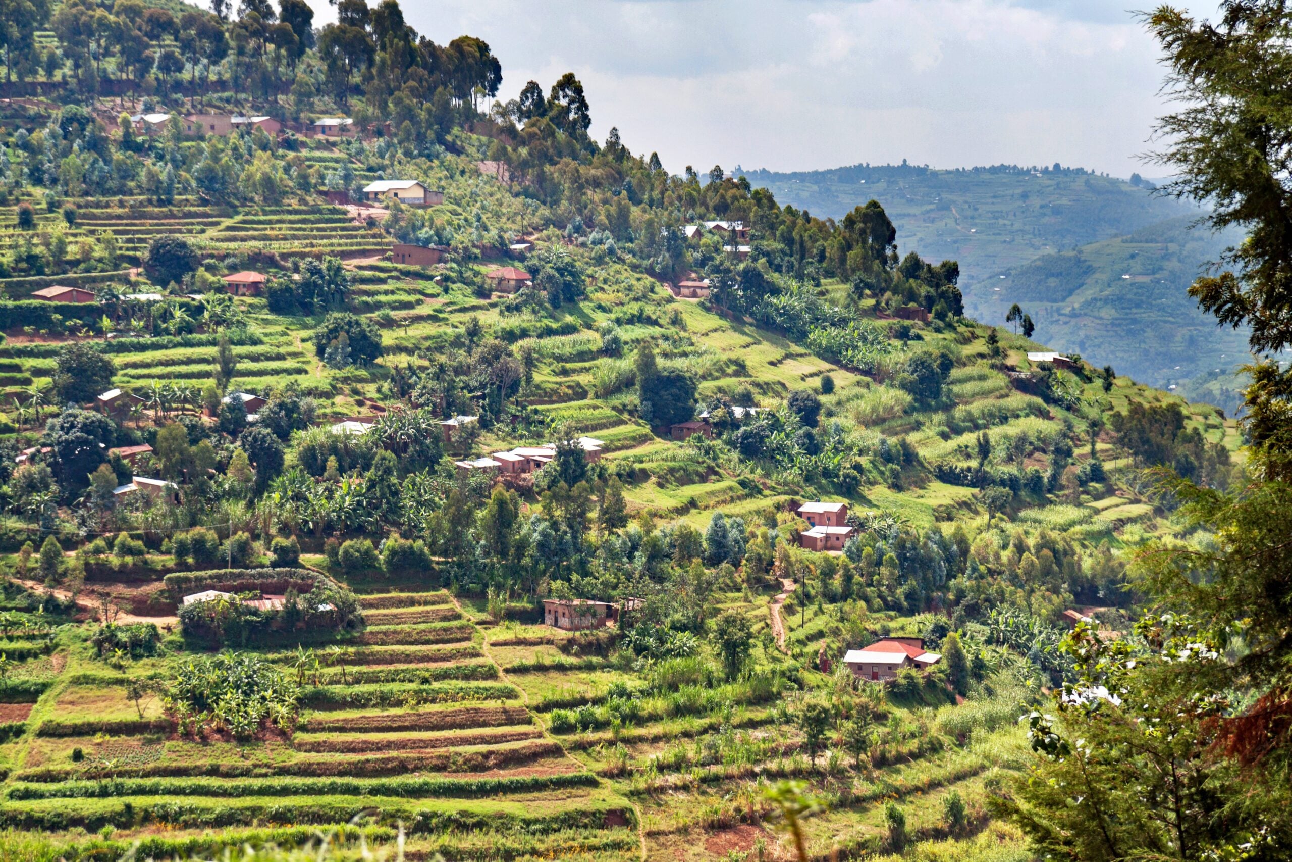
1. Rwanda is known as the “Land of a Thousand Hills” because of its mountainous and rolling landscape.
2. Rwanda has the highest proportion of women in parliament in the world, with women holding nearly 64% of seats in its Chamber of Deputies.
3. Lake Kivu, on Rwanda’s border with the Democratic Republic of the Congo, is one of only a few known “killer lakes” containing large amounts of dissolved carbon dioxide and methane.
4. Rwanda uses methane extracted from Lake Kivu to generate electricity, turning a potentially dangerous natural gas reserve into an energy source.
5. Rwanda was one of the first countries in the world to introduce a major ban on plastic bags, helping Kigali earn a reputation as one of Africa’s cleanest cities.
6. On the last Saturday of each month, Rwandans take part in Umuganda, a nationwide community-work programme involving activities such as cleaning streets, planting trees and improving public spaces.
7. Rwanda is one of the few places in the world where visitors can see wild mountain gorillas, which live among the volcanic forests of the Virunga Mountains.
8. Mount Karisimbi is Rwanda’s highest mountain and one of the volcanoes of the Virunga range.
9. Akagera National Park is home to Africa’s Big Five — lions, leopards, elephants, rhinos and buffalo — following major wildlife reintroduction and conservation programmes.
10. Rwanda became famous for using drones to deliver blood and medical supplies to hospitals and clinics, allowing urgent deliveries to reach remote parts of the country quickly.
Read more: Facts about Rwanda
At a glance
Capital city: Kigali
Population: 14.6 million
Area: 26,338 sq km
Major languages: Kinyarwanda, French, English, Swahili
Major religions: Christianity
Time zone: UTC+2 (Central Africa Time)

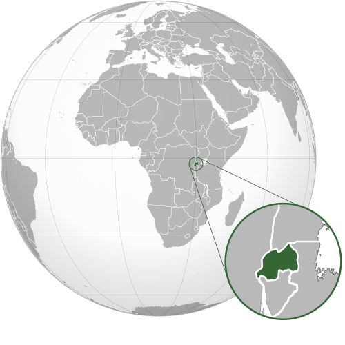
Where is Rwanda?
Continent: Africa
Region: Eastern Africa
Neighboring countries: Uganda, Tanzania, Burundi and the Democratic Republic of the Congo
Highest point: Mount Karisimbi (4,507 m / 14,787 ft)
Geography of Rwanda
Rwanda is one of the smaller African countries and is landlocked in Eastern Africa.
Known for its mountainous terrain and rolling green hills, the country rises from lower plains and wetlands in the east towards high plateaus, mountain ranges and volcanoes in the west and northwest.
Virunga Mountains & Western Highlands
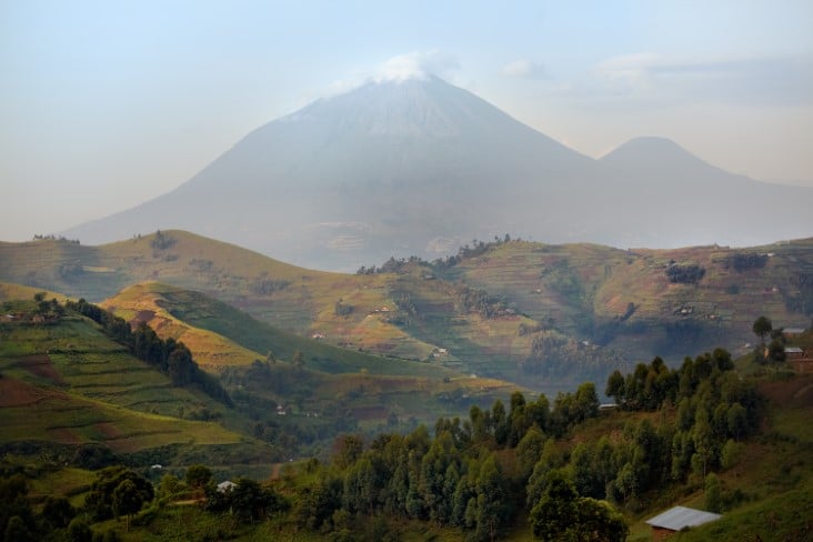
The Virunga Mountains rise along Rwanda’s northwestern border with the Democratic Republic of the Congo and Uganda. This volcanic range contains several major peaks, including Mount Karisimbi, Rwanda’s highest point. The southwestern highlands include steep mountains and valleys covered in places by montane rainforest, including Nyungwe Forest.
Lake Kivu & the Western Rift Valley
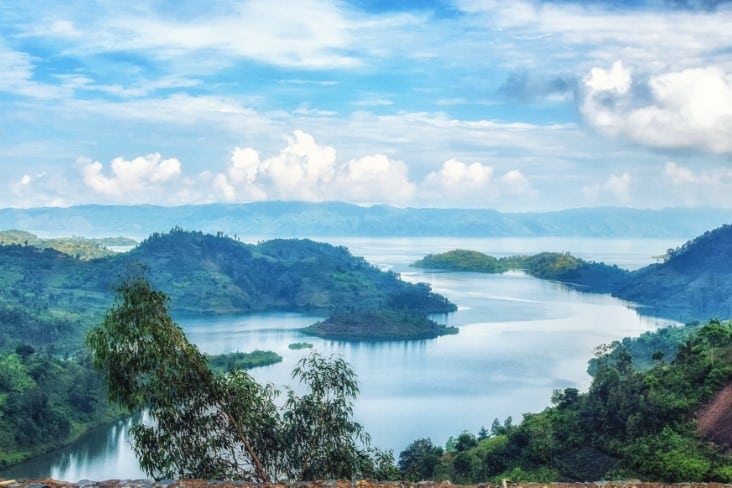
Lake Kivu lies along much of Rwanda’s western border with the Democratic Republic of the Congo. It is one of the African Great Lakes and occupies part of the Albertine Rift. Its deeply indented shoreline is surrounded by steep green hills and mountains.
Central Highlands & Rolling Hills
Much of central Rwanda consists of high plateaus broken by countless hills, ridges and valleys, giving the country its famous nickname, the “Land of a Thousand Hills.” The land generally slopes downwards from the higher Congo–Nile Divide towards lower elevations in eastern Rwanda.
Eastern Plains, Lakes & Wetlands
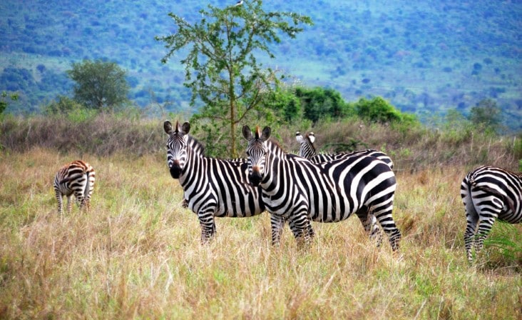
Eastern Rwanda is lower, warmer and generally flatter than the mountainous west. Rolling grasslands and savanna are mixed with lakes, rivers and extensive wetlands. These landscapes are especially prominent in Akagera National Park.
See article: Flag of Rwanda
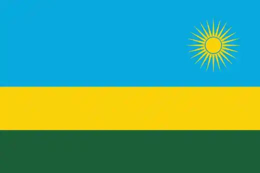
Rwanda flag
Rwanda’s flag has changed several times throughout its history. During Belgian colonial rule, the Belgian flag was used, while a red-yellow-green tricolor was introduced in 1961 and later marked with a black “R” to distinguish it from Guinea’s flag.
After the 1994 genocide, Rwanda replaced symbols associated with the former regime, adopting its current blue, yellow and green flag on 31 December 2001.

Caitriona Maria is an education writer and owner of The Facts Institute. With seven years of teaching experience and a background in educational content, she specialises in creating clear reference resources about countries, geography and global topics.