North America is the third-largest continent in the world, with 23 independent countries and a wide variety of landscapes.
Explore the interactive map above to discover North America’s countries, capital cities, major rivers and mountain peaks. Select a country or territory to view geographical information, or use the map controls to show and hide different features.
Where is North America on the world map?
North America lies north of South America and is located in the Northern and Western Hemispheres. The continent is bordered by the Arctic Ocean to the north, the Atlantic Ocean to the east and the Pacific Ocean to the west.
It extends from Greenland and the Canadian Arctic in the north to Panama in Central America, where it connects to South America.
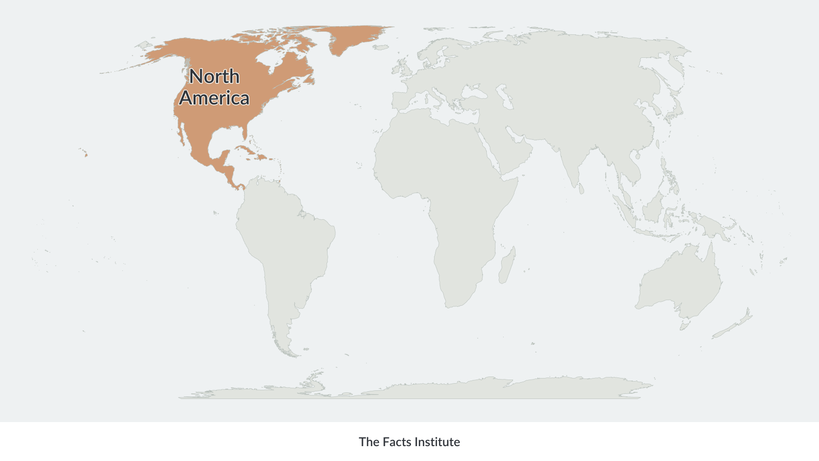
North America includes Canada, the United States, Mexico, Central America and the Caribbean islands. The Bering Strait separates Alaska from northeastern Asia, while the Isthmus of Panama connects North America to South America.
Greenland, located northeast of Canada, is the world’s largest island and is geographically part of North America.
North America physical map
A physical map of North America shows the continent’s natural features, including mountain ranges, plains, rivers, lakes, valleys and coastal lowlands.
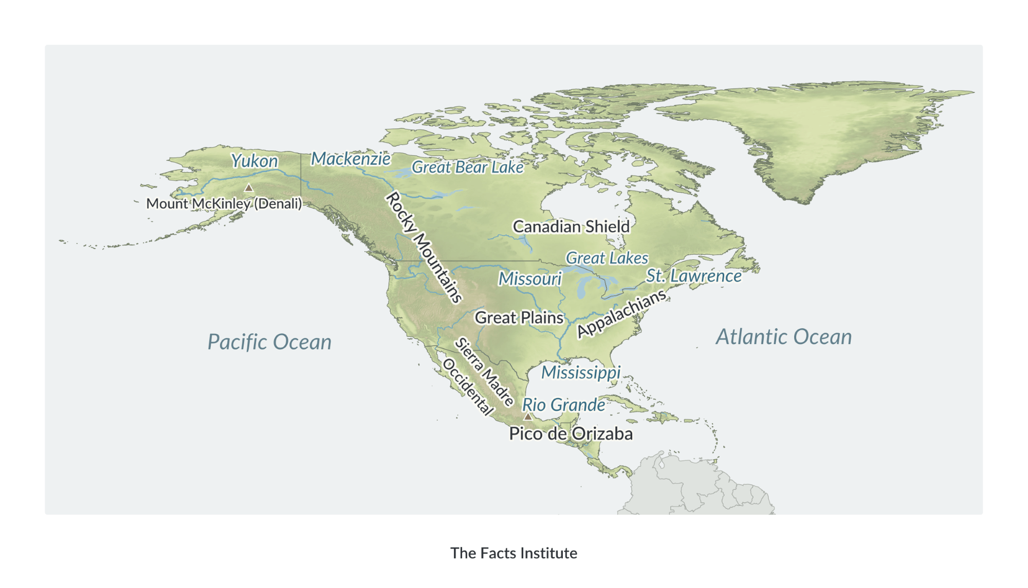
The Rocky Mountains extend through western Canada and the United States, forming part of a much larger mountain system along the continent’s western side. The Appalachian Mountains stretch across eastern North America, while the Great Plains occupy a broad area of central Canada and the United States.
The Canadian Shield covers much of eastern and central Canada and contains extensive forests, lakes and ancient rock formations. Farther south, the Sierra Madre mountain ranges extend across Mexico, while volcanic mountain ranges are found throughout Central America.
The Mississippi-Missouri river system is one of North America’s largest drainage networks. Other major rivers include the Mackenzie, St. Lawrence, Yukon and Rio Grande.
North America is also home to the Great Lakes, a group of five large freshwater lakes along the Canada–United States border. Lake Superior is the largest freshwater lake in the world by surface area.
Mount McKinley (Denali) in Alaska is North America’s highest mountain, reaching approximately 6,190 meters (20,310 feet).
The physical map uses differences in elevation to distinguish mountainous areas from lower-lying terrain.
North America political map
A political map of North America shows its international borders, countries, territories and capital cities.
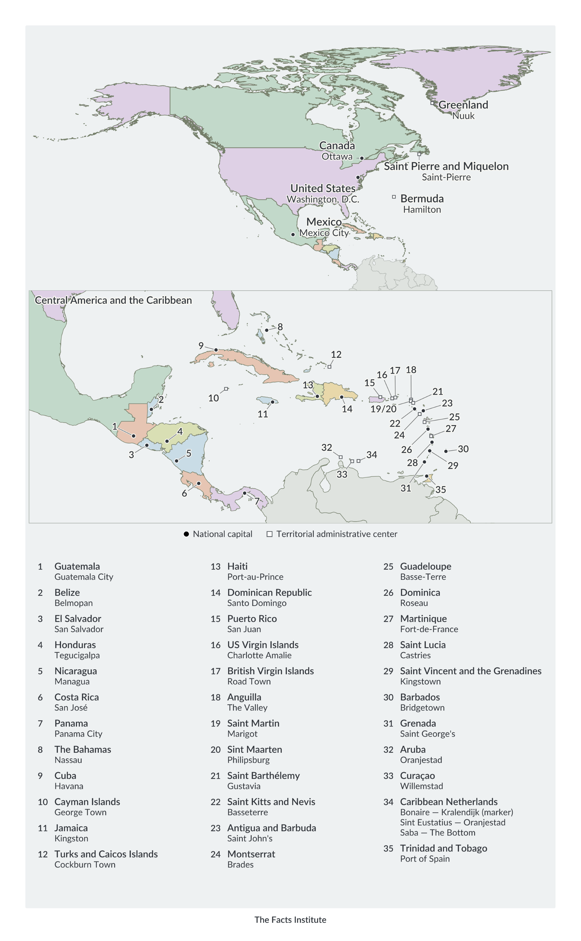
North America has 23 independent countries, ranging from Canada, the United States and Mexico to the smaller nations of Central America and the Caribbean.
North America is commonly divided into three geographical subregions: Northern America, Central America and the Caribbean.
Central America consists of seven countries: Belize, Costa Rica, El Salvador, Guatemala, Honduras, Nicaragua and Panama. The Caribbean includes numerous islands, with 13 independent countries alongside several dependent territories.
Greenland is an autonomous territory within the Kingdom of Denmark, while Puerto Rico is a territory of the United States. Other territories include Bermuda, the Cayman Islands and several British, French and Dutch Caribbean islands.
Canada is the largest country in North America by total area, while Saint Kitts and Nevis is the smallest independent country. The United States has the continent’s largest population.
More North America maps and geography resources
Explore more North America resources, including:
These resources provide additional ways to study the continent, compare its countries and practice identifying geographical features.
Map sources: Terrain elevation data from USGS (SRTM and GMTED2010) and NOAA (ETOPO1), via Mapzen/AWS.

Caitriona Maria is an education writer and owner of The Facts Institute. With seven years of teaching experience and a background in educational content, she specialises in creating clear reference resources about countries, geography and global topics.