10 fun facts about Mozambique
1. Mozambique is the only one-word country name containing all five vowels: a, e, i, o and u.
2. Mozambique takes its name from the Island of Mozambique, which may have been named after a local ruler known as Mussa al-Bik.
3. The Island of Mozambique was once an important trading center linking Africa, India and Western Europe. It is also a UNESCO World Heritage Site.
4. The island is home to the Chapel of Nossa Senhora de Baluarte. Built in 1522, it is believed to be the oldest surviving European-built structure in the Southern Hemisphere.
5. Mozambique’s flag prominently features an AK-47 rifle, making it the only national flag to display a modern assault rifle as part of its design.
6. Mozambique joined the Commonwealth in 1995 despite never having been part of the British Empire. Most of the country was formerly ruled by Portugal.
7. Gorongosa National Park lost most of its large wildlife during Mozambique’s civil war. Since then, conservation projects have helped populations of elephants and other animals recover.
8. The Bazaruto Archipelago is home to coral reefs, dolphins, sea turtles and one of the last significant populations of dugongs in the western Indian Ocean.
9. Around one-fifth of Lake Malawi, also known as Lake Niassa, lies within Mozambique. The lake contains hundreds of fish species found nowhere else in the world.
10. The Quirimbas Archipelago in northern Mozambique consists of 31 islands stretching along nearly 200 miles (320 km) of coastline. The islands are surrounded by coral reefs, mangroves and waters rich in marine life. Historic settlements such as Ibo Island reflect centuries of African, Arab, Indian and Portuguese influence.
Read more: Facts about Mozambique

At a glance
Capital city: Maputo
Population: 35.6 million
Area: 799,380 sq km
Major languages: Makhuwa, Portuguese
Major religions: Roman Catholic, Muslim, Zionist Christian, Evangelical/Pentecostal
Time zone: UTC+2 (Central Africa Time)
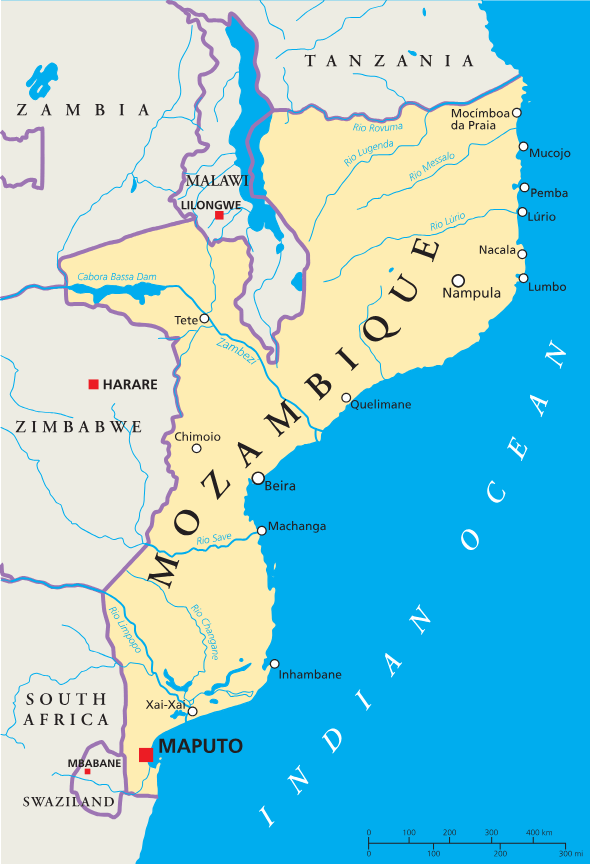
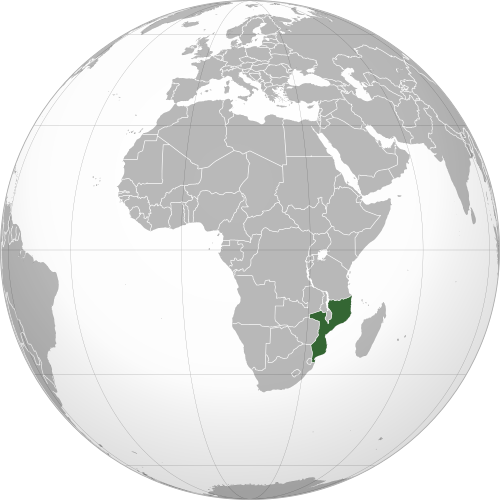
Geography of Mozambique
Mozambique is one of the coastal African countries in Eastern Africa, stretching along the Indian Ocean.
It consists of a wide coastal plain that rises inland towards plateaus, highlands and mountains.
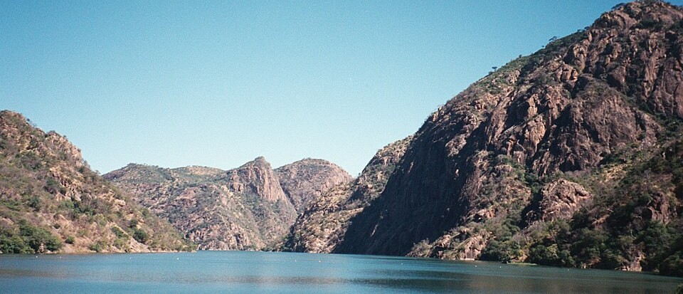
Zambezi River & Central Mozambique
The Zambezi is Mozambique’s longest river, flowing eastwards across the center of the country before forming a large delta on the Indian Ocean. In western Mozambique, the river passes through the huge Cahora Bassa reservoir before continuing towards the coast.
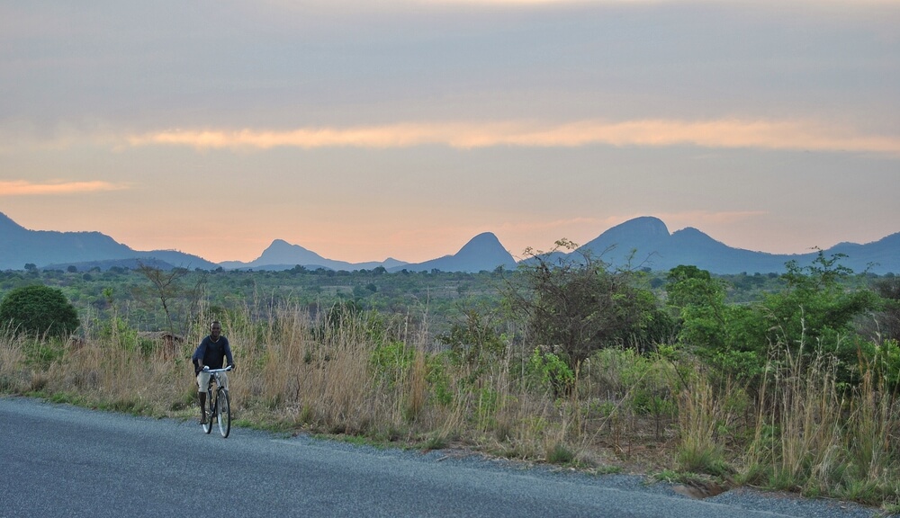
Northern Plateaus & Highlands
Northern Mozambique is generally higher and more rugged than the south. Large plateaus and uplands extend across provinces such as Niassa and Cabo Delgado, broken by isolated mountains and rocky outcrops.
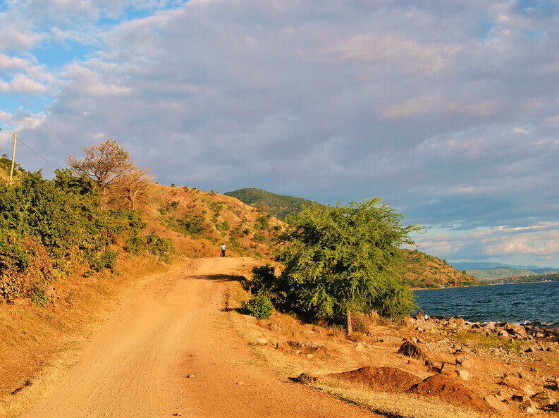
Lake Niassa & the Great Rift Valley
Lake Niassa, known internationally as Lake Malawi, lies along Mozambique’s northwestern border with Malawi. It is part of the East African Rift system and is one of Africa’s largest and deepest lakes.
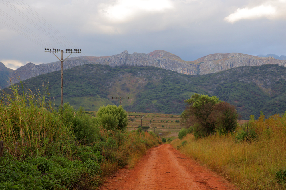
Western Mountains & Monte Binga
Mozambique’s highest and steepest landscapes are found mainly along its western border. In Manica Province, the Chimanimani Mountains rise sharply above the surrounding plains and continue across the border into Zimbabwe. Monte Binga, in the Chimanimani range, is the highest point in Mozambique.
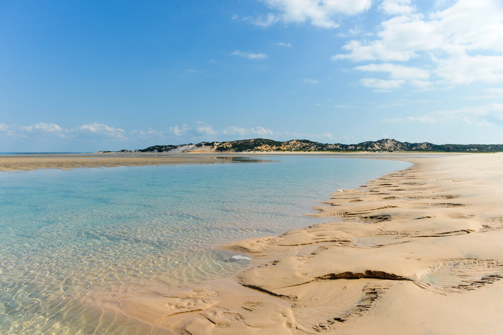
Indian Ocean Coast & Offshore Islands
Mozambique has a long coastline along the Mozambique Channel, part of the western Indian Ocean. Much of the coast is low-lying, with sandy beaches, estuaries and dunes. Offshore lie several groups of islands, including the Bazaruto Archipelago in the south and the Quirimbas Archipelago in the north.
See article: Flag of Mozambique
Mozambique flag
The flag of Mozambique developed from the colors used by the Mozambique Liberation Front, or FRELIMO, during the struggle for independence from Portugal. After independence in 1975, Mozambique adopted a different flag featuring many of the symbols still used today.
The current design was introduced in 1983. It includes an open book, hoe and AK-47 rifle inside a yellow star. Proposals to replace the flag were considered in 2005, partly because of objections to the rifle and its connection with FRELIMO, but the existing design was retained.
Image credits:
Mozambique (centered orthographic projection): M.Bitton, via Wikimedia Commons, licensed under CC BY-SA 4.0.

Caitriona Maria is an education writer and owner of The Facts Institute. With seven years of teaching experience and a background in educational content, she specialises in creating clear reference resources about countries, geography and global topics.