10 fun facts about Sudan
1. Sudan was once the largest country in Africa by area. After South Sudan gained independence in 2011, Sudan became the continent’s third-largest country.
2. Sudan has more pyramids than Egypt, with hundreds of ancient pyramids between around 900 BC and 350 CE.
3. The UNESCO-listed Archaeological Sites of the Island of Meroe contain pyramids, temples and palaces that preserve the remains of the powerful ancient Kingdom of Kush.
4. Sudan’s capital, Khartoum, lies at the meeting point of the Blue Nile and White Nile, which join to form the main Nile River.
5. The name Sudan comes from the Arabic Bilād as-Sūdān, traditionally translated as “Land of the Blacks.”
6. Much of northern Sudan lies within the Sahara Desert, while farther south the landscape transitions into the semi-arid Sahel and savanna.
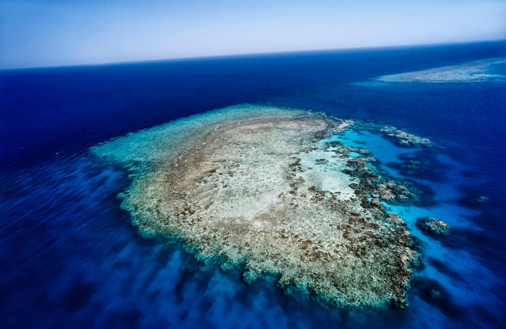
7. Sudan’s Red Sea coast contains spectacular coral reefs. The UNESCO-listed Sanganeb and Dungonab Bay marine parks are home to sharks, turtles, manta rays and a globally significant population of dugongs.
8. In 1963, Jacques Cousteau and his team established an underwater research habitat called Conshelf Two off the coast of Sudan, where five aquanauts lived beneath the Red Sea for a month.
9. Sudan is one of the world’s most important producers of gum arabic, a natural substance collected from acacia trees and widely used in foods, medicines and other products.
10. Sudan is known for powerful dust storms called haboobs, which can sweep across the country as towering walls of sand and dust. These storms can produce winds of up to around 113 km/h (70 mph) and can completely block out the sun.
Read more: Facts about Sudan

At a glance
Capital city: Khartoum
Population: 51.7 million
Area: 1,861,484 sq km
Major languages: Arabic, English, Nubian, Ta Bedawie, Fur
Major religions: Islam
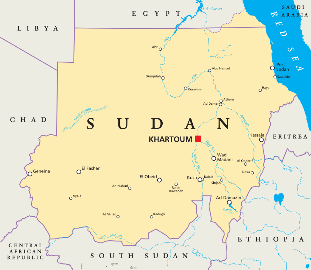
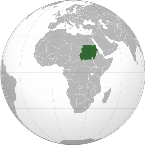
Where is Sudan?
Continent: Africa
Region: Northern Africa
Neighboring countries: Egypt, Libya, Chad, Central African Republic, South Sudan, Ethiopia and Eritrea
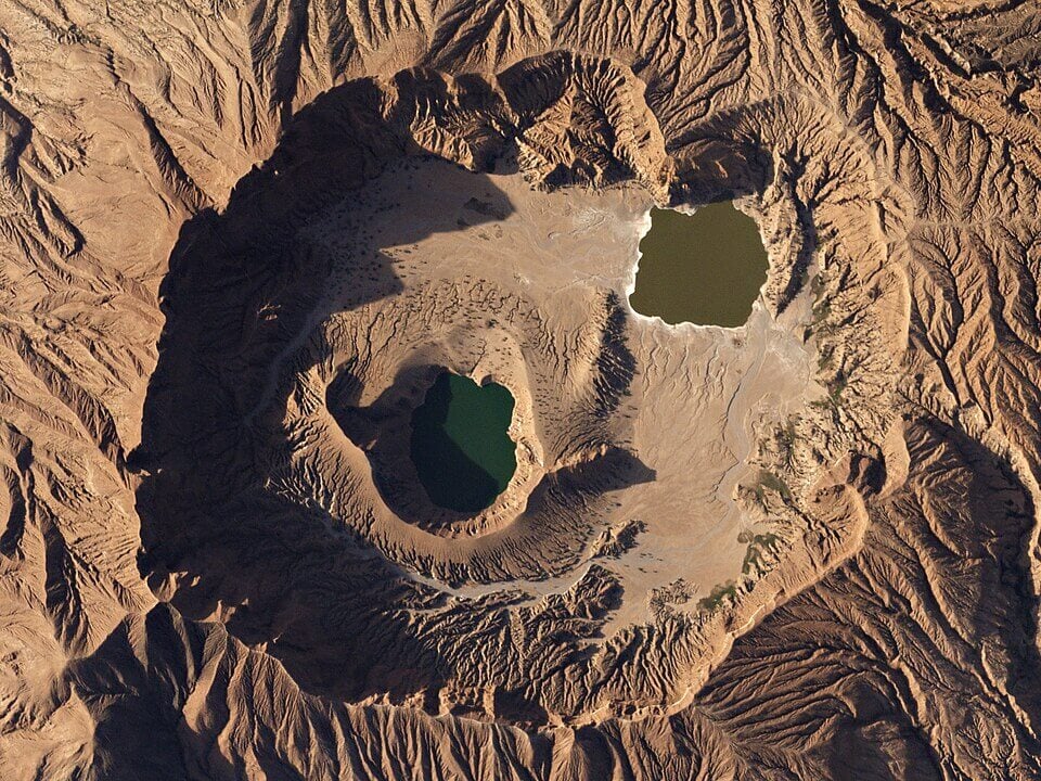
Highest point: Deriba Caldera (3,042 m / 9,980 ft)
Geography of Sudan
Sudan is one of the largest African countries by area and lies in Northern Africa, with a coastline on the Red Sea.
Much of the country consists of broad plains and desert, while mountains and highlands rise in the west, east and parts of central Sudan.
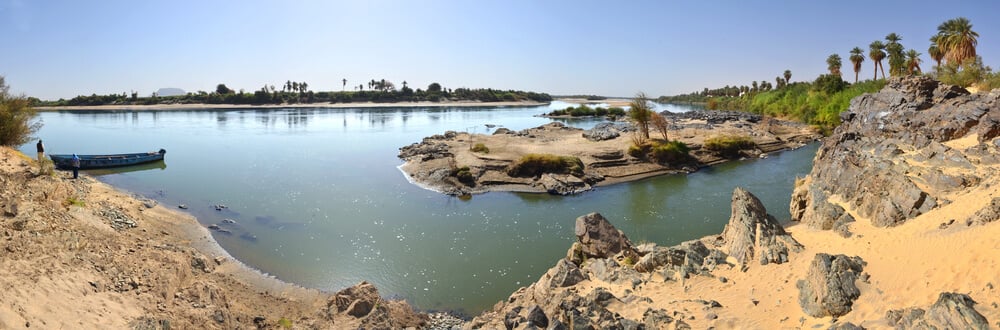
Nile River & Central Plains
The Nile is Sudan’s most important river and flows north through the country towards Egypt. The White Nile and Blue Nile meet at Khartoum, forming the main Nile, which continues north through increasingly arid landscapes. Much of central Sudan consists of wide, relatively flat plains.
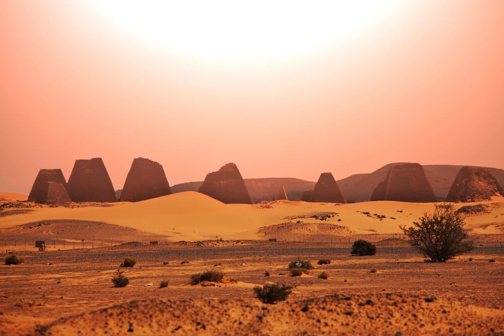
Sahara & Nubian Desert
Northern Sudan lies within the Sahara Desert and is the driest part of the country. The Nubian Desert extends across much of the northeast between the Nile and the Red Sea Hills, while other sandy and rocky desert landscapes occur west of the Nile. This contrasts with the grasslands and savanna found farther south.
Red Sea Hills & Coast
The Red Sea Hills form a rugged mountain range in eastern Sudan, running roughly parallel to the Red Sea coast. Between the mountains and the sea lies a narrow coastal plain 16 to 40 km (10 to 25 miles) wide, while offshore waters contain coral reefs and islands.
Jebel Marra & Nuba Mountains
Jebel Marra is a large volcanic mountain range in the Darfur region of western Sudan and contains the country’s highest point. Another major upland region is the Nuba Mountains, which rise from the plains of south-central Sudan as a collection of isolated hills and rocky massifs.
See article: Flag of Sudan
Sudan flag
Sudan adopted its current national flag in May 1970, following a military coup the previous year. The design was created by artist Abdel Rahman Ahmed Al-Jali and replaced the blue-yellow-green flag used after independence in 1956.
The flag uses the pan-Arab colors of red, white, black and green, with three horizontal stripes and a green triangle at the hoist.
Image credits:
Sudan (centered orthographic projection): Dinamik, via Wikimedia Commons, licensed under CC BY-SA 3.0.
Jebel Marra Volcano, Sudan: Planet Labs, Inc., via Wikimedia Commons, licensed under CC BY-SA 4.0. Cropped.

Caitriona Maria is an education writer and owner of The Facts Institute. With seven years of teaching experience and a background in educational content, she specialises in creating clear reference resources about countries, geography and global topics.