10 fun facts about Zambia
1. Zambia takes its name from the Zambezi River, one of Africa’s major rivers, which flows through the country and forms much of its southern border with Zimbabwe.
2. The famous Broken Hill skull was discovered in Zambia in 1921. The exceptionally well-preserved fossil hominin skull has been dated to around 299,000 years ago.
3. Zambia shares Victoria Falls with neighboring Zimbabwe. The UNESCO-listed waterfall stretches about 1,700 meters (5,600 feet) across the Zambezi River and is considered the world’s largest curtain of falling water.
4. Victoria Falls is traditionally known as Mosi-oa-Tunya, meaning “the Smoke that Thunders,” a name inspired by the enormous clouds of spray produced by the falls.
5. Near Victoria Falls is the famous Devil’s Pool, a natural rock pool close to the edge of the waterfall that can be visited when water levels are low enough.
6. Zambia is home to Kalambo Falls, a spectacular uninterrupted waterfall around 221 meters (725 feet) high, twice the height of Victoria Falls.
7. Lake Kariba, shared by Zambia and Zimbabwe, is the world’s largest artificial lake by volume, holding around 180 cubic kilometers of water.
8. Zambia has 20 national parks and 36 Game Management Areas, which together cover around 30% of the country’s land area.
9. Nshima is one of Zambia’s staple foods. The thick cornmeal porridge is traditionally eaten with the hands and served with side dishes such as meat, beans and vegetables.
10. Zambia’s national flag features an African fish eagle flying above red, black and orange stripes. The eagle represents the country’s ability to rise above its challenges.
Read more: Facts about Zambia

At a glance
Capital city: Lusaka
Population: 21.9 million
Area: 752,618 sq km
Major languages: English, Bemba, Nyanja, Tonga
Time zone: UTC+2 (Central Africa Time)
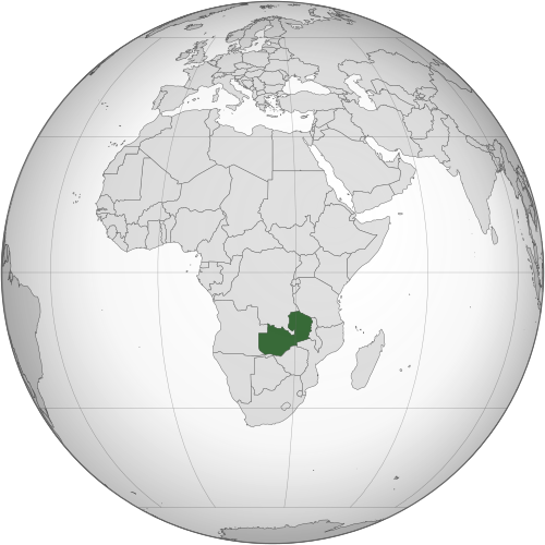
Where is Zambia?
Continent: Africa
Region: Eastern Africa
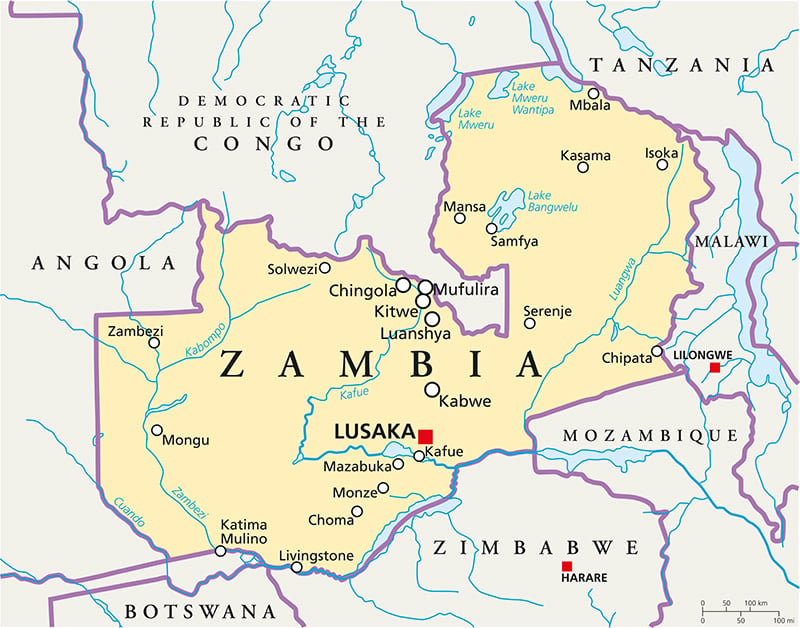
Neighboring countries: Democratic Republic of the Congo, Tanzania, Malawi, Mozambique, Zimbabwe, Botswana, Namibia and Angola
Highest point: Mafinga Central (2,339 m / 7,674 ft)
Geography of Zambia
Zambia is one of the landlocked African countries and lies in Eastern Africa.
Much of the country consists of elevated plateaus covered by savanna and woodland, broken by river valleys, wetlands, lakes and mountainous terrain.
Central Plateau & Woodlands
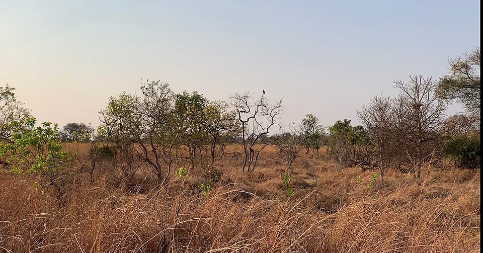
Much of Zambia lies on a broad plateau between 900 and 1,500 meters (3,000–5,000 feet). Large areas are covered by miombo woodland and open savanna. The capital, Lusaka, and many of Zambia’s other major towns are located on this elevated plateau.
Northern & Eastern Highlands
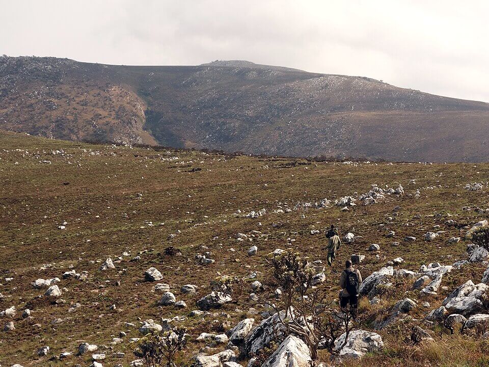
Higher terrain occurs in northern and eastern Zambia, particularly along the borders with Malawi and Tanzania. The Mafinga Hills rise along the border with Malawi and contain Mafinga Central, the highest point in Zambia.
Zambezi River & Victoria Falls
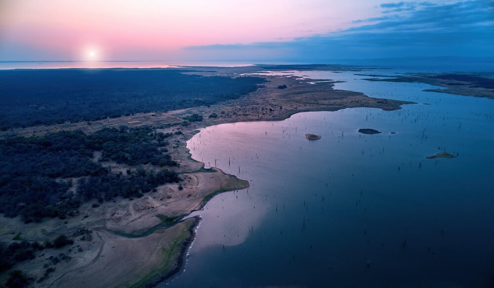
The Zambezi is one of Zambia’s most important rivers and forms part of its southern border with Zimbabwe. Near Livingstone, the river plunges over Victoria Falls, one of the world’s largest waterfalls. Farther downstream, the Zambezi flows into Lake Kariba, a vast artificial reservoir shared by Zambia and Zimbabwe.
Lakes, Wetlands & River Valleys
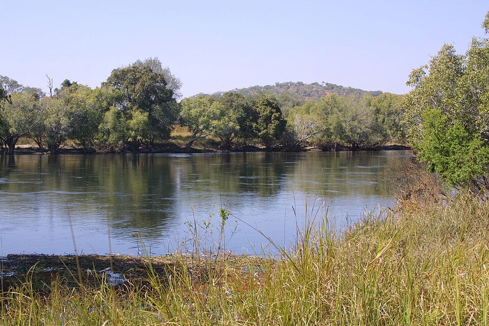
Northern Zambia contains several major lakes and wetlands, including parts of Lake Tanganyika and Lake Mweru, as well as the extensive Bangweulu wetlands. The Kafue River, one of the main tributaries of the Zambezi, crosses central Zambia and flows through the Kafue Flats, a broad floodplain.
See article: Flag of Zambia
Zambia flag
Before independence, the territory that is now Zambia was known as Northern Rhodesia, a British protectorate. During this period the territory used a colonial blue ensign that incorporated the Union Jack and a local badge.
Zambia’s current flag was adopted on 24 October 1964, the day the country gained independence from Britain. The design was modified slightly in 1996, but its overall layout remained unchanged.
Image credits:
Kafue National Park (Geography, Image one): LittleT889, via Wikimedia Commons, licensed under CC BY-SA 4.0. Cropped.
Mafinga Central, Zambia: Mark Horrell, via Wikimedia Commons, licensed under CC BY-SA 3.0. Cropped.
Kafue River: Paulmaz at English Wikipedia, via Wikimedia Commons, licensed under CC BY-SA 2.5. Cropped.

Caitriona Maria is an education writer and owner of The Facts Institute. With seven years of teaching experience and a background in educational content, she specialises in creating clear reference resources about countries, geography and global topics.