10 fun facts about the Republic of Congo
1. The Republic of the Congo is often called Congo-Brazzaville, or just Congo, to distinguish it from its much larger neighbor, the Democratic Republic of the Congo.
2. The Congo River forms much of the country’s eastern border. At about 4,700 km (2,900 mi) long, it is Africa’s second-longest river after the Nile and is also considered the deepest river in the world.
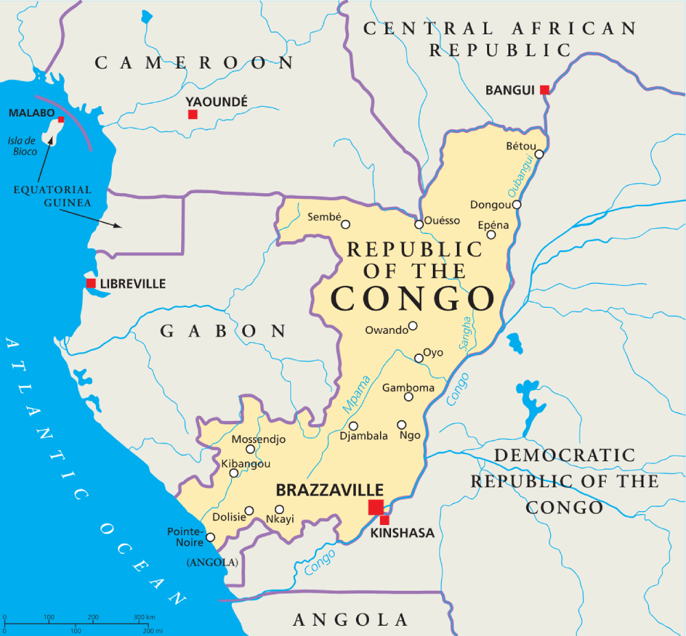
3. Brazzaville lies directly across the Congo River from Kinshasa, the capital of the Democratic Republic of the Congo. They are the closest pair of national capitals in the world.
4. Much of the Republic of the Congo lies within the Congo Basin rainforest, the largest rainforest in Africa.
5. The Sangha Trinational protected area stretches across the Republic of the Congo, Cameroon and the Central African Republic and protects wildlife including forest elephants, western lowland gorillas and chimpanzees.
6. Brazzaville is famous for its sapeurs, members of La Sape, a cultural movement known for extravagant suits, polished shoes and highly elegant dress.
7. Diosso Gorge, near the Atlantic coast, is sometimes nicknamed the “Grand Canyon of the Congo” because of its dramatic red and orange cliffs.
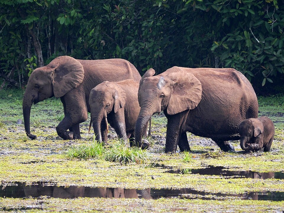
8. Odzala-Kokoua National Park is an expansive 13,500 square kilometer (5,200 square mile) protected area consisting of about 85% forest. It was established in 1935, making it one of the oldest national parks in Africa.
9. From 1969 to 1991, the country was known as the People’s Republic of the Congo and became Africa’s first Marxist-Leninist state.
10. The remote forests of the Congo Basin are associated with the legend of Mokele-mbembe, a mysterious long-necked creature sometimes described as the Congo’s answer to the Loch Ness Monster.
Read more: Facts about the Republic of Congo

At a glance
Capital city: Brazzaville
Population: 6.5 million
Area: 342,000 sq km
Major languages: French, Lingala and Kituba (Monokutuba)
Major religions: Christianity
Time zone: UTC+1 (West Africa Time)
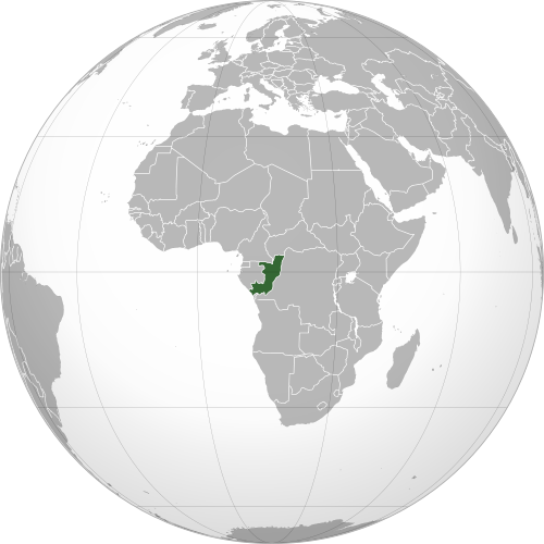
Where is the Republic of Congo?
Continent: Africa
Region: Central (Middle) Africa
Neighboring countries: Gabon, Cameroon, Central African Republic, Democratic Republic of the Congo and Angola
Highest point: Mont Nabemba (1,020 m / 3,346 ft)
Geography of the Republic of Congo
The Republic of the Congo is one of the African countries and lies in Central Africa, with a short coastline on the Atlantic Ocean.
Its landscape is dominated by tropical rainforests and traversed by major river systems, with limited mountainous terrain.
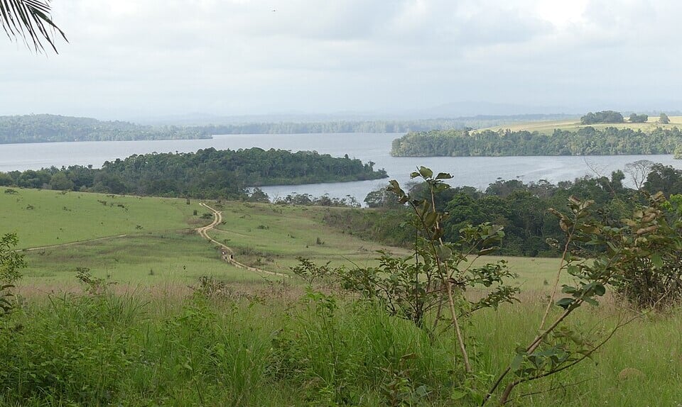
Atlantic Coast & Coastal Plains
A narrow coastal plain stretches along the Atlantic Ocean in southwestern Congo. Pointe-Noire, the country’s principal port city, lies on the coast, while lagoons, mangroves and sandy beaches occur along parts of the shoreline.
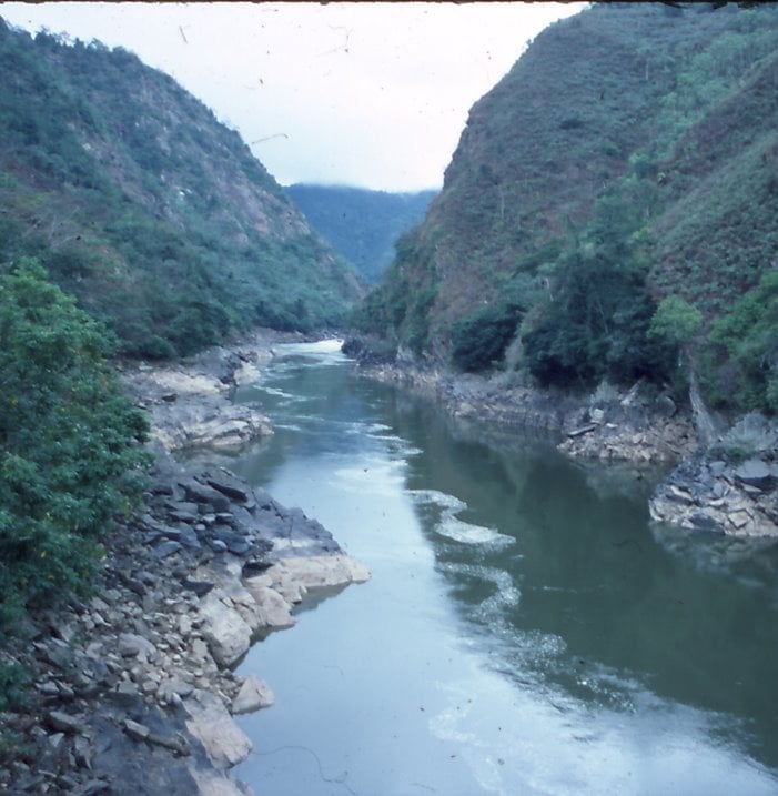
Mayombe Highlands & Niari Valley
Just inland from the coast, the forested Mayombe hills rise above the coastal plain. Farther east lies the lower Niari Valley, which contains a mixture of savanna, woodland and farmland.
Congo Basin
The Republic of Congo forms part of the vast Congo Basin, with around two-thirds of the country covered by forest. Extensive tropical rainforest covers much of the north, with low-lying wetlands and swamp forests occurring particularly in the northeast.
Congo River & Major Waterways
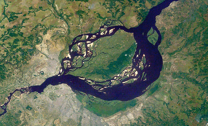
The Congo River forms much of the country’s eastern border with the Democratic Republic of the Congo. Brazzaville lies beside Pool Malebo, a broad lake-like section of the river opposite Kinshasa. Major northern rivers include the Sangha and Likouala, while the Ubangi forms part of the eastern border before joining the Congo River.
See article: Flag of the Republic of Congo
Republic of Congo flag
The Republic of the Congo introduced its green, yellow and red flag in 1959, shortly before gaining independence from France in 1960.
It was replaced in 1970 when the country became a Marxist one-party state, but the original flag was restored in 1991 during the return to multiparty democracy.
Image credits:
Pool Malebo: NASA, Public Domain.
Odzala-Kokoua National Park (elephants): Matt Muir, via Wikimedia Commons, licensed under CC BY 4.0.

Caitriona Maria is an education writer and owner of The Facts Institute. With seven years of teaching experience and a background in educational content, she specialises in creating clear reference resources about countries, geography and global topics.