10 fun facts about Ivory Coast
1. Ivory Coast is the world’s largest producer of cocoa beans, making the country one of the most important places in the global chocolate industry.
2. The country officially adopted the name Côte d’Ivoire for international use in 1986, although “Ivory Coast” remains widely used in English.
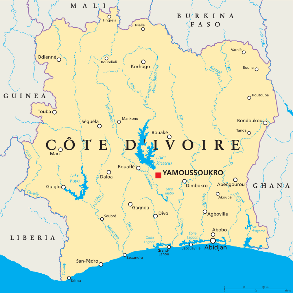
3. Ivory Coast has two important capital cities: Yamoussoukro is the official political capital, while Abidjan remains the country’s largest city and main economic center.
4. Yamoussoukro is home to the Basilica of Our Lady of Peace, the largest church in the world and a landmark inspired by St. Peter’s Basilica in Vatican City.
5. Ivory Coast takes its English name from the historic ivory trade that took place along this part of the West African coast.
6. The orange, white and green flag of Ivory Coast looks remarkably similar to the flag of Ireland, but the colors appear in the opposite order.
7. Mount Nimba rises to 1,752 m (5,748 ft) along the border with Guinea and is the highest point in both Ivory Coast and Guinea.
8. Taï National Park protects one of the last major areas of primary rainforest in West Africa and is famous for chimpanzees that have been observed using tools, including stones to crack nuts.
9. Comoé National Park covers around 11,500 sq km (4,440 sq mi), making it one of the largest protected areas in West Africa.
10. Ivory Coast’s national football team is nicknamed Les Éléphants (“The Elephants”) and has won the Africa Cup of Nations multiple times.
Read more: Facts about Ivory Coast

At a glance
Capital city: Yamoussoukro (legislative), Abidjan (administrative)
Population: 32.7 million
Area: 322,463 sq km
Major languages: French
Major religions: Islam, Christianity
Time zone: UTC 0 (Greenwich Mean Time)
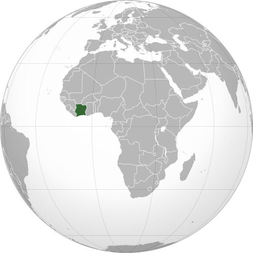
Where is Ivory Coast?
Continent: Africa
Region: Western Africa
Neighboring countries: Liberia, Guinea, Mali, Burkina Faso and Ghana
Highest point: Mount Nimba (1,752 m / 5,748 ft)
Geography of Ivory Coast
Ivory Coast is one of the African countries in Western Africa, with a long coastline on the Gulf of Guinea.
Much of the country consists of low plains and gently rolling plateaus, with tropical forests in the south, savanna in the north and mountains in the far west.
Coastal Plains & Lagoons
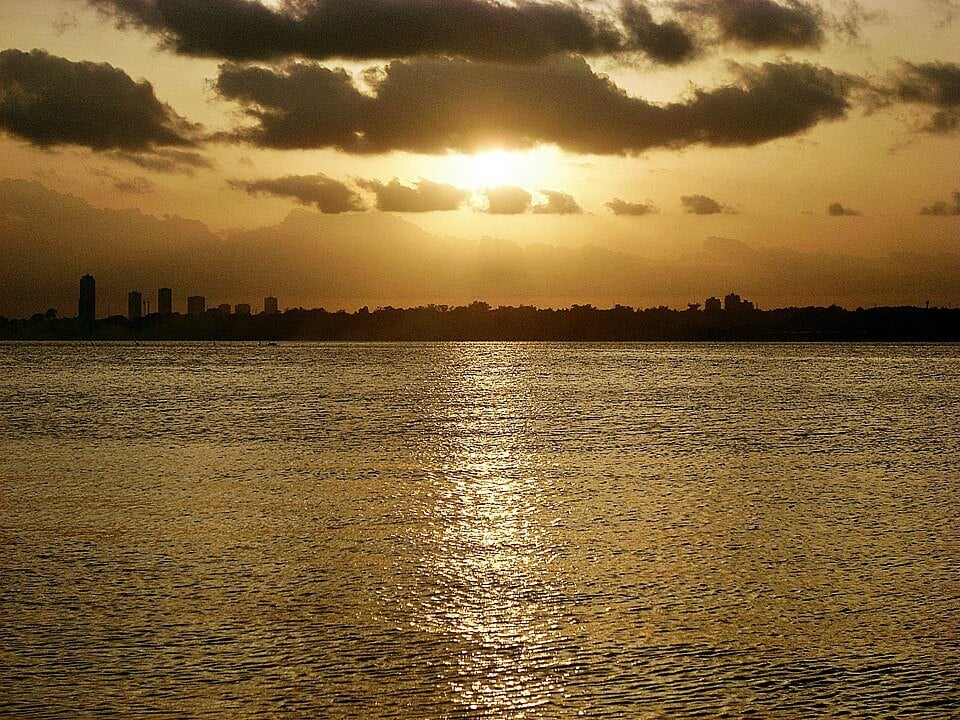
Low coastal plains stretch along the Gulf of Guinea in southern Ivory Coast. The eastern part of the coast is lined by a series of lagoons, including the Ébrié Lagoon beside Abidjan.
Southern Forests
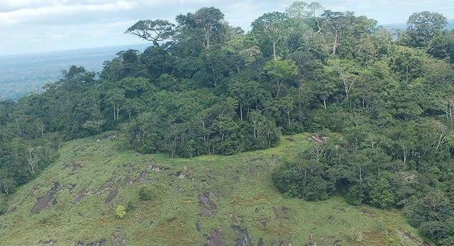
Southern Ivory Coast lies within the tropical forest zone of West Africa. Some of the largest remaining areas of primary rainforest are found in the southwest around Taï National Park, an area of 5,082 square kilometers (1,962 square miles).
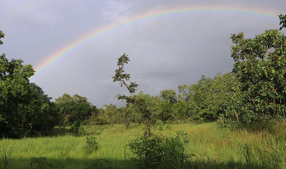
Northern Savanna & Major Rivers
Northern Ivory Coast is generally drier and more elevated than the south, with large areas covered by savanna. Several major rivers flow generally from north to south across Ivory Coast towards the Gulf of Guinea. The Bandama crosses the center of the country, while the Sassandra drains much of the west and the Comoé (Komoé) flows through the east. The Cavally forms part of the western border with Liberia.
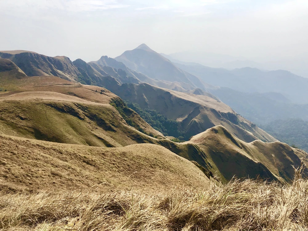
Western Mountains & Mount Nimba
The most mountainous terrain lies in western Ivory Coast near the borders with Guinea and Liberia. Here, the land rises sharply around the Nimba Mountains. Mount Nimba is the highest point in Ivory Coast.
See article: Flag of Ivory Coast
Ivory Coast flag
Côte d’Ivoire was a French protectorate from 1844 and became a colony in 1893, using the French flag during colonial rule.
Its current orange, white and green tricolor was adopted in December 1959 as the country moved toward independence and was retained when Côte d’Ivoire became independent on 7 August 1960.
Image credits:
Ivory Coast (centered orthographic projection): Martin23230;* Derivative work: by Marcos Elias de Oliveira Júnior talk! Marcos Elias de Oliveira Júnior fala!, via Wikimedia Commons, licensed under CC BY-SA 3.0.
Ébrié Lagoon, Abidjan: Willy Stephane Awaho, via Wikimedia Commons, licensed under CC BY 2.0. Cropped.
Taï National Park: Jojoy99, via Wikimedia Commons, licensed under CC BY-SA 4.0. Cropped.
Comoé Savanna: ETF89, via Wikimedia Commons, licensed under CC BY-SA 4.0. Cropped.
Mount Nimba: Dodé Houehounha, via UNESCO, 2019, licensed under CC BY-SA 3.0 IGO. Cropped.

Caitriona Maria is an education writer and owner of The Facts Institute. With seven years of teaching experience and a background in educational content, she specialises in creating clear reference resources about countries, geography and global topics.