10 fun facts about Chile
1. Chile is one of the longest and narrowest countries in the world, stretching about 4,270 km (2,653 mi) from north to south between the Andes Mountains and the Pacific Ocean.
2. Chile is home to the Atacama Desert, widely regarded as the driest non-polar desert on Earth. Some parts receive almost no measurable rainfall for years at a time.
3. Chile has the highest life expectancy among countries in South America, at 81 years.
4. Easter Island, or Rapa Nui, is a remote Chilean island in the southeastern Pacific famous for its monumental moai statues. Around 900 of these enormous stone figures were created and used in rituals said to honor their ancestral chiefs.
5. Northern Chile is home to the Chinchorro mummies, the oldest known examples of deliberately mummified human remains. Some are more than 7,000 years old, making them considerably older than the famous mummies of ancient Egypt.
6. Chile contains the second largest continuous mass of ice outside the polar regions. Areas such as Patagonia and the Andes hold a large proportion of South America’s glacier ice.
7. Chile is the world’s leading copper-producing country and has some of the planet’s largest known copper deposits. Mining has played a major role in the Chilean economy for generations.
8. Chile is home to Ojos Del Salado, the world’s highest active volcano.
9. The most powerful earthquake ever recorded struck southern Chile on 22 May 1960. Known as the Valdivia earthquake, it reached a magnitude of 9.5 and generated tsunamis that travelled across the Pacific Ocean.
10. Puerto Williams, on Navarino Island in southern Chile, is often described as the world’s southernmost city. It lies farther south than the better-known Argentine city of Ushuaia.
Read more: Facts about Chile

At a glance
Capital city: Santiago
Population: 18,664,652
Area: 756,102 sq km
Major languages: Spanish (official)
Major religions: Christianity
Time zone: UTC−3 to UTC−6

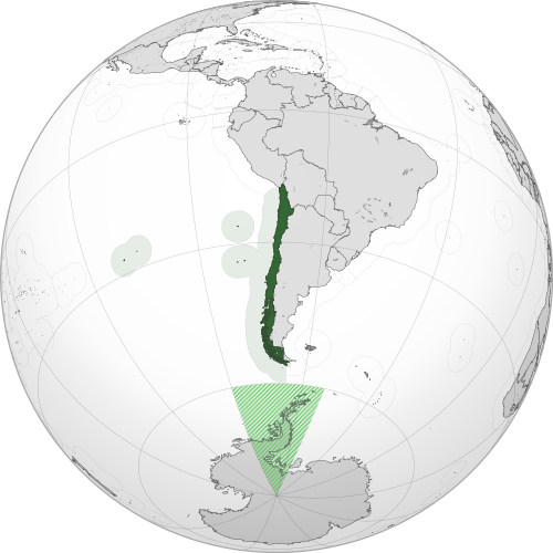
Geography of Chile
Chile lies along the western edge of South America, stretching for thousands of kilometers between the Pacific Ocean and the Andes Mountains.
Its unusually long and narrow shape gives it an extremely varied landscape, ranging from the Atacama Desert in the north to fertile valleys, forests, volcanoes, fjords, glaciers and the mountains of Patagonia in the south.
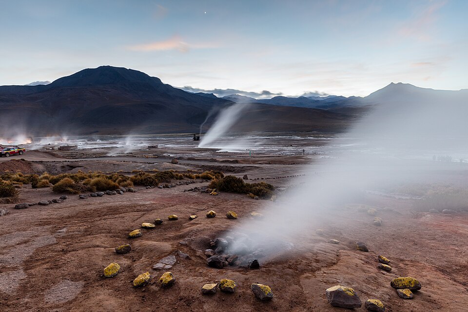
Atacama Desert & Northern Chile
Northern Chile is dominated by the extremely arid Atacama Desert and the Andes mountains. This highland region contains numerous volcanoes, salt flats, lagoons and geothermal features, including the El Tatio geyser field.
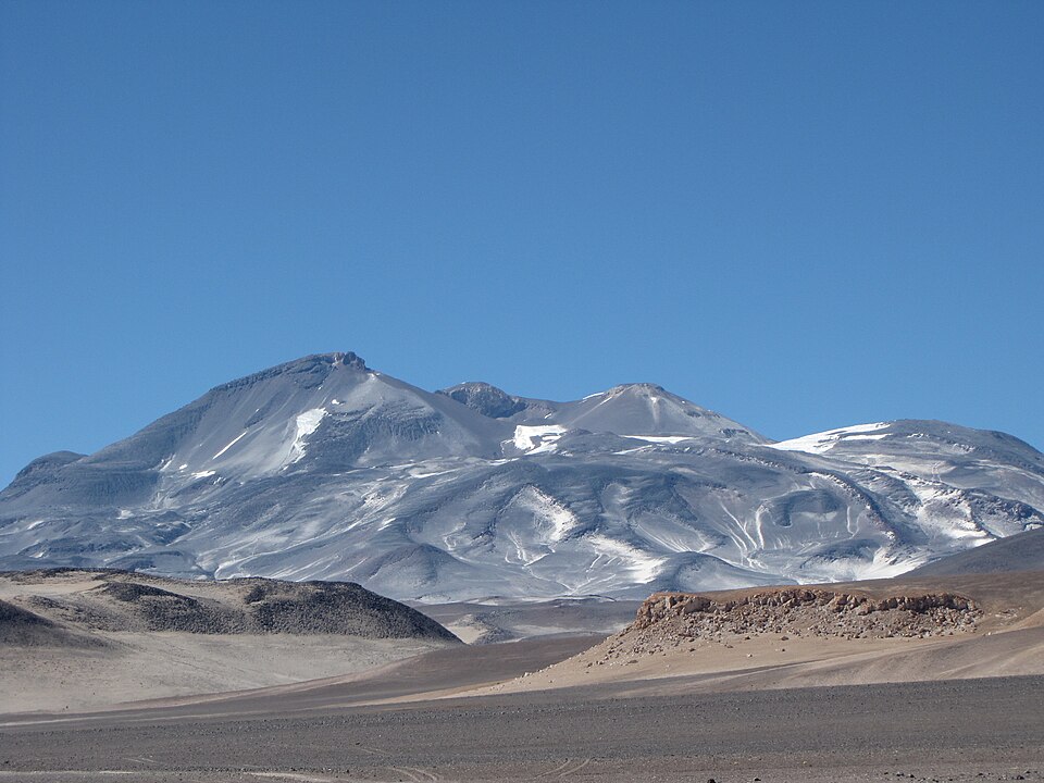
Andes Mountains & Ojos del Salado
The Andes Mountains extend along almost the entire eastern side of Chile, forming much of the border with Argentina. Glaciers and seasonal snowmelt from the mountains feed rivers and provide important freshwater supplies, particularly in central Chile. Numerous volcanoes rise within the range, including Ojos del Salado, the highest point in Chile and the highest active volcano in the world.
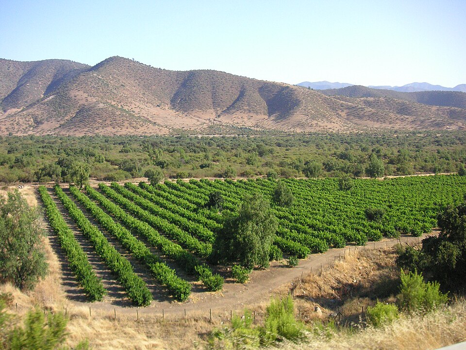
Central Valley & Coastal Range
Central Chile contains a fertile valley lying between the Andes and the lower Chilean Coast Range. Santiago and many of the country’s other major cities are located in this region, which has a Mediterranean climate and contains much of Chile’s agricultural land and vineyards.
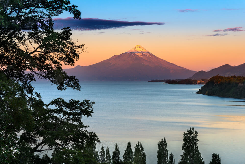
Lake District & Southern Forests
Extending roughly from Temuco to Puerto Montt, Chile’s Lake District contains numerous glacial lakes surrounded by forests and volcanic mountains. Major lakes include Llanquihue, Villarrica and Ranco, while several active volcanoes rise across the region.
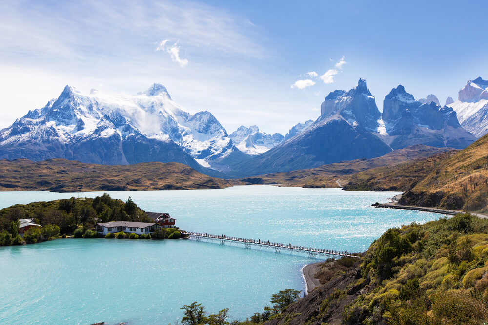
Patagonia, Fjords & Glaciers
Southern Chile forms part of Patagonia, a vast geographical region shared with Argentina. The landscape is highly rugged, with mountains, forests, glaciers, ice fields, fjords, channels and thousands of islands. The Southern Patagonian Ice Field feeds numerous glaciers extending through the region.
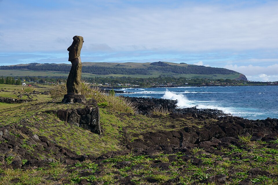
Pacific Islands
Chile also includes several remote islands in the Pacific Ocean. These include the Juan Fernández Islands and Rapa Nui (Easter Island), which lies more than 3,500 km (2,180 mi) west of mainland Chile.
See article: Flag of Chile
Chile flag
Chile’s flag developed during the country’s struggle for independence from Spain. Chile’s first national flag was adopted in 1812 and featured horizontal stripes of blue, white and yellow. A transitional blue, white and red tricolor followed in 1817, before the present design was introduced later that year.
The current flag was officially adopted on October 18, 1817, and was first used publicly during Chile’s Declaration of Independence in February 1818.
Image credits:
El Tatio, Atacama, Chile: Diego Delso, via Wikimedia Commons, licensed under CC BY-SA 4.0. Cropped.
Ojos del Salado: sergejf, via Wikimedia Commons, licensed under CC BY-SA 2.0. Cropped.
Chilean vineyard in Andes foothills: Beatrice Murch, via Wikimedia Commons, licensed under CC BY-SA 2.0. Cropped.
Easter Island: kallerna, via Wikimedia Commons, licensed under CC BY-SA 4.0. Cropped.

Caitriona Maria is an education writer and owner of The Facts Institute. With seven years of teaching experience and a background in educational content, she specialises in creating clear reference resources about countries, geography and global topics.